Chamrousse lakes loop
Add to my favorites

Caution! Zone of vigilance near the route
Bouquetin des Alpes - du 01/06/2026 au 30/09/2026 In progress
Bouquetin des Alpes - du 01/06/2026 au 30/09/2026 In progress
Bouquetin des Alpes - du 01/06/2026 au 30/09/2026 In progress
Bouquetin des Alpes - du 01/06/2026 au 30/09/2026 In progress
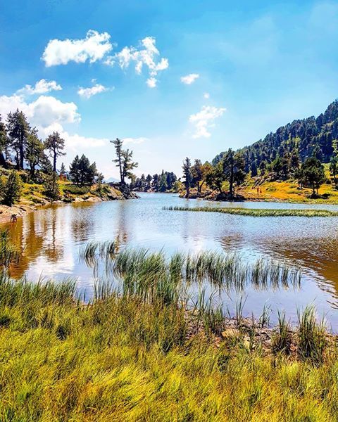
Departure: Tourist Office 1750 - Roche-Béranger.
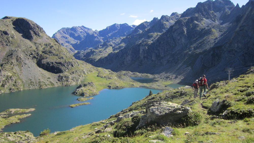
In one day, discover our three natural mountain lakes (plus les Vallons): Chamrousse 1750 > lac Achard > lacs Robert > lac des Pourettes > lac des Vallons > Chamrousse 1750.
The characteristics of the route.

Chamrousse (38)
- Distance 11.77 km
- Elevation gain 640 m
- Elevation lost 640 m
- Min. elevation 1742 m
- Max. elevation. 2157 m
- Duration (depending on pace) 6h
- Marking Yes
A change of scenery and a feast for the eyes are guaranteed!
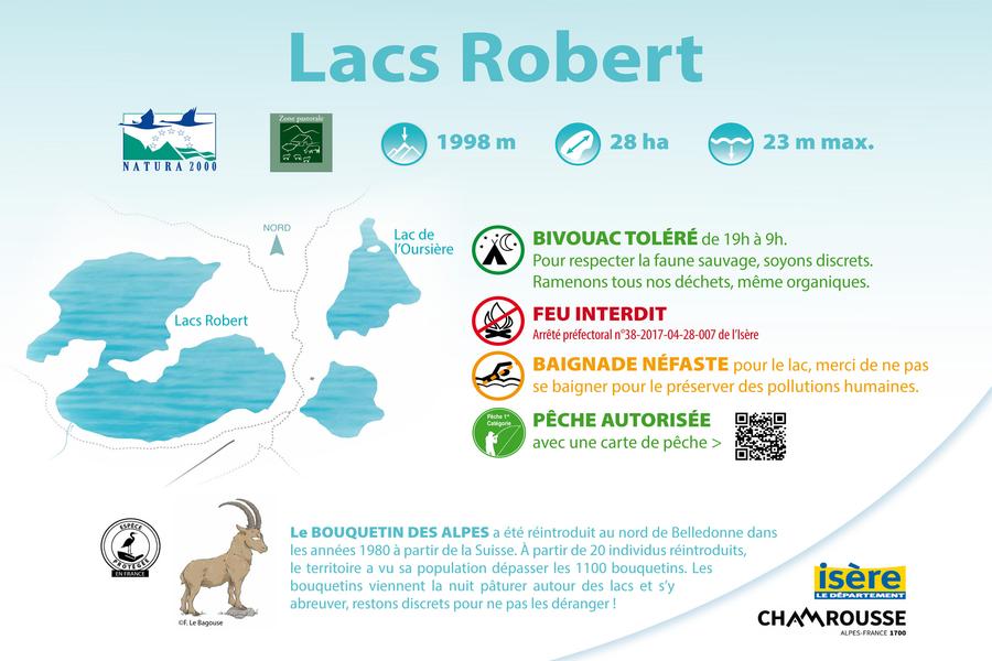
You'll easily find a quiet spot on the banks of Lac Achard (Espace Naturel Sensible*). Continue on to the Robert lakes (Natura 2000 area) for a bite to eat before descending to the Pourettes lake and then on to Recoin (1650m).
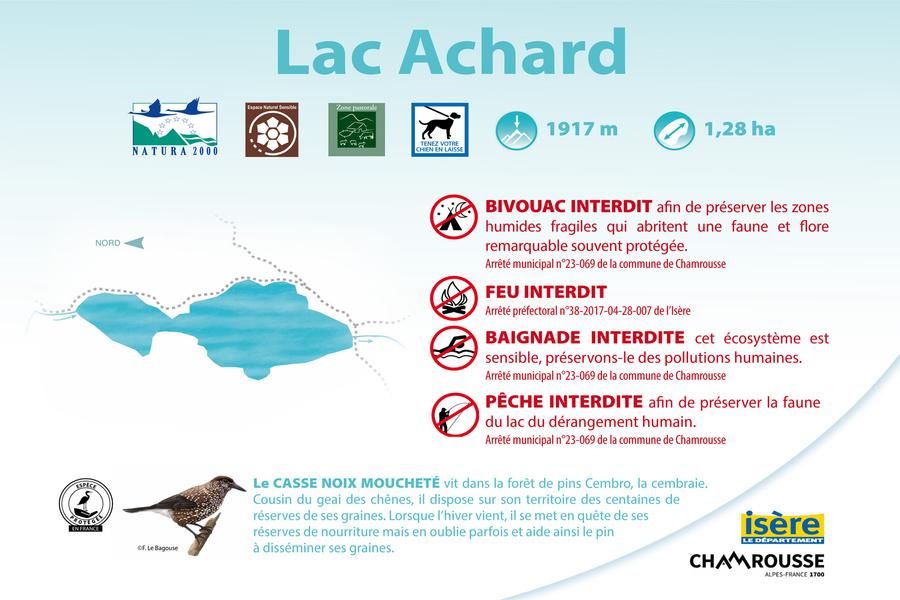
*In the ENS we remind you that fire, camping, fishing and swimming are strictly forbidden (under penalty of fine). Bivouacs are authorized from sunset to sunrise (except from May to October, by prefectural decree). Please stay on the trails to preserve fragile environments.
? The little extra: the "hiking star" summer medal for children!
On presentation of a photo taken at the hiking site, brave little hikers will be awarded a named diploma + possible purchase of the Chamrousse lakes hiking star to hang proudly on the backpack (on sale for €3 at Tourist Offices).Good plans : Discovery of the natural altitude lakes, marmot observation, fishing in the "Lacs Robert" lakes, discovery of the alpine pasture and picnic tables in the middle.Admission fee : Free access.Opening : From 01/07 to 15/10 daily. Subject to snow conditions.
You'll easily find a quiet spot on the banks of Lac Achard (Espace Naturel Sensible*). Continue on to the Robert lakes (Natura 2000 area) for a bite to eat before descending to the Pourettes lake and then on to Recoin (1650m).
*In the ENS we remind you that fire, camping, fishing and swimming are strictly forbidden (under penalty of fine). Bivouacs are authorized from sunset to sunrise (except from May to October, by prefectural decree). Please stay on the trails to preserve fragile environments.
? The little extra: the "hiking star" summer medal for children!
On presentation of a photo taken at the hiking site, brave little hikers will be awarded a named diploma + possible purchase of the Chamrousse lakes hiking star to hang proudly on the backpack (on sale for €3 at Tourist Offices).Good plans : Discovery of the natural altitude lakes, marmot observation, fishing in the "Lacs Robert" lakes, discovery of the alpine pasture and picnic tables in the middle.Admission fee : Free access.Opening : From 01/07 to 15/10 daily. Subject to snow conditions.
Area : Grésivaudan
Report a problem
Website TOPO_Boucle des lacs de Chamrousse Features of the application :
- Location and orientation on detailed maps thanks to the GPS of your smartphone
- Description of routes and points of interest on the route
- Photo gallery by route
- Detailed elevation profile
- Route tracking alert to warn you if you stray from the route
- Send predefined messages by SMS to your contacts
- Emergency module: trigger a call or send an emergency SMS in case of problem
- Agenda: access to events organized in the department
- News: find in the application the latest news on the web portal
- Adding achievements
- Add reports in case of problems encountered on the routes
- Share on social networks
Add your time and share your feelings
Services nearby

Chamrousse Tourist Office
Chamrousse

Arselle Peatbog (Preserved Natural Area)
Chamrousse

Romanche Museum
Livet-et-Gavet
Uriage-les-Bains Tourist Information Office
Saint-Martin-d'Uriage

Refuge de la Pra
Revel


Information updated on 2026-04-13 by Office du Tourisme de Chamrousse


Follow us on
the digital trails
the digital trails





The Isère Outdoor application was created
by the Département de l'Isère
Infos & contact
Conseil départemental de l'Isère
7 rue Fantin Latour
CS 41096
38 022 Grenoble cedex 1
Tel. 04 76 00 38 38
 Isère Outdoor - Parcours - Chamrousse lakes loop
Hello, world! This is a toast message.
Isère Outdoor - Parcours - Chamrousse lakes loop
Hello, world! This is a toast message.
Isère Outdoor - Parcours - Chamrousse lakes loop
Hello, world! This is a toast message.


OK
Annuler