Le Ruisseau des Pavés
Add to my favorites

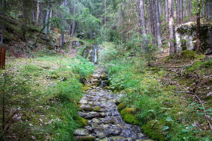
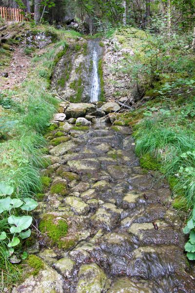
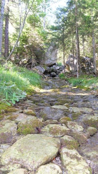
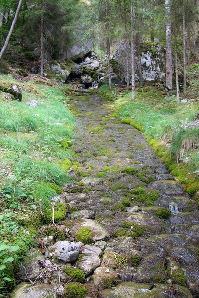
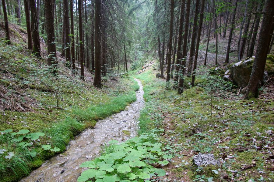
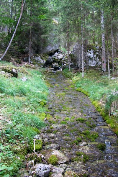
Come and discover this small stream hidden in a large forest above Cordéac. A trail with several stations will help you understand the history of this cobbled stream!
The characteristics of the route.

Châtel-en-Trièves (38)
- Distance 3.5 km
- Elevation gain 330 m
- Elevation lost 330 m
- Min. elevation 964 m
- Max. elevation. 1291 m
- Duration (depending on pace) 2h
- Marking No
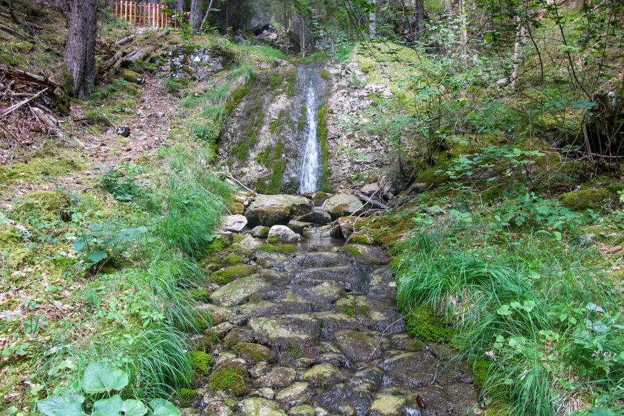
Mountain torrents have always been difficult to contain between snowmelt and heavy precipitation. This fun trail invites you to discover how mankind has managed to control the flow of water. You'll also learn how the atypical ruisseau des pavés was formed...Equipments : Car park, Free car park, Step by step description : Departure : Park in the parking lot on the Pavés stream path. The parking lot is at the top of the village of Cordéac. To get there, take an unpaved track. After a few hundred meters, you'll find the parking lot.
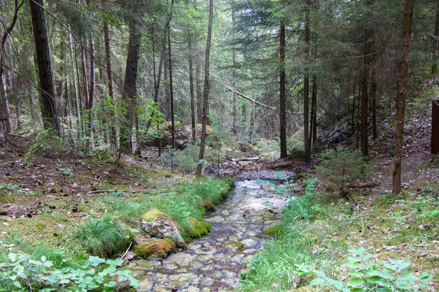
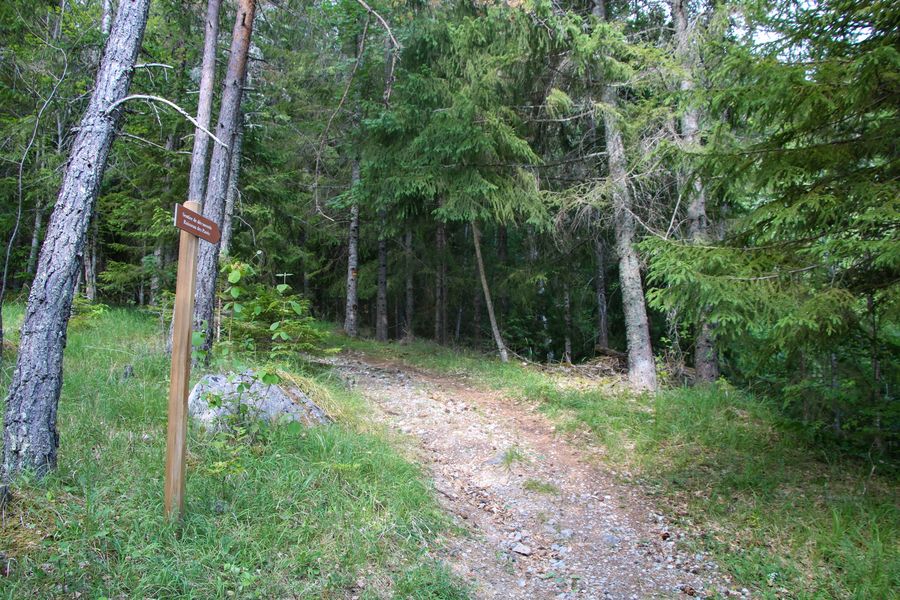
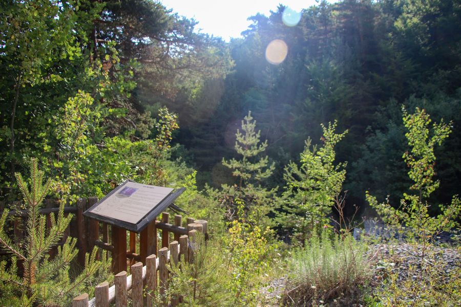
1) Look for the first sign "Sentier du ruisseau des Pavés". First follow the track, which climbs steeply, then a little further up, the path starts off to the right and enters the forest. The trail twists and turns through the forest along the famous "ruisseau des pavés". A series of stations explain the original history of this creek. Take advantage of the coolness of the area to take a short break and watch the water flow. Be careful with children, as the stones are slippery.
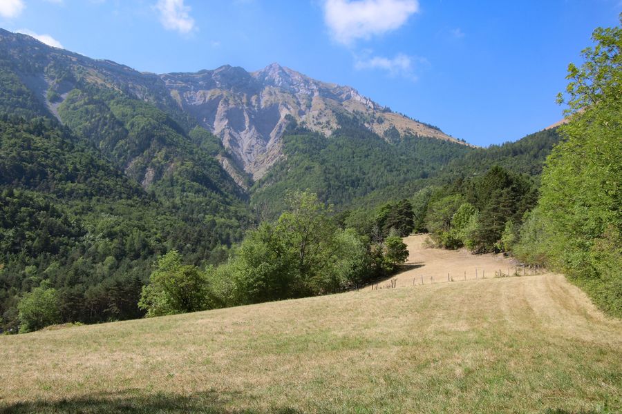
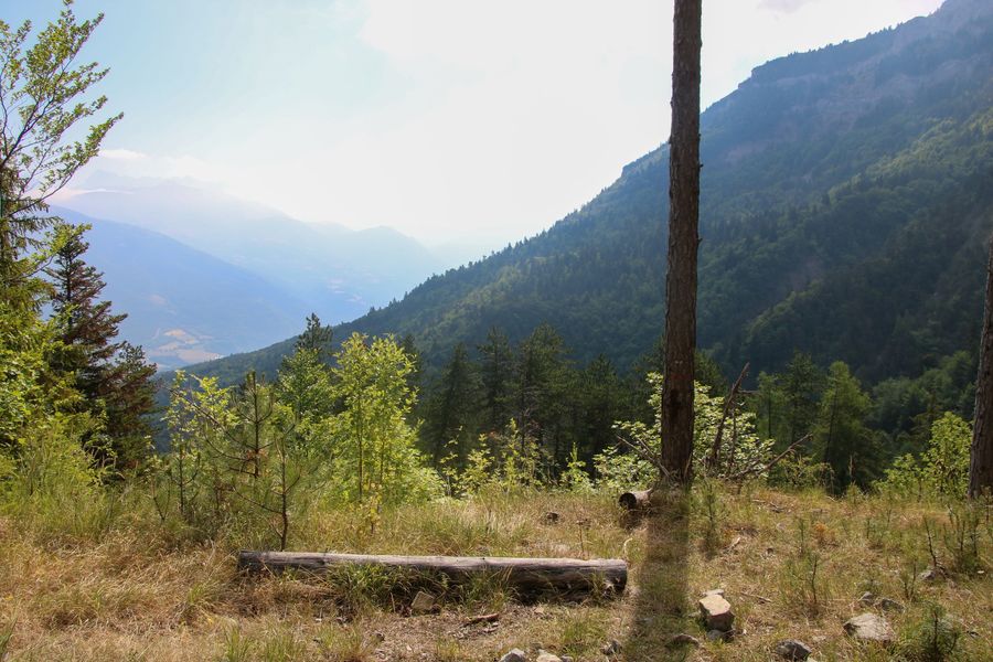
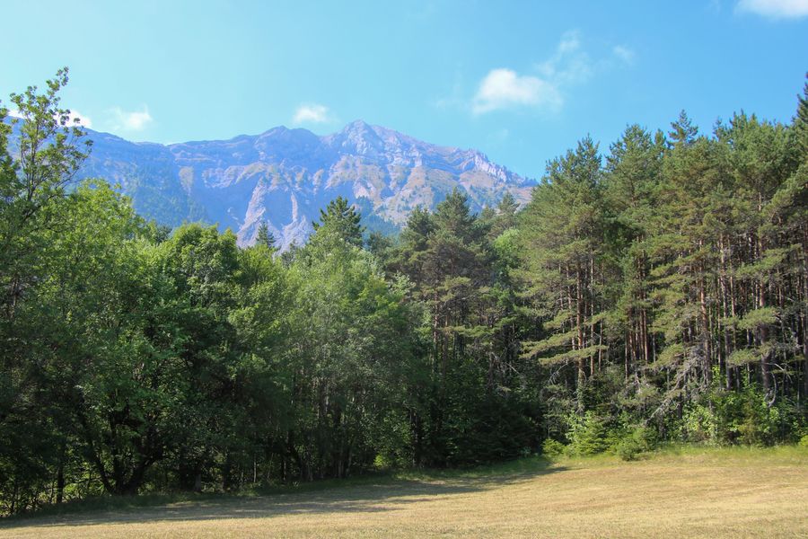
2) Continue uphill, joining a forest track. Turn right for a fine view of the surrounding peaks. The path continues downhill to the right. Beware, it can be slippery. You'll come to a magnificent forest, and continue until you reach a crossroads. At this junction, take the path that continues downhill, signposted so you don't get lost.
3) This pretty path offers views of the peaks, and you'll pass by some nice fields. You'll soon come to the yellow "Chalanne" signpost, and follow the signs for Le Châtel by taking the wide track that rises to the right. You'll soon reach your starting point.
Area : Trièves
Report a problem
Website Pdf file Features of the application :
- Location and orientation on detailed maps thanks to the GPS of your smartphone
- Description of routes and points of interest on the route
- Photo gallery by route
- Detailed elevation profile
- Route tracking alert to warn you if you stray from the route
- Send predefined messages by SMS to your contacts
- Emergency module: trigger a call or send an emergency SMS in case of problem
- Agenda: access to events organized in the department
- News: find in the application the latest news on the web portal
- Adding achievements
- Add reports in case of problems encountered on the routes
- Share on social networks
Add your time and share your feelings
Services nearby

Heritage House
Pellafol

Bureau d'Informations Touristiques de Mens - Office de Tourisme du Trièves
Mens
Musée du Trièves
Mens

Espace Naturel Sensible Sources des Gillardes
Pellafol
Maison du tourisme de Corps
Corps


Information updated on 2025-02-12 by Office de Tourisme du Trièves


Follow us on
the digital trails
the digital trails


![]()
The Isère Outdoor application was created
by the Département de l'Isère
Infos & contact
Conseil départemental de l'Isère
7 rue Fantin Latour
CS 41096
38 022 Grenoble cedex 1
Tel. 04 76 00 38 38
 Isère Outdoor - Parcours - Le Ruisseau des Pavés
Hello, world! This is a toast message.
Isère Outdoor - Parcours - Le Ruisseau des Pavés
Hello, world! This is a toast message.
Isère Outdoor - Parcours - Le Ruisseau des Pavés
Hello, world! This is a toast message.


OK
Annuler