Car free-hike 2 days & 1 night - The balcony of Haut-Breda in the Belledonne mountains
Add to my favorites

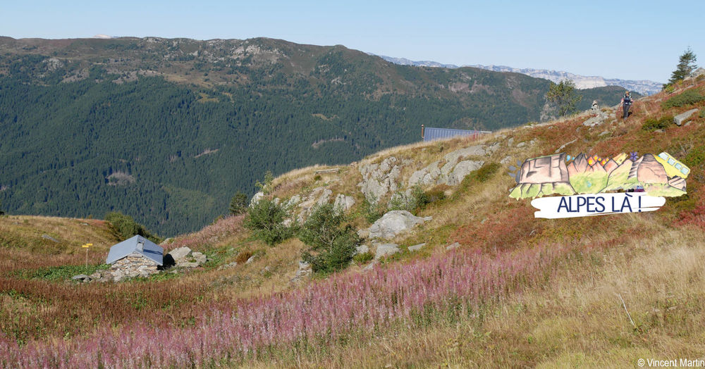
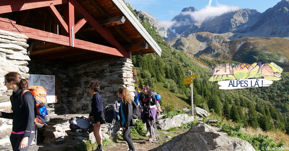
A two-day hike, accessible without a car, to discover the alpine huts of Haut-Bréda.
You can spend the night in an unguarded hut or in a bivouac.
Itinerary with public transport proposed by Alpes Là.
The characteristics of the route.

Le Haut-Bréda (38)
- Distance 12.5 km
- Elevation gain 1180 m
- Elevation lost 1120 m
- Min. elevation 928 m
- Max. elevation. 1999 m
- Duration (depending on pace) 4h05
- Marking Yes
From Village-Ecole bus stop, La Ferrière- (930 m) - 1 h 45 (2.9 km, D+ 521 m)
From the village-school bus stop (La Ferrière), climb the stairs just before the church to reach the town hall and school. Continue through the forest on the path signposted north-east towards Chalet du Bout until you reach the ridge (Carrefour du Bout).
1) Carrefour du Bout (1535m) - 1 h (1.8 km, D+ 269 m)
[Possible return trip to Chalet du Bout (10min)].
Climb the ridge through the forest until you reach the GR738® at Les Lanches.
Then cross to the west (right) to Lac du Léat.
2) Chalet et Lac du Léat (1719 m) - 1 h 20 (2.5 km, D+ 276 m,
D- 214 m)
Continue on the GR® as it rises in a balcony to reach the second Tigneux chalet and then the Montagne des Tigneux (1994m). Then descend westwards to the Petite Valloire crossroads and the Chalet de la Fouetterie just below.
3) Le Chalet de la Fouetterie (1823 m) - 30 min (1.2 km, D+ 92 m,
D- 13 m)
Return to the Petite Valloire crossroads.
Leave the GR® and cross over on a balcony path to the south to the Chalet de la Grande Valloire.
4) First Chalet de la Grande Valloire (1840 m) - 1h25 (3.8 km,
D- 835 m)
Continue on the path, crossing the Grande Valloire stream, then at the end of the alpine pasture, start a long descent through the forest.
Rejoin the Valloire stream, stay on the left bank track until you reach the parking lot [Pont de la Valloire post] and the Camorel bus stop on the main road.Marking : This route is marked with yellow signs and yellow paint (PR) and red and white paint (GR).Delicate passages : Forêt du Bout sensitive natural area.Admission fee : Free access. Plan the cost of the trip by Bus Cars Région.Opening : From 01/05 to 31/10 daily. Subject to favorable weather.Warning : A car-free hike where you can take the bus to and from the site. Make sure you know the time and day of traffic before you leave.
From the village-school bus stop (La Ferrière), climb the stairs just before the church to reach the town hall and school. Continue through the forest on the path signposted north-east towards Chalet du Bout until you reach the ridge (Carrefour du Bout).
1) Carrefour du Bout (1535m) - 1 h (1.8 km, D+ 269 m)
[Possible return trip to Chalet du Bout (10min)].
Climb the ridge through the forest until you reach the GR738® at Les Lanches.
Then cross to the west (right) to Lac du Léat.
2) Chalet et Lac du Léat (1719 m) - 1 h 20 (2.5 km, D+ 276 m,
D- 214 m)
Continue on the GR® as it rises in a balcony to reach the second Tigneux chalet and then the Montagne des Tigneux (1994m). Then descend westwards to the Petite Valloire crossroads and the Chalet de la Fouetterie just below.
3) Le Chalet de la Fouetterie (1823 m) - 30 min (1.2 km, D+ 92 m,
D- 13 m)
Return to the Petite Valloire crossroads.
Leave the GR® and cross over on a balcony path to the south to the Chalet de la Grande Valloire.
4) First Chalet de la Grande Valloire (1840 m) - 1h25 (3.8 km,
D- 835 m)
Continue on the path, crossing the Grande Valloire stream, then at the end of the alpine pasture, start a long descent through the forest.
Rejoin the Valloire stream, stay on the left bank track until you reach the parking lot [Pont de la Valloire post] and the Camorel bus stop on the main road.Marking : This route is marked with yellow signs and yellow paint (PR) and red and white paint (GR).Delicate passages : Forêt du Bout sensitive natural area.Admission fee : Free access. Plan the cost of the trip by Bus Cars Région.Opening : From 01/05 to 31/10 daily. Subject to favorable weather.Warning : A car-free hike where you can take the bus to and from the site. Make sure you know the time and day of traffic before you leave.
Area : Grésivaudan
Report a problem
Website Pdf file Features of the application :
- Location and orientation on detailed maps thanks to the GPS of your smartphone
- Description of routes and points of interest on the route
- Photo gallery by route
- Detailed elevation profile
- Route tracking alert to warn you if you stray from the route
- Send predefined messages by SMS to your contacts
- Emergency module: trigger a call or send an emergency SMS in case of problem
- Agenda: access to events organized in the department
- News: find in the application the latest news on the web portal
- Adding achievements
- Add reports in case of problems encountered on the routes
- Share on social networks
Add your time and share your feelings
Services nearby

Crêt du Poulet refuge
Crêts en Belledonne

Espace Naturel Sensible de la forêt du Bout et Combe Grasse
Le Haut-Bréda
Refuge de l'Oule
Le Haut-Bréda

Forges and Mills Museum in Pinsot
Le Haut-Bréda

Foyer de ski de fond du Barioz
Crêts en Belledonne


Information updated on 2025-12-18 by Isère Attractivité


Follow us on
the digital trails
the digital trails





The Isère Outdoor application was created
by the Département de l'Isère
Infos & contact
Conseil départemental de l'Isère
7 rue Fantin Latour
CS 41096
38 022 Grenoble cedex 1
Tel. 04 76 00 38 38
 Isère Outdoor - Parcours - Car free-hike 2 days & 1 night - The balcony of Haut-Breda in the Belledonne mountains
Hello, world! This is a toast message.
Isère Outdoor - Parcours - Car free-hike 2 days & 1 night - The balcony of Haut-Breda in the Belledonne mountains
Hello, world! This is a toast message.
Isère Outdoor - Parcours - Car free-hike 2 days & 1 night - The balcony of Haut-Breda in the Belledonne mountains
Hello, world! This is a toast message.


OK
Annuler