Randonnée sans voiture - Hameau de la Sure
Add to my favorites

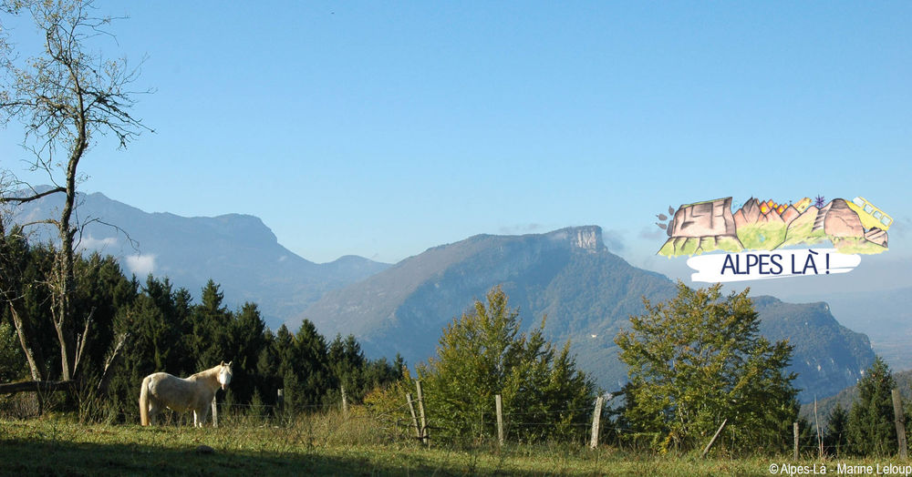
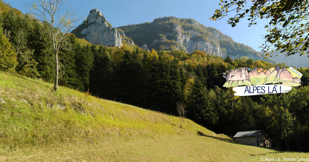
Au fil des hameaux de la Sure-en-Chartreuse, du Col de la Placette à Voreppe, une découverte de l'activité agricole et de l'histoire locale.
Itinéraire avec transport en commun proposé par Alpes Là.
The characteristics of the route.

La Sure en Chartreuse (38)
- Distance 8.9 km
- Elevation gain 330 m
- Elevation lost 670 m
- Min. elevation 249 m
- Max. elevation. 819 m
- Duration (depending on pace) 3h30
- Marking Yes
Admission fee : Free access.Opening : From 01/03 to 01/11.
Subject to favorable weather.
Area : Pays Voironnais
Report a problem
Pdf file Features of the application :
- Location and orientation on detailed maps thanks to the GPS of your smartphone
- Description of routes and points of interest on the route
- Photo gallery by route
- Detailed elevation profile
- Route tracking alert to warn you if you stray from the route
- Send predefined messages by SMS to your contacts
- Emergency module: trigger a call or send an emergency SMS in case of problem
- Agenda: access to events organized in the department
- News: find in the application the latest news on the web portal
- Adding achievements
- Add reports in case of problems encountered on the routes
- Share on social networks
Add your time and share your feelings
Services nearby

Pays Voironnais Tourist Office, Voiron information office
Voiron

Mainssieux Museum
Voiron

Espace Naturel Sensible des Tourbières de l'Herretang
Saint-Laurent-du-Pont
Coeur de Chartreuse Tourist Information center at Saint Laurent du Pont
Saint-Laurent-du-Pont

Col de Porte
Sarcenas


Information updated on 2023-04-25 by Isère Attractivité


Follow us on
the digital trails
the digital trails


![]()
The Isère Outdoor application was created
by the Département de l'Isère
Infos & contact
Conseil départemental de l'Isère
7 rue Fantin Latour
CS 41096
38 022 Grenoble cedex 1
Tel. 04 76 00 38 38
 Isère Outdoor - Parcours - Randonnée sans voiture - Hameau de la Sure
Hello, world! This is a toast message.
Isère Outdoor - Parcours - Randonnée sans voiture - Hameau de la Sure
Hello, world! This is a toast message.
Isère Outdoor - Parcours - Randonnée sans voiture - Hameau de la Sure
Hello, world! This is a toast message.


OK
Annuler