Car-free hikes- Discovery of the Plateau des Petites Roches in the Chartreuse Mountains
Add to my favorites

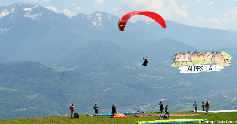
An easy hike along the cliffs of the Petites Roches plateau, past lookouts and hang-gliding launch sites. Admire the paragliders and you may well find yourself inspired to take up paragliding...
Itinerary with public transport proposed by Alpes Là.
The characteristics of the route.

Saint-Pancrasse (38)
- Distance 6.7 km
- Elevation gain 350 m
- Elevation lost 390 m
- Min. elevation 861 m
- Max. elevation. 1058 m
- Duration (depending on pace) 2h45
- Marking Yes
Start: Saint Pancrasse Mairie (995 m) - 15 min (0.7 km, D+ 20 m)
From the stop, start off along the departmental road heading north-east (towards Col de Marcieu). After the elementary school, leave the road to take the road on the left which starts with a parking lot (route du Tournon).
Continue through the hamlet towards Les Gaudes until you cross the main road again.
1) Le Tournoud Nord (1013 m) - 1 h 20 (2.8 km, D+ 220 m, D- 170 m)
Cross the D30 and turn slightly right onto a downhill path through several small wooded valleys.
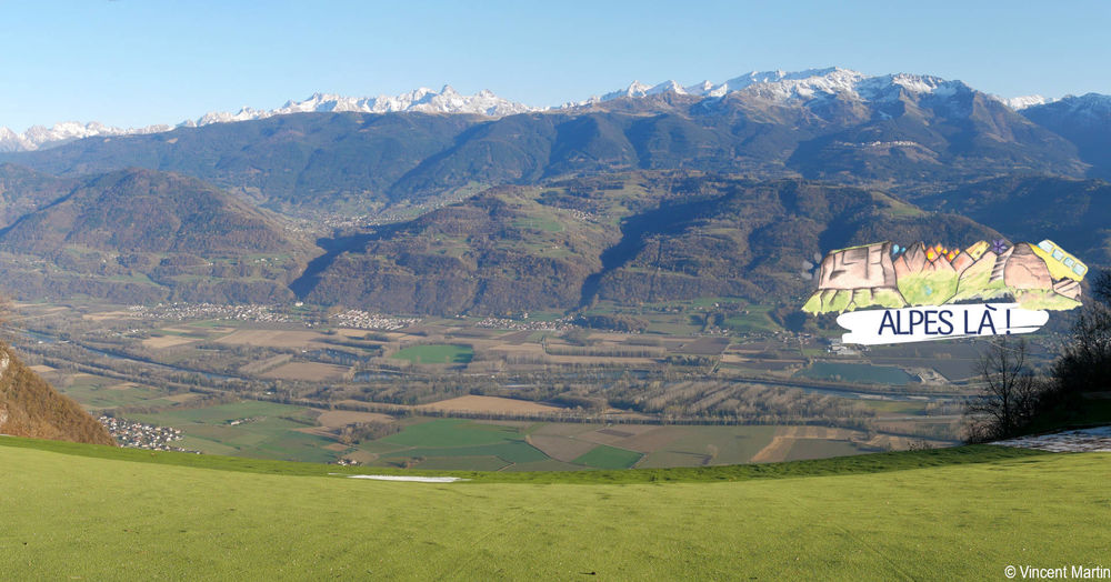
Reach a parking area at antennae level (964 m), then follow a path along the cliffs to reach Bec Margain and its orientation table.
2) Bec Margain (1055 m) - 40 min (1.5 km, D+ 50 m, D- 160 m)
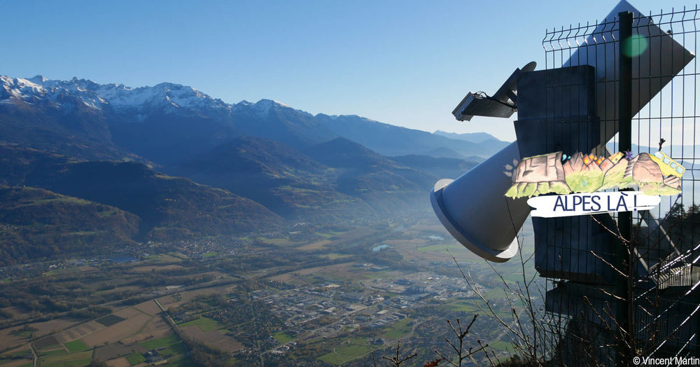
Continue along the path, passing a curious scientific measuring instrument (see photo and next page) and the hang-gliding and paragliding take-off areas. After skirting the "Chalet" paragliding launch area (green carpet), reach the Funicular station.
3) Funicular station (971 m) - 30 min (1.7 km, D+ 40 m, D- 45 m)
Go around Eglise St Hilaire to the north on Chemin du Pal de Fer to reach Les Gaudes. Take the northeast path (to the right) to reach the chapel. Arrive at Gros Buisson and continue west to reach the hamlet of Les Vials at the level of the departmental road.
The bus stop is slightly to the left.
Back to top : Les Vials - Plateau des Petites Roches (955 m)Delicate passages : Itinerary with no particular difficulties, but with a few passages close to cliffs (take care with children). Please respect meadows and fences.Admission fee : Free access. Plan the cost of the trip by Bus Cars Région.Opening : From 01/03 to 01/11. Subject to favorable weather.Warning : A car-free hike where you can take the bus to and from the site. Make sure you know the time and day of traffic before you leave.
From the stop, start off along the departmental road heading north-east (towards Col de Marcieu). After the elementary school, leave the road to take the road on the left which starts with a parking lot (route du Tournon).
Continue through the hamlet towards Les Gaudes until you cross the main road again.
1) Le Tournoud Nord (1013 m) - 1 h 20 (2.8 km, D+ 220 m, D- 170 m)
Cross the D30 and turn slightly right onto a downhill path through several small wooded valleys.
Reach a parking area at antennae level (964 m), then follow a path along the cliffs to reach Bec Margain and its orientation table.
2) Bec Margain (1055 m) - 40 min (1.5 km, D+ 50 m, D- 160 m)
Continue along the path, passing a curious scientific measuring instrument (see photo and next page) and the hang-gliding and paragliding take-off areas. After skirting the "Chalet" paragliding launch area (green carpet), reach the Funicular station.
3) Funicular station (971 m) - 30 min (1.7 km, D+ 40 m, D- 45 m)
Go around Eglise St Hilaire to the north on Chemin du Pal de Fer to reach Les Gaudes. Take the northeast path (to the right) to reach the chapel. Arrive at Gros Buisson and continue west to reach the hamlet of Les Vials at the level of the departmental road.
The bus stop is slightly to the left.
Back to top : Les Vials - Plateau des Petites Roches (955 m)Delicate passages : Itinerary with no particular difficulties, but with a few passages close to cliffs (take care with children). Please respect meadows and fences.Admission fee : Free access. Plan the cost of the trip by Bus Cars Région.Opening : From 01/03 to 01/11. Subject to favorable weather.Warning : A car-free hike where you can take the bus to and from the site. Make sure you know the time and day of traffic before you leave.
Area : Grésivaudan
Report a problem
Website Pdf file Features of the application :
- Location and orientation on detailed maps thanks to the GPS of your smartphone
- Description of routes and points of interest on the route
- Photo gallery by route
- Detailed elevation profile
- Route tracking alert to warn you if you stray from the route
- Send predefined messages by SMS to your contacts
- Emergency module: trigger a call or send an emergency SMS in case of problem
- Agenda: access to events organized in the department
- News: find in the application the latest news on the web portal
- Adding achievements
- Add reports in case of problems encountered on the routes
- Share on social networks
Add your time and share your feelings
Services nearby

Espace naturel sensible du col du Coq
Plateau des Petites Roches
Espace naturel sensible du Marais de Montfort
Crolles

Les Petites Roches Tourist Information Office
Plateau des Petites Roches

Museum Arcabas in Chartreuse
Saint-Pierre-de-Chartreuse

Location de matériel au foyer de ski de fond
Saint-Pierre-de-Chartreuse


Information updated on 2025-12-18 by Isère Attractivité


Follow us on
the digital trails
the digital trails





The Isère Outdoor application was created
by the Département de l'Isère
Infos & contact
Conseil départemental de l'Isère
7 rue Fantin Latour
CS 41096
38 022 Grenoble cedex 1
Tel. 04 76 00 38 38
 Isère Outdoor - Parcours - Car-free hikes- Discovery of the Plateau des Petites Roches in the Chartreuse Mountains
Hello, world! This is a toast message.
Isère Outdoor - Parcours - Car-free hikes- Discovery of the Plateau des Petites Roches in the Chartreuse Mountains
Hello, world! This is a toast message.
Isère Outdoor - Parcours - Car-free hikes- Discovery of the Plateau des Petites Roches in the Chartreuse Mountains
Hello, world! This is a toast message.


OK
Annuler