Le Col des deux soeurs
Add to my favorites

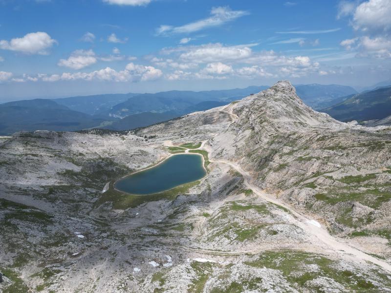
Le premier parcours vraiment difficile avec des parties sur sentier rocheux. Mais une vue à couper le souffle et une sensation de liberté arrivée au col des deux sœurs.
The characteristics of the route.

Villard-de-Lans (38)
- Distance 26.48 km
- Elevation gain 1430 m
- Elevation lost 1430 m
- Min. elevation 1002 m
- Max. elevation. 2056 m
- Duration (depending on pace) 4h30
- Marking Yes
Equipments : Free car park, Car park, Picnic area, Admission fee : Free access.Opening : From 01/04 to 31/10 daily.
Subject to favorable snow and weather conditions.
Area : Massif du Vercors
Report a problem
Website Features of the application :
- Location and orientation on detailed maps thanks to the GPS of your smartphone
- Description of routes and points of interest on the route
- Photo gallery by route
- Detailed elevation profile
- Route tracking alert to warn you if you stray from the route
- Send predefined messages by SMS to your contacts
- Emergency module: trigger a call or send an emergency SMS in case of problem
- Agenda: access to events organized in the department
- News: find in the application the latest news on the web portal
- Adding achievements
- Add reports in case of problems encountered on the routes
- Share on social networks
Add your time and share your feelings
Services nearby

Maison du Patrimoine
Villard-de-Lans

Office Municipal de Tourisme de Villard de Lans
Villard-de-Lans

Auberge des Allières
Lans-en-Vercors

Foyer de ski de fond des Hauts Plateaux
Corrençon-en-Vercors
Méaudre Information Office
Autrans-Méaudre en Vercors


Information updated on 2026-10-01 by Office Municipal de Tourisme de Villard-de-Lans


Follow us on
the digital trails
the digital trails





The Isère Outdoor application was created
by the Département de l'Isère
Infos & contact
Conseil départemental de l'Isère
7 rue Fantin Latour
CS 41096
38 022 Grenoble cedex 1
Tel. 04 76 00 38 38
 Isère Outdoor - Parcours - Le Col des deux soeurs
Hello, world! This is a toast message.
Isère Outdoor - Parcours - Le Col des deux soeurs
Hello, world! This is a toast message.
Isère Outdoor - Parcours - Le Col des deux soeurs
Hello, world! This is a toast message.


OK
Annuler