Electric bike route: Uriage - Chamrousse (Luitel road side)
Add to my favorites

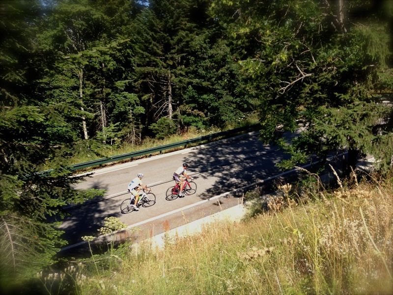
Discover the sporty ascent of Chamrousse in a leisurely version thanks to the electrically assisted bike. Climb by the Luitel (road n°111 on the right side at the golf roundabout).
The characteristics of the route.
Vaulnaveys-le-Haut (38)
- Distance 19.87 km
- Elevation gain 1400 m
- Elevation lost 20 m
- Min. elevation 407 m
- Max. elevation. 1793 m
- Marking Yes
Another way up is possible via the Seiglières (road n°111 on the left).Marking : White and green signs titled "Montée de Chamrousse".Equipments : Public WC, Ping pong table, Charging station for 2 electric wheels, Admission fee : Free access.Opening : All year round.
Subject to favorable weather.
Area : Grésivaudan
Report a problem
Website Features of the application :
- Location and orientation on detailed maps thanks to the GPS of your smartphone
- Description of routes and points of interest on the route
- Photo gallery by route
- Detailed elevation profile
- Route tracking alert to warn you if you stray from the route
- Send predefined messages by SMS to your contacts
- Emergency module: trigger a call or send an emergency SMS in case of problem
- Agenda: access to events organized in the department
- News: find in the application the latest news on the web portal
- Adding achievements
- Add reports in case of problems encountered on the routes
- Share on social networks
Add your time and share your feelings
Services nearby

Uriage-les-Bains Tourist Information Office
Saint-Martin-d'Uriage
Chamrousse Tourist Office
Chamrousse

Arselle Peatbog (Preserved Natural Area)
Chamrousse

The chemistry Museum
Jarrie
Museum of the French Revolution
Vizille


Information updated on 2025-05-22 by Office du Tourisme de Chamrousse


Follow us on
the digital trails
the digital trails





The Isère Outdoor application was created
by the Département de l'Isère
Infos & contact
Conseil départemental de l'Isère
7 rue Fantin Latour
CS 41096
38 022 Grenoble cedex 1
Tel. 04 76 00 38 38
 Isère Outdoor - Parcours - Electric bike route: Uriage - Chamrousse (Luitel road side)
Hello, world! This is a toast message.
Isère Outdoor - Parcours - Electric bike route: Uriage - Chamrousse (Luitel road side)
Hello, world! This is a toast message.
Isère Outdoor - Parcours - Electric bike route: Uriage - Chamrousse (Luitel road side)
Hello, world! This is a toast message.


OK
Annuler