St Hugues en Chartreuse
Add to my favorites

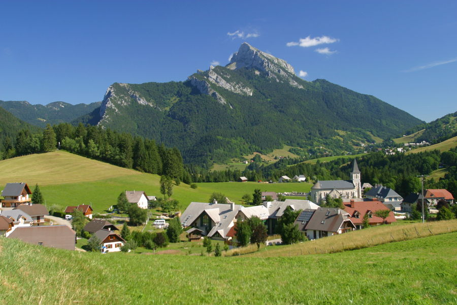
At the foot of three emblematic peaks of the massif (Chamechaude, Charmant Som, and Grand Som), the plateau of St Hugues is an ideal site for family walks and the discovery of mountain agriculture
The characteristics of the route.

Saint-Pierre-de-Chartreuse (38)
- Distance 5.9 km
- Elevation gain 220 m
- Elevation lost 220 m
- Min. elevation 881 m
- Max. elevation. 1070 m
- Duration (depending on pace) 1h30
- Marking Yes
Ideas for Visits Near the Route:
Musée de la Grande Chartreuse (4 km from the start): audio-guided tours.
Petits Jardiniers (3 km from the start): cultivation of medicinal plants.
Fleurs de Lyne (5 km from the start): soap factory.
Musée d'Art Sacré Contemporain (50 m from the start): St Hugues Church.
All information and other visit ideas can be found at chartreuse-tourisme.com/rsf.
Information / Safety:
It is essential to adopt certain rules and follow some advice to fully enjoy your walks and hikes safely! Before leaving, follow our recommendations and advice at chartreuse-tourisme.com/conseils-rando-trail (or upon request at tourist offices).
Note: A mountain guide is a specialist in mountain fauna and flora, hiking off the beaten path away from crowds, local history, alpine and farming traditions, etc. for your safety! Make use of them! A detailed list is available at chartreuse-tourisme.com/accomp (or at tourist offices). You hike at your own risk. Chartreuse Tourism and tourist offices cannot be held responsible for the proposed itineraries.
Reminder: Stay on marked paths and do not cross or enter the meadows.
Useful Numbers:
Weather (to be checked before departure): 3250 or www.meteo.fr
Mountain emergency: 112Marking : Starting panels are placed in the villages at parking areas or public reception points. To follow your route, posts are set up at intersections and can be identified by a plaque indicating their name and altitude. Between two posts, painted markings guide you along the path to follow. You may also be guided by small direction signs. A map of 'Walks and Hikes in Chartreuse' is recommended.Admission fee : Free of charge.Opening : From 01/05 to 30/11. Subject to favorable weather.Step by step description : Starting from St Hugues in Chartreuse (parking near the church), head towards Flin. Stay on the path that crosses the meadows, and from Flin, head towards Vivier. Continue on to Cherlieu, and at the edge of the hamlet, climb into the Coleau woods towards Le Clot. From there, reach Les Epallets and then the Crêt des Egaux, and return to St Hugues via the Old Road of Cherlieu.
Area : Cœur de Chartreuse
Report a problem
Pdf file Features of the application :
- Location and orientation on detailed maps thanks to the GPS of your smartphone
- Description of routes and points of interest on the route
- Photo gallery by route
- Detailed elevation profile
- Route tracking alert to warn you if you stray from the route
- Send predefined messages by SMS to your contacts
- Emergency module: trigger a call or send an emergency SMS in case of problem
- Agenda: access to events organized in the department
- News: find in the application the latest news on the web portal
- Adding achievements
- Add reports in case of problems encountered on the routes
- Share on social networks
The latest reviews & times
BlorkRaider
The 2022/09/01
En savoir plus
BlorkRaider
finished in 01:50:00
The 2022/09/01
En savoir plus
Lou59
The 2022/08/13
En savoir plus
See all reviews & times
2022/09/01 BlorkRaider
Une randonnée principalement forestière qui permet de traverser les alpages. Essentiellement couverte l’humidité est conservée de sorte qu’il faut être attentif sur l’unique montée du parcours assez boueuse et glissante.
2022/09/01 01:50:00
BlorkRaider
BlorkRaider
2022/08/13 Lou59
Déjeuner à l’auberge du Charmant som
Excellent accueil - une carte unique salade, charcuterie, omelette, fromage à 18 €
Il est préférable de réserver
Très belle vue. Spacieuse terrasse
Services nearby

Museum of Contemporary Sacred Art
Saint-Pierre-de-Chartreuse

Location de matériel au foyer de ski de fond
Saint-Pierre-de-Chartreuse

Coeur de Chartreuse Tourist Information center at Saint Pierre de Chartreuse
Saint-Pierre-de-Chartreuse

Espace naturel sensible du col du Coq
Plateau des Petites Roches
Museum of la Grande Chartreuse
Saint-Pierre-de-Chartreuse


Information updated on 2024-10-30 by Chartreuse Tourisme


Follow us on
the digital trails
the digital trails


![]()
The Isère Outdoor application was created
by the Département de l'Isère
Infos & contact
Conseil départemental de l'Isère
7 rue Fantin Latour
CS 41096
38 022 Grenoble cedex 1
Tel. 04 76 00 38 38
 Isère Outdoor - Parcours - St Hugues en Chartreuse
Hello, world! This is a toast message.
Isère Outdoor - Parcours - St Hugues en Chartreuse
Hello, world! This is a toast message.
Isère Outdoor - Parcours - St Hugues en Chartreuse
Hello, world! This is a toast message.


OK
Annuler