Parcours sportif vert
Add to my favorites

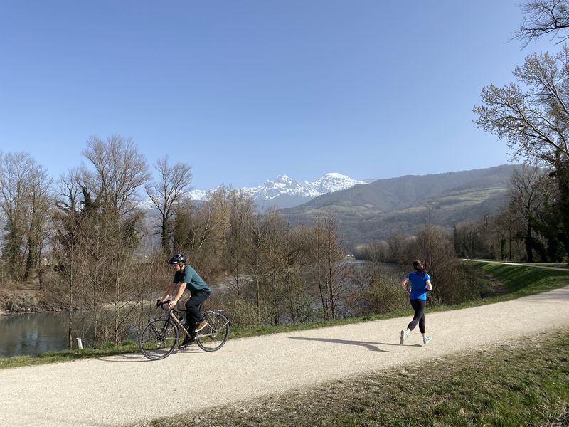
Un parcours balisé pour la pratique de la marche, du jogging, du cross et du VTT.
The characteristics of the route.
Montbonnot-Saint-Martin (38)
- Distance 9.8 km
- Elevation gain 30 m
- Elevation lost 30 m
- Min. elevation 215 m
- Max. elevation. 222 m
- Marking Yes
Equipments : Car park, Admission fee : Free access.Opening : All year round.
Area : Grésivaudan
Report a problem
Website Pdf file Features of the application :
- Location and orientation on detailed maps thanks to the GPS of your smartphone
- Description of routes and points of interest on the route
- Photo gallery by route
- Detailed elevation profile
- Route tracking alert to warn you if you stray from the route
- Send predefined messages by SMS to your contacts
- Emergency module: trigger a call or send an emergency SMS in case of problem
- Agenda: access to events organized in the department
- News: find in the application the latest news on the web portal
- Adding achievements
- Add reports in case of problems encountered on the routes
- Share on social networks
Add your time and share your feelings
Services nearby

Espace naturel sensible du Bois de la Batie
Saint-Ismier

Sappey-en-Chartreuse Tourist Information Center
Le Sappey-en-Chartreuse

Maison Bergès
Villard-Bonnot
Musée Hébert
La Tronche
La Combe de Lancey Museum
La Combe-de-Lancey


Information updated on 2022-07-21 by Département de l'Isère


Follow us on
the digital trails
the digital trails


![]()
The Isère Outdoor application was created
by the Département de l'Isère
Infos & contact
Conseil départemental de l'Isère
7 rue Fantin Latour
CS 41096
38 022 Grenoble cedex 1
Tel. 04 76 00 38 38
 Isère Outdoor - Parcours - Parcours sportif vert
Hello, world! This is a toast message.
Isère Outdoor - Parcours - Parcours sportif vert
Hello, world! This is a toast message.
Isère Outdoor - Parcours - Parcours sportif vert
Hello, world! This is a toast message.


OK
Annuler