Le Bois d'Autimont -vtt
Add to my favorites

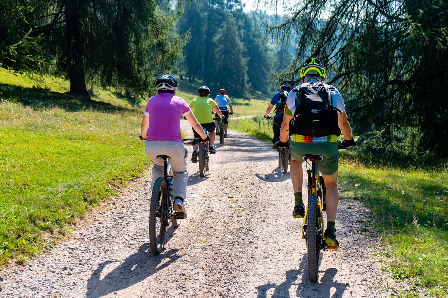
En plein coeur du bois d'Autimont, le chemin qui s'immisce entre hêtres, châtaigniers et chênes offre de très beaux points de vue sur les massifs environnants.
The characteristics of the route.

Faramans (38)
- Distance 11.2 km
- Elevation gain 140 m
- Elevation lost 140 m
- Min. elevation 340 m
- Max. elevation. 437 m
- Duration (depending on pace) 1h45
- Marking Yes
Equipments : Picnic area, Public WC, Car park, Opening : All year round.
Area : Bièvre Isère
Report a problem
Website Pdf file Features of the application :
- Location and orientation on detailed maps thanks to the GPS of your smartphone
- Description of routes and points of interest on the route
- Photo gallery by route
- Detailed elevation profile
- Route tracking alert to warn you if you stray from the route
- Send predefined messages by SMS to your contacts
- Emergency module: trigger a call or send an emergency SMS in case of problem
- Agenda: access to events organized in the department
- News: find in the application the latest news on the web portal
- Adding achievements
- Add reports in case of problems encountered on the routes
- Share on social networks
Alex38260
The 2023/07/22
En savoir plus
Borki
finished in 02:00:00
The 2022/08/28
En savoir plus
Ajouter votre chrono et partager vos sensations
2023/07/22 Alex38260
Excellent parcours qui part du centre de Faramans. 2 grosses montées pour se chauffer puis un joli bois qui redescend sur des chemins entre les champs pour un retour sur faramans.
2022/08/28 02:00:00
Borki
Borki
2023/07/22 Alex38260
Excellent parcours qui part du centre de Faramans. 2 grosses montées pour se chauffer puis un joli bois qui redescend sur des chemins entre les champs pour un retour sur faramans.
2022/08/28 02:00:00
Borki
Borki
Services nearby

La Côte-Saint-André Tourist information center
La Côte-Saint-André

Hector berlioz Museum
La Côte-Saint-André

Espace naturel sensible Les fontaines de Beaufort
Beaufort
Musée des Liqueurs Cherry-Rocher
La Côte-Saint-André
Office de tourisme
Beaurepaire


Information updated on 2023-10-13 by Office de Tourisme Terres de Berlioz


Follow us on
the digital trails
the digital trails


![]()
The Isère Outdoor application was created
by the Département de l'Isère
Infos & contact
Conseil départemental de l'Isère
7 rue Fantin Latour
CS 41096
38 022 Grenoble cedex 1
Tel. 04 76 00 38 38
 Isère Outdoor - Parcours - Le Bois d'Autimont -vtt
Hello, world! This is a toast message.
Isère Outdoor - Parcours - Le Bois d'Autimont -vtt
Hello, world! This is a toast message.
Isère Outdoor - Parcours - Le Bois d'Autimont -vtt
Hello, world! This is a toast message.


OK
Annuler