Tour of the ''Villages du Bachat'' by Electric mountain bike
Add to my favorites

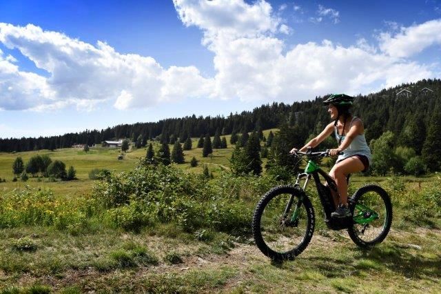
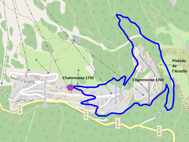
Cross-country and electric mountain bike average loop (blue level) around Chamrousse 1750, 1700 and 1600 - Arselle Plateau.
Estimated time based on an average speed of 7km/h.
The characteristics of the route.
Chamrousse (38)
- Distance 5.6 km
- Elevation gain 150 m
- Elevation lost 150 m
- Min. elevation 1634 m
- Max. elevation. 1764 m
- Duration (depending on pace) 0h47
- Marking Yes
Equipment rental in Chamrousse 1650, 1700 et 1750 shops.
Guided outings in Chamrousse 1750 by "École Moniteur Cycliste Français (MCF)" and "Bureau des guides et accompagnateurs".Marking : Local yellow markings.Equipments : Public WC, Parking nearby, Charging station for 2 electric wheels, Admission fee : Free access.Opening : From 01/06 to 30/09.
Guided outings in Chamrousse 1750 by "École Moniteur Cycliste Français (MCF)" and "Bureau des guides et accompagnateurs".Marking : Local yellow markings.Equipments : Public WC, Parking nearby, Charging station for 2 electric wheels, Admission fee : Free access.Opening : From 01/06 to 30/09.
Area : Grésivaudan
Report a problem
Website Features of the application :
- Location and orientation on detailed maps thanks to the GPS of your smartphone
- Description of routes and points of interest on the route
- Photo gallery by route
- Detailed elevation profile
- Route tracking alert to warn you if you stray from the route
- Send predefined messages by SMS to your contacts
- Emergency module: trigger a call or send an emergency SMS in case of problem
- Agenda: access to events organized in the department
- News: find in the application the latest news on the web portal
- Adding achievements
- Add reports in case of problems encountered on the routes
- Share on social networks
Add your time and share your feelings
Services nearby

Arselle Peatbog (Preserved Natural Area)
Chamrousse

Chamrousse Tourist Office
Chamrousse

Romanche Museum
Livet-et-Gavet
Office Thermal et Touristique d'Uriage-les-Bains
Saint-Martin-d'Uriage

Refuge de la Pra
Revel


Information updated on 2024-10-04 by Office du Tourisme de Chamrousse


Follow us on
the digital trails
the digital trails


![]()
The Isère Outdoor application was created
by the Département de l'Isère
Infos & contact
Conseil départemental de l'Isère
7 rue Fantin Latour
CS 41096
38 022 Grenoble cedex 1
Tel. 04 76 00 38 38
 Isère Outdoor - Parcours - Tour of the ''Villages du Bachat'' by Electric mountain bike
Hello, world! This is a toast message.
Isère Outdoor - Parcours - Tour of the ''Villages du Bachat'' by Electric mountain bike
Hello, world! This is a toast message.
Isère Outdoor - Parcours - Tour of the ''Villages du Bachat'' by Electric mountain bike
Hello, world! This is a toast message.


OK
Annuler