Between village and forest by mountain bike
Add to my favorites

Caution! Zone of vigilance near the route
Faucon pèlerin - du 01/02/2026 au 30/06/2026 In progress
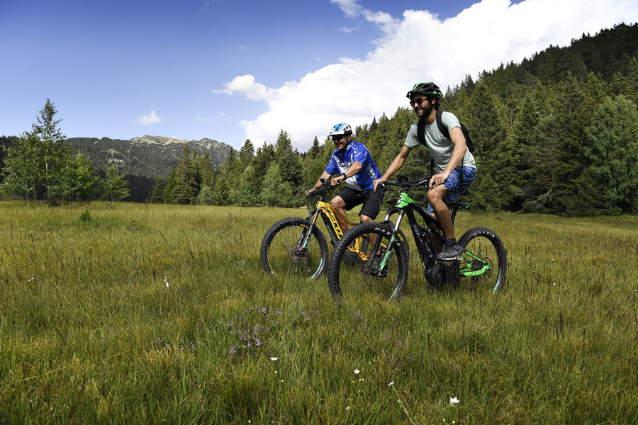
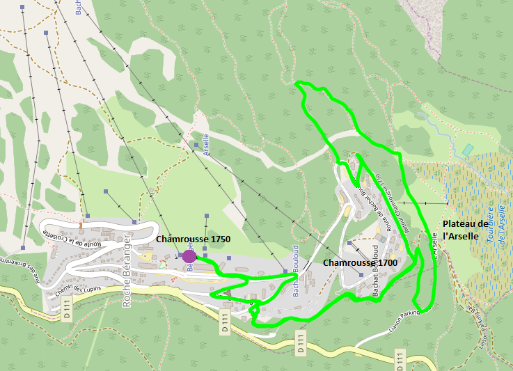
Cross-country and electric mountain bike average loop (green level) around Chamrousse 1750, 1700 and 1600.
Estimated time based on an average cross-country speed of 6km/h.
The characteristics of the route.

Chamrousse (38)
- Distance 7 km
- Elevation gain 180 m
- Elevation lost 180 m
- Min. elevation 1635 m
- Max. elevation. 1750 m
- Duration (depending on pace) 1h10
- Marking Yes
Equipment rental in Chamrousse 1650, 1700 et 1750 shops.
Guided outings in Chamrousse 1750 by "École Moniteur Cycliste Français (MCF)" and "Bureau des guides et accompagnateurs".Marking : Yellow (orange) MTB-FFC markings.Equipments : Public WC, Parking nearby, Admission fee : Free access.Opening : From 01/06 to 30/09.Warning : Following the replacement of the La Bérangère chairlift, work is underway on the footpaths and mountain bike trails.
Guided outings in Chamrousse 1750 by "École Moniteur Cycliste Français (MCF)" and "Bureau des guides et accompagnateurs".Marking : Yellow (orange) MTB-FFC markings.Equipments : Public WC, Parking nearby, Admission fee : Free access.Opening : From 01/06 to 30/09.Warning : Following the replacement of the La Bérangère chairlift, work is underway on the footpaths and mountain bike trails.
Area : Grésivaudan
Report a problem
Website Features of the application :
- Location and orientation on detailed maps thanks to the GPS of your smartphone
- Description of routes and points of interest on the route
- Photo gallery by route
- Detailed elevation profile
- Route tracking alert to warn you if you stray from the route
- Send predefined messages by SMS to your contacts
- Emergency module: trigger a call or send an emergency SMS in case of problem
- Agenda: access to events organized in the department
- News: find in the application the latest news on the web portal
- Adding achievements
- Add reports in case of problems encountered on the routes
- Share on social networks
Add your time and share your feelings
Services nearby

Arselle Peatbog (Preserved Natural Area)
Chamrousse

Chamrousse Tourist Office
Chamrousse

Romanche Museum
Livet-et-Gavet
Office Thermal et Touristique d'Uriage-les-Bains
Saint-Martin-d'Uriage

Refuge de la Pra
Revel


Information updated on 2024-10-04 by Office du Tourisme de Chamrousse


Follow us on
the digital trails
the digital trails


![]()
The Isère Outdoor application was created
by the Département de l'Isère
Infos & contact
Conseil départemental de l'Isère
7 rue Fantin Latour
CS 41096
38 022 Grenoble cedex 1
Tel. 04 76 00 38 38
 Isère Outdoor - Parcours - Between village and forest by mountain bike
Hello, world! This is a toast message.
Isère Outdoor - Parcours - Between village and forest by mountain bike
Hello, world! This is a toast message.
Isère Outdoor - Parcours - Between village and forest by mountain bike
Hello, world! This is a toast message.


OK
Annuler