Boucle vélo de Maupas et Veurey
Add to my favorites

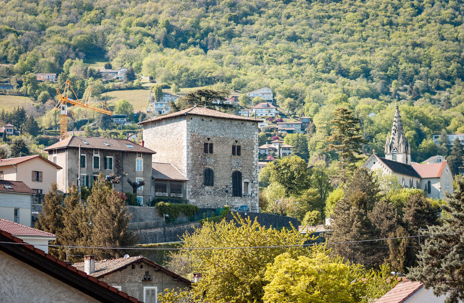
This loop offers a breath of fresh air around the Isère river. At its north-western end, take time to discover Veurey-Voroize, the Parc des Cordées and the Templar Tower.
The characteristics of the route.
Saint-Égrève (38)
- Distance 13.4 km
- Elevation gain 110 m
- Elevation lost 110 m
- Min. elevation 193 m
- Max. elevation. 234 m
- Duration (depending on pace) 1h20
- Marking No
On the way back, before crossing the Isère, take a break by leaving the voie verte on the left. Take a step back and enjoy a breathtaking view of the dam and the Chartreuse massif.
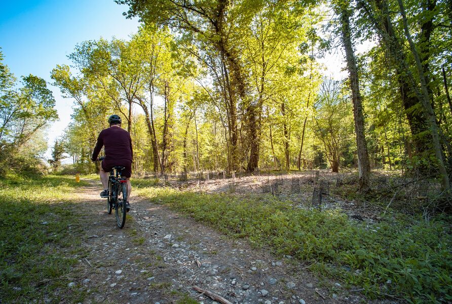
This beautiful loop around the Isère begins at the parking lot next to the Saint-Égrève dam. This meeting point has direct access to the greenway, which takes you north-west to Grenoble and south-east to complete the Confluence-Isère-Drac loop.
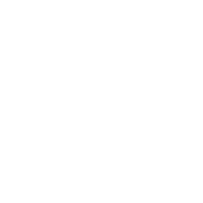
On the outward journey, head northwest along the banks of the Isère on the greenway. Once you've left Veurey-Voroize, as you ride along the edge of the forest, the route is so quiet that you'll need to keep in mind that it's not reserved for cycles. The last section takes you to the Saint-Égrève dam via the river banks. This easy, safe loop will delight novice cyclists.
From the parking lot, take the cycle path to join the Berges de l'Isère greenway. Heading north-west, it follows the course of the river for almost 5km.
After passing under the D3, take the cycle path which bends to the right
to make a U-turn and climb back up to road level. Cross the river along the D3. On the other side of the bridge, continue on the cycle path which takes you back under the D3 and onto the greenway up the Isère.
Follow the cycle path as it veers right towards Veurey-Voroize, makes a U-turn and rejoins the carriageway. At the end of the road, turn right onto the D1532 and a few meters further on, turn left to enter Veurey-Voroize on the D3, route de Montaud.
Turn left, just in front of the planted median, along the Metrovelo BOX, rue des Perrières. 40m further on, do not enter the housing estate, but continue on rue des Perrières, which turns left.
Continue through the undergrowth, on the two-way cycle lane* of rue Abbé Cuchet.
At the stop sign, continue straight ahead on rue du Maupas (D74), which runs alongside the Place Victor Jat parking lot.
At the traffic lights, cross avenue Saint-Jean (D1532) and continue straight ahead, on chemin du Moulin, towards village de l'amitié. At the stop sign, turn left onto chemin de l'Orphelinat. At the end of this road, turn left onto chemin des Bauches, which joins route de Vanne, on which you turn right.
Turn right and follow the Isère upstream for 1.5km along the voie verte.
Turn left onto the cycle path, which takes you back to road level, back across the Isère and back to your starting point.Equipments : Parking nearby, Admission fee : Free access.Opening : All year round. Subject to favorable weather.
This beautiful loop around the Isère begins at the parking lot next to the Saint-Égrève dam. This meeting point has direct access to the greenway, which takes you north-west to Grenoble and south-east to complete the Confluence-Isère-Drac loop.
On the outward journey, head northwest along the banks of the Isère on the greenway. Once you've left Veurey-Voroize, as you ride along the edge of the forest, the route is so quiet that you'll need to keep in mind that it's not reserved for cycles. The last section takes you to the Saint-Égrève dam via the river banks. This easy, safe loop will delight novice cyclists.
From the parking lot, take the cycle path to join the Berges de l'Isère greenway. Heading north-west, it follows the course of the river for almost 5km.
After passing under the D3, take the cycle path which bends to the right
to make a U-turn and climb back up to road level. Cross the river along the D3. On the other side of the bridge, continue on the cycle path which takes you back under the D3 and onto the greenway up the Isère.
Follow the cycle path as it veers right towards Veurey-Voroize, makes a U-turn and rejoins the carriageway. At the end of the road, turn right onto the D1532 and a few meters further on, turn left to enter Veurey-Voroize on the D3, route de Montaud.
Turn left, just in front of the planted median, along the Metrovelo BOX, rue des Perrières. 40m further on, do not enter the housing estate, but continue on rue des Perrières, which turns left.
Continue through the undergrowth, on the two-way cycle lane* of rue Abbé Cuchet.
At the stop sign, continue straight ahead on rue du Maupas (D74), which runs alongside the Place Victor Jat parking lot.
At the traffic lights, cross avenue Saint-Jean (D1532) and continue straight ahead, on chemin du Moulin, towards village de l'amitié. At the stop sign, turn left onto chemin de l'Orphelinat. At the end of this road, turn left onto chemin des Bauches, which joins route de Vanne, on which you turn right.
Turn right and follow the Isère upstream for 1.5km along the voie verte.
Turn left onto the cycle path, which takes you back to road level, back across the Isère and back to your starting point.Equipments : Parking nearby, Admission fee : Free access.Opening : All year round. Subject to favorable weather.
Area : Grenoble-Alpes Métropole
Report a problem
Website Pdf file Features of the application :
- Location and orientation on detailed maps thanks to the GPS of your smartphone
- Description of routes and points of interest on the route
- Photo gallery by route
- Detailed elevation profile
- Route tracking alert to warn you if you stray from the route
- Send predefined messages by SMS to your contacts
- Emergency module: trigger a call or send an emergency SMS in case of problem
- Agenda: access to events organized in the department
- News: find in the application the latest news on the web portal
- Adding achievements
- Add reports in case of problems encountered on the routes
- Share on social networks
Add your time and share your feelings
Services nearby

Sassenage Tourist Information Center
Sassenage

Arhome, Museum of the industrial innovation
Grenoble
Mountain Troops Museum
Grenoble
Bastille Tourist Information Center
Grenoble

La Moliere
Autrans-Méaudre en Vercors


Information updated on 2024-08-01 by Office de Tourisme Grenoble Alpes


Follow us on
the digital trails
the digital trails


![]()
The Isère Outdoor application was created
by the Département de l'Isère
Infos & contact
Conseil départemental de l'Isère
7 rue Fantin Latour
CS 41096
38 022 Grenoble cedex 1
Tel. 04 76 00 38 38
 Isère Outdoor - Parcours - Boucle vélo de Maupas et Veurey
Hello, world! This is a toast message.
Isère Outdoor - Parcours - Boucle vélo de Maupas et Veurey
Hello, world! This is a toast message.
Isère Outdoor - Parcours - Boucle vélo de Maupas et Veurey
Hello, world! This is a toast message.


OK
Annuler