Creys et Bocages - 17,5 km - Bleu
Add to my favorites

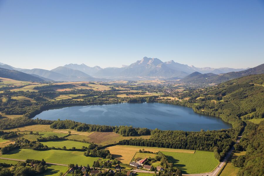
L’idéal est de faire la boucle en soirée. La crête entre les Troussiers et Tors, offre une magnifique vue sur l’Obiou !
The characteristics of the route.

Saint-Théoffrey (38)
- Distance 17.6 km
- Elevation gain 330 m
- Elevation lost 330 m
- Min. elevation 918 m
- Max. elevation. 1141 m
- Marking Yes
Admission fee : Free access.Opening : All year round.
Area : Matheysine
Report a problem
Website Pdf file Features of the application :
- Location and orientation on detailed maps thanks to the GPS of your smartphone
- Description of routes and points of interest on the route
- Photo gallery by route
- Detailed elevation profile
- Route tracking alert to warn you if you stray from the route
- Send predefined messages by SMS to your contacts
- Emergency module: trigger a call or send an emergency SMS in case of problem
- Agenda: access to events organized in the department
- News: find in the application the latest news on the web portal
- Adding achievements
- Add reports in case of problems encountered on the routes
- Share on social networks
Add your time and share your feelings
Services nearby

Belvédère Olivier Messiaen
Saint-Théoffrey

Musuem "La Mine Image"
La Motte-d'Aveillans

Maison du Tourisme de La Motte d'Aveillans
La Motte-d'Aveillans
Alpe du Grand Serre Tourist Office
Alpe Du Grand Serre
Museum of the French Revolution
Vizille


Information updated on 2021-08-04 by Matheysine Tourisme


Follow us on
the digital trails
the digital trails


![]()
The Isère Outdoor application was created
by the Département de l'Isère
Infos & contact
Conseil départemental de l'Isère
7 rue Fantin Latour
CS 41096
38 022 Grenoble cedex 1
Tel. 04 76 00 38 38
 Isère Outdoor - Parcours - Creys et Bocages - 17,5 km - Bleu
Hello, world! This is a toast message.
Isère Outdoor - Parcours - Creys et Bocages - 17,5 km - Bleu
Hello, world! This is a toast message.
Isère Outdoor - Parcours - Creys et Bocages - 17,5 km - Bleu
Hello, world! This is a toast message.


OK
Annuler