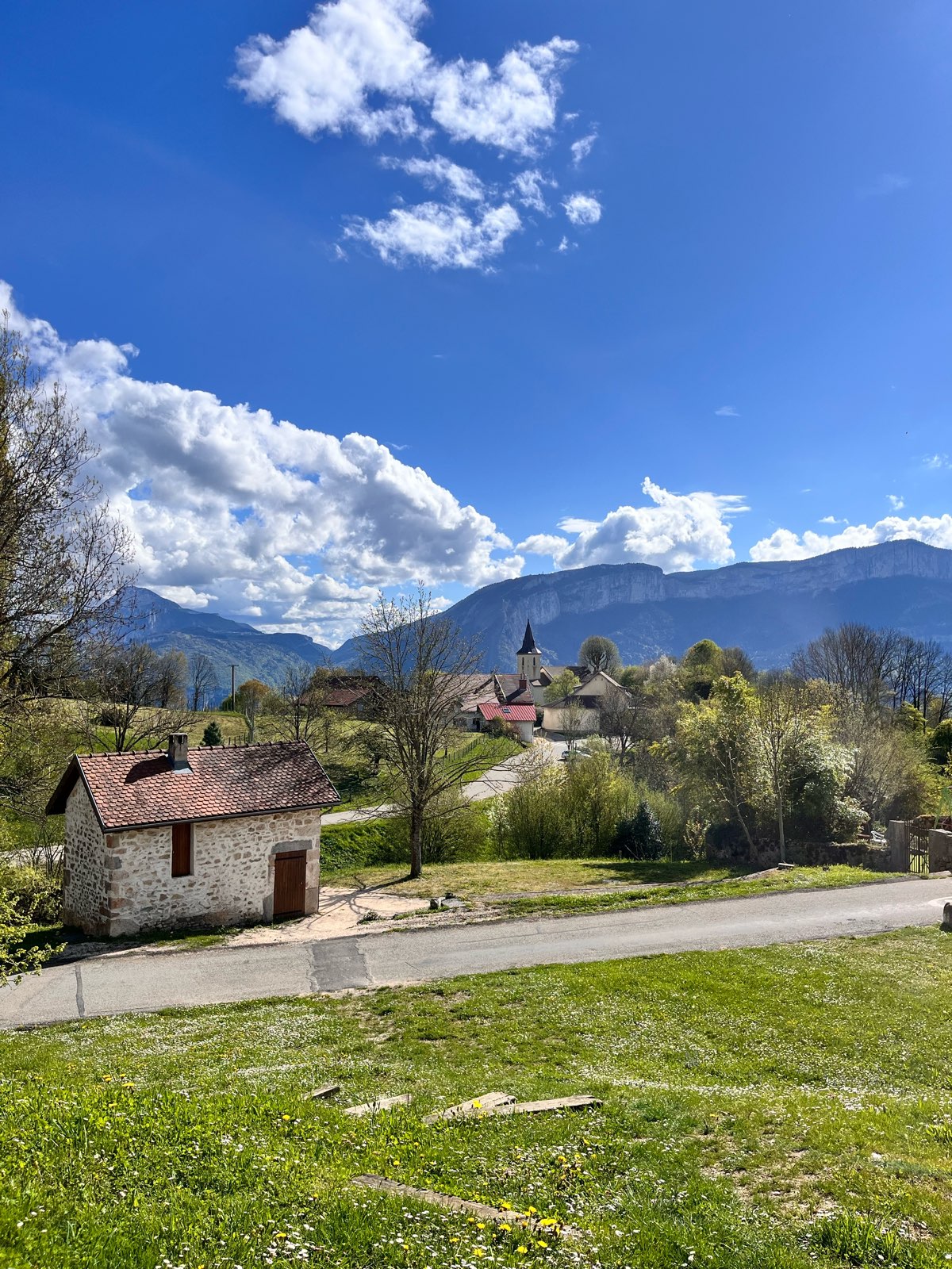
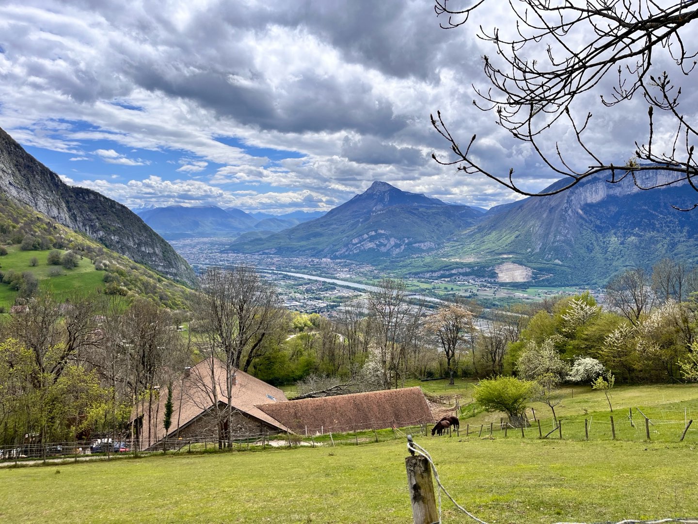
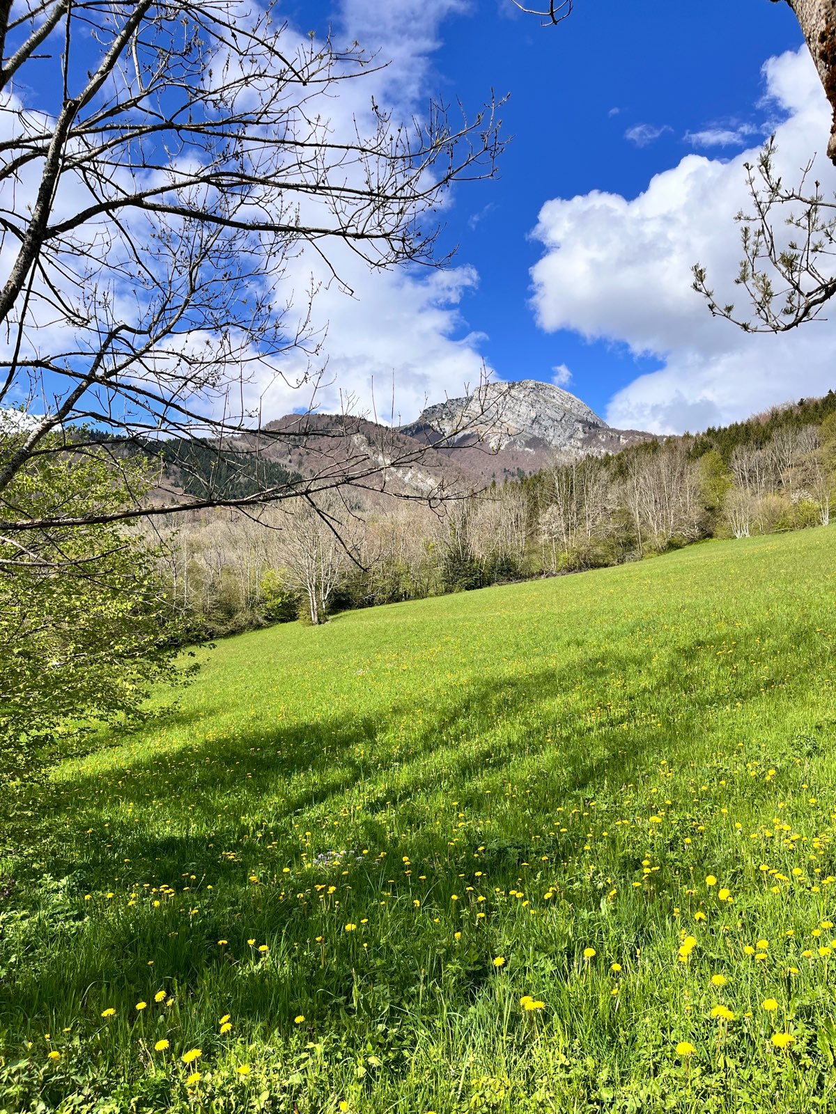
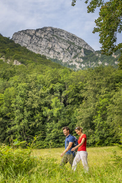
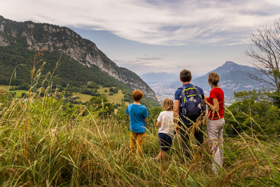
The Charvet hill, a fabulous viewpoint
Add to my favorites

Caution! Zone of vigilance near the route
Faucon pèlerin - du 01/02/2026 au 30/06/2026 In progress
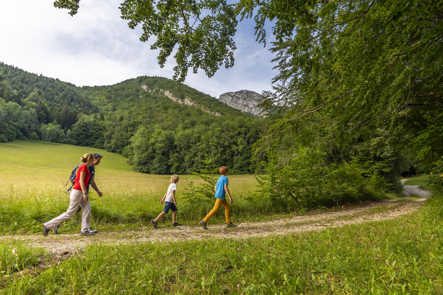
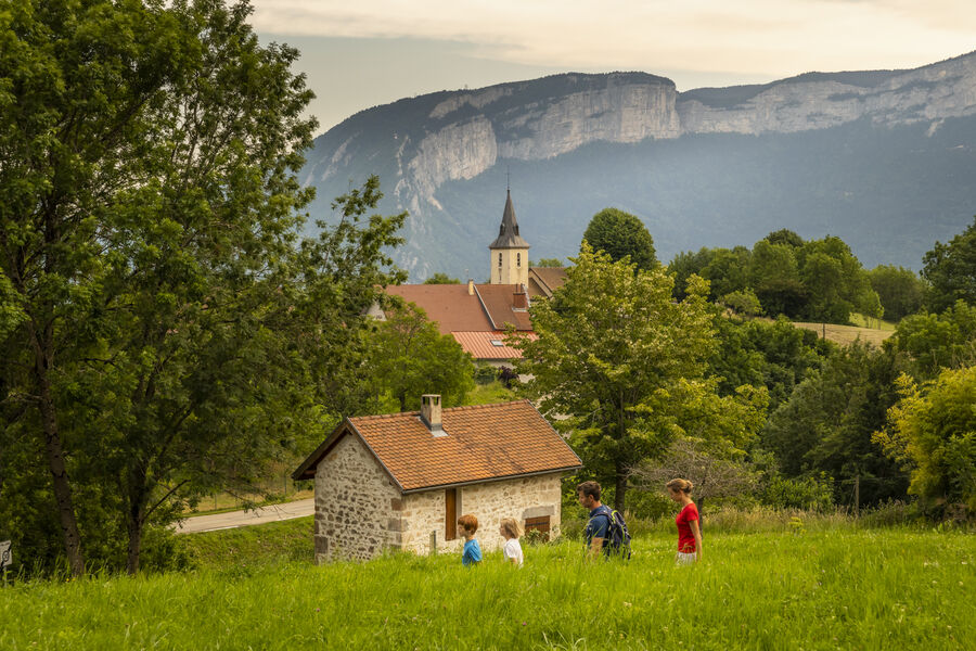
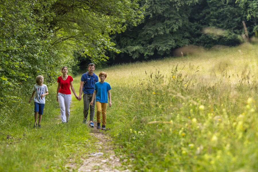
Almost all of this hike is done in the shade of the beech trees whose leaves cover the ground and, with the limestone rocks and the ruins of old stone houses, give all its charm to this trip in the forest of Chartreuse
The characteristics of the route.

Mont-Saint-Martin (38)
- Distance 5.9 km
- Elevation gain 300 m
- Elevation lost 300 m
- Min. elevation 750 m
- Max. elevation. 1049 m
- Duration (depending on pace) 2h30
- Marking Yes
Marking : Hiking trail : yellow markingsEquipments : Car park, Free car park, Admission fee : Free of chargeOpening : All year round.Step by step description : From Mont-Saint-Martin (alt. 740 m), walk 100 m up the road towards Collavière. Follow the yellow markings on this trail. At Collavière (alt. 745 m), turn right towards the day-care center and Namière, the "Chemin des Combes", still on asphalt. After two hairpin bends, continue along the road until you come to a barrier. Turn right onto the "chemin de Namière", heading for Les Combes via the "boucle du Sabot". Just after the first house in the hamlet of Namière, turn left to follow the track above this first house. Stay on the big track as it rises peacefully. It makes a sharp left-hand bend and continues northwards. Don't take the downhill path to the left on the straight, but continue to follow the yellow markings straight ahead. When you reach the meadows, don't follow the signs for the Dauphins mill, but take the slightly downhill track to the left. Another 100 m and you'll reach the Les Combes crossroads (alt. 920 m). Then fork right towards Côte Charvet, marked at 700 m and 25 minutes. After a steep climb, you arrive at côte Charvet (alt. 1,050 m), the high point of your hike.
Turn left towards Mont-Saint-Martin via Spain, to pass the foot of the côte Charvet (alt. 975 m), where you continue to the right. At the next junction, on Espagne (alt. 910 m), turn left towards Collavière.
You quickly lose altitude and, over cemented switchbacks, reach the asphalt road. Just turn left to get back to Collavière, then right to get back to the entrance to Mont-Saint-Martin.
Alternative: You can combine this hike with the one from Le Fontanil to Mont-Saint-Martin. You'll then cover 12.8 km, with an ascent of 850 m. (See topo "Du Fontanil à Mont-Saint-Martin").
Points of interest:
- The village of Mont-Saint-Martin
- Meadows
- The history of the mills
- View of Grenoble
- View of the Vercors
- The hamlet of Espagne
Area : Grenoble-Alpes Métropole
Report a problem
Website Pdf file Features of the application :
- Location and orientation on detailed maps thanks to the GPS of your smartphone
- Description of routes and points of interest on the route
- Photo gallery by route
- Detailed elevation profile
- Route tracking alert to warn you if you stray from the route
- Send predefined messages by SMS to your contacts
- Emergency module: trigger a call or send an emergency SMS in case of problem
- Agenda: access to events organized in the department
- News: find in the application the latest news on the web portal
- Adding achievements
- Add reports in case of problems encountered on the routes
- Share on social networks
ecile20
The 2025/04/23
En savoir plus
Ajouter votre chrono et partager vos sensations
Services nearby

Sassenage Tourist Information Center
Sassenage

Col de Porte
Sarcenas
Sappey-en-Chartreuse Tourist Information Center
Le Sappey-en-Chartreuse
Bastille Tourist Information Center
Grenoble

Mountain Troops Museum
Grenoble


Information updated on 2025-05-06 by Office de Tourisme Grenoble Alpes


Follow us on
the digital trails
the digital trails


![]()
The Isère Outdoor application was created
by the Département de l'Isère
Infos & contact
Conseil départemental de l'Isère
7 rue Fantin Latour
CS 41096
38 022 Grenoble cedex 1
Tel. 04 76 00 38 38
 Isère Outdoor - Parcours - The Charvet hill, a fabulous viewpoint
Hello, world! This is a toast message.
Isère Outdoor - Parcours - The Charvet hill, a fabulous viewpoint
Hello, world! This is a toast message.
Isère Outdoor - Parcours - The Charvet hill, a fabulous viewpoint
Hello, world! This is a toast message.


OK
Annuler