Le tour du Pic de l’Oeilly, le col de la Madeleine et la réserve naturelle du Luitel
Add to my favorites

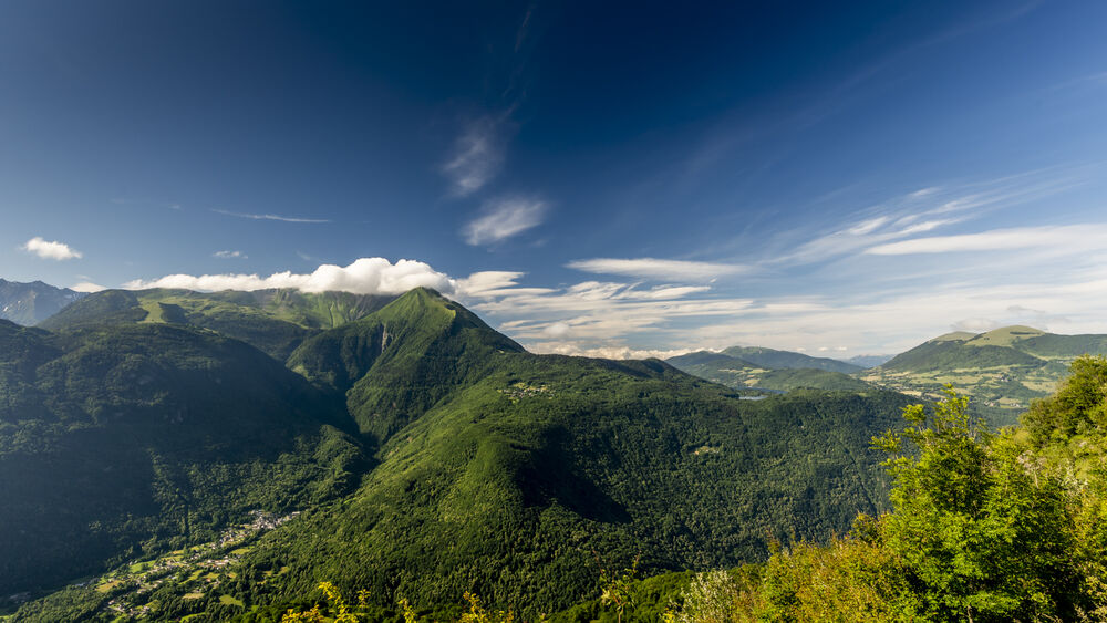
In the south of Belledonne, the Luitel pass keeps the traces of the ancient glaciers.
This easy hike around Œilly is a trip back in time with the vestiges of
with the vestiges of the rural life of yesteryear.
The characteristics of the route.

Séchilienne (38)
- Distance 9 km
- Elevation gain 410 m
- Elevation lost 410 m
- Min. elevation 1086 m
- Max. elevation. 1385 m
- Duration (depending on pace) 3h45
- Marking Yes
Equipments : Car park, Free car park, Admission fee : Free of chargeOpening : Throughout the year : open daily.Step by step description : Start from the parking lot at the reserve house. Cross the small footbridge, head in the direction
towards the Maison de la Réserve and take the path on the left towards Lac Luitel.
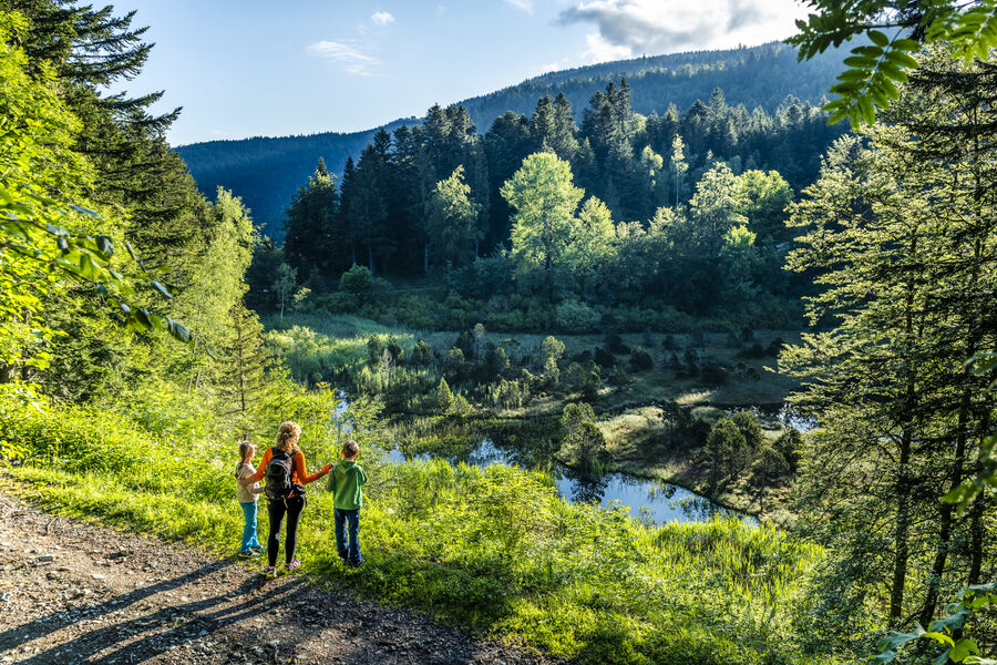
At the junction with the main track, turn left. Shortly afterwards, you'll come to a viewpoint overlooking
Lac Luitel. Continue straight ahead on the track towards Pied du Pic de l'Oeilly and Baraque
Pagnot, where you take the downhill track on the right towards Eau Morel. Turn
left along the meadows and then right onto the path leading steeply downhill towards
steep descent towards La Roche and Col de la Madeleine. From La Roche, access the Madeleine lookout. Climb back up to La Roche and turn right onto the wide track that leads to the Cherley house. At the summit of Cherley, turn right onto the track towards
Buissonière, cross the route de Séchilienne to reach Les Trois Fontaines. Take the path opposite and climb up to La Croix. Return to the road and turn right. Go straight on at the place-dit de la Réserve to return to the parking lot via the Col du Luitel road.
Area : Grenoble-Alpes Métropole
Report a problem
Website Pdf file Features of the application :
- Location and orientation on detailed maps thanks to the GPS of your smartphone
- Description of routes and points of interest on the route
- Photo gallery by route
- Detailed elevation profile
- Route tracking alert to warn you if you stray from the route
- Send predefined messages by SMS to your contacts
- Emergency module: trigger a call or send an emergency SMS in case of problem
- Agenda: access to events organized in the department
- News: find in the application the latest news on the web portal
- Adding achievements
- Add reports in case of problems encountered on the routes
- Share on social networks
Add your time and share your feelings
Services nearby

Arselle Peatbog (Preserved Natural Area)
Chamrousse

Romanche Museum
Livet-et-Gavet

Chamrousse Tourist Office
Chamrousse
Museum of the French Revolution
Vizille
Vizille Tourist Information Center
Vizille


Information updated on 2026-05-06 by Office de Tourisme Grenoble Alpes


Follow us on
the digital trails
the digital trails


![]()
The Isère Outdoor application was created
by the Département de l'Isère
Infos & contact
Conseil départemental de l'Isère
7 rue Fantin Latour
CS 41096
38 022 Grenoble cedex 1
Tel. 04 76 00 38 38
 Isère Outdoor - Parcours - Le tour du Pic de l’Oeilly, le col de la Madeleine et la réserve naturelle du Luitel
Hello, world! This is a toast message.
Isère Outdoor - Parcours - Le tour du Pic de l’Oeilly, le col de la Madeleine et la réserve naturelle du Luitel
Hello, world! This is a toast message.
Isère Outdoor - Parcours - Le tour du Pic de l’Oeilly, le col de la Madeleine et la réserve naturelle du Luitel
Hello, world! This is a toast message.


OK
Annuler