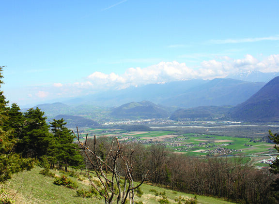
The Echaillon pass and the Uriol ridges from Saint-Paul-de-Varces
Add to my favorites

Caution! Zone of vigilance near the route
Faucon pèlerin - du 01/02/2026 au 30/06/2026 In progress
The tour of the Pieu from St Paul de Varces
The characteristics of the route.

Saint-Paul-de-Varces (ND)
- Distance 13.2 km
- Elevation gain 800 m
- Elevation lost 800 m
- Min. elevation 354 m
- Max. elevation. 911 m
- Duration (depending on pace) 5h30
- Marking Yes
Equipments : Car park, Delicate passages : Steep and slippery descent between the Crêtes and the Circuit de la LampeAdmission fee : Free access.Opening : All year round.
Subject to favorable weather.Step by step description : Departure is from the Saint-Paul-de-Varces town hall parking lot. From the Saint-Paul-de-Varces signpost, turn right onto the Charrière Chaude road towards Prélenfrey and Ongrie. At "Ongrie", go straight on for 1 km, then turn left towards "Pont du Batou". Go down the road and cross the "Pont du Batou". Immediately after the bridge, take the right-hand path towards Prélenfrey. Follow the path to the end of a large track at "Les Rioux". Continue straight on up to "Gros Moran" for 400 m. At Gros Moran, take the left-hand track towards Echaillon. Climb to the end of the field and take the flat "Pierre Grosse" path to the Col de l'Echaillon. At the "Col de l'Echaillon", start to descend the track for about 20 m towards "Le Gua", then take the left-hand path towards "Vif" and "Uriol". Climb the forest track which leads to meadows offering exceptional panoramic views. Follow the path along the edge of the meadows for 3 km to "Uriol". At "Uriol", turn left onto the track leading to "St Paul de Varces" and "Crêtes d'Uriol" for 350 m. Then leave the track and take the path on the right towards "Crêtes d'Uriol" for 17O m, then take the small path on your left. Turn right in the direction of "Crêtes d'Uriol" when this path joins the track. Continue along the track for 150 m and turn left onto the path leading up to the Crêtes d'Uriol. At "Crêtes d'Uriol", continue downhill towards "Brise Tourte". Be sure to follow the paint markings, and take care not to take the left-hand path blocked by a cross. Follow the path down to "Brise Tourte", then turn left onto the narrow, winding, steep path, some of which leads to the "Forêt du Gerbier". At "Forêt du Gerbier", don't cross the La Lampe torrent again, but go down 10 m and take the small, winding path on the right towards "Le Charmas". At "Le Charmas", turn left onto the track, emerge onto the road and follow the signs for "St Paul de Varces" all the way to the finish. From chemin du Charmas, continue straight ahead on chemin des Bérards. Turn left onto chemin du Bémont and right onto chemin neuf until you reach the end of the route du Vercors. Turn left and return to the starting point.
Area : Grenoble-Alpes Métropole
Report a problem
Website Pdf file Features of the application :
- Location and orientation on detailed maps thanks to the GPS of your smartphone
- Description of routes and points of interest on the route
- Photo gallery by route
- Detailed elevation profile
- Route tracking alert to warn you if you stray from the route
- Send predefined messages by SMS to your contacts
- Emergency module: trigger a call or send an emergency SMS in case of problem
- Agenda: access to events organized in the department
- News: find in the application the latest news on the web portal
- Adding achievements
- Add reports in case of problems encountered on the routes
- Share on social networks
Add your time and share your feelings
Services nearby

Musée Champollion
Vif

Auberge des Allières
Lans-en-Vercors

Espace naturel sensible de la tourbière du Peuil
Claix
Musée Autrefois
Champ-sur-Drac
Maison du Patrimoine
Villard-de-Lans


Information updated on 2025-05-06 by Office de Tourisme Grenoble Alpes


Follow us on
the digital trails
the digital trails


![]()
The Isère Outdoor application was created
by the Département de l'Isère
Infos & contact
Conseil départemental de l'Isère
7 rue Fantin Latour
CS 41096
38 022 Grenoble cedex 1
Tel. 04 76 00 38 38
 Isère Outdoor - Parcours - The Echaillon pass and the Uriol ridges from Saint-Paul-de-Varces
Hello, world! This is a toast message.
Isère Outdoor - Parcours - The Echaillon pass and the Uriol ridges from Saint-Paul-de-Varces
Hello, world! This is a toast message.
Isère Outdoor - Parcours - The Echaillon pass and the Uriol ridges from Saint-Paul-de-Varces
Hello, world! This is a toast message.


OK
Annuler