The Maupas spring from St Pierre de Mésage
Add to my favorites

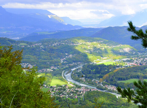
The Maupas spring from St Pierre de Mésage
The characteristics of the route.

Saint-Pierre-de-Mésage (38)
- Distance 8.6 km
- Elevation gain 520 m
- Elevation lost 520 m
- Min. elevation 331 m
- Max. elevation. 699 m
- Duration (depending on pace) 3h15
- Marking Yes
Equipments : Car park, Admission fee : Free access.Opening : All year round.
Subject to favorable weather.Step by step description : Start from the St Pierre de Mésage town hall. Take the route du Connex up to the Eglise St Pierre. Turn right towards Grand David on chemin Romain. At "Grand David", turn left onto the track towards La Frette "Le Moulin". At the "Le Moulin" post, go straight on towards "Font Chaise". At "Font Chaise", continue up the track towards "Le Châtaignier" for just over 2 km. A short distance above the "Le Châtaignier" intersection you'll come to the "Câble à keller". Leave the track and turn right onto the narrow path leading to the "Source de Maupas", 380 m away. At the spring, continue along the path towards "Pont de Loula" and "Loula". At the Loula power station, turn left onto the path leading up to "Font Jillarde". At "Font Jillarde", turn right onto the track leading down to "Les Peyrauds". At the end of the road just before "Les Peyrauds", follow the road to the left for 100 m, then turn right up the Venelle to reach "Les Peyrauds" and continue straight downhill towards St Pierre de Mésage and "L'Oratoire de la Salette". At the intersection with Rue de l'Oratoire, turn right to reach L'Oratoire de la Salette. Continue straight on until you reach "Grand David", where you must turn left onto the path leading to "Eglise St Pierre" and "St Pierre de Mésage" to return to the starting point.
See and know : The church of St Pierre de Mésage is a typical village church with a pointed steeple that can be seen from afar. The Loula power station, built in 1901, turbines water from the Lacs de Laffrey and has a head of 363m.
Area : Grenoble-Alpes Métropole
Report a problem
Website Features of the application :
- Location and orientation on detailed maps thanks to the GPS of your smartphone
- Description of routes and points of interest on the route
- Photo gallery by route
- Detailed elevation profile
- Route tracking alert to warn you if you stray from the route
- Send predefined messages by SMS to your contacts
- Emergency module: trigger a call or send an emergency SMS in case of problem
- Agenda: access to events organized in the department
- News: find in the application the latest news on the web portal
- Adding achievements
- Add reports in case of problems encountered on the routes
- Share on social networks
Add your time and share your feelings
Services nearby

Vizille Tourist Information Center
Vizille

Museum of the French Revolution
Vizille
Musée Autrefois
Champ-sur-Drac
The chemistry Museum
Jarrie

Belvédère Olivier Messiaen
Saint-Théoffrey


Information updated on 2025-05-06 by Office de Tourisme Grenoble Alpes


Follow us on
the digital trails
the digital trails


![]()
The Isère Outdoor application was created
by the Département de l'Isère
Infos & contact
Conseil départemental de l'Isère
7 rue Fantin Latour
CS 41096
38 022 Grenoble cedex 1
Tel. 04 76 00 38 38
 Isère Outdoor - Parcours - The Maupas spring from St Pierre de Mésage
Hello, world! This is a toast message.
Isère Outdoor - Parcours - The Maupas spring from St Pierre de Mésage
Hello, world! This is a toast message.
Isère Outdoor - Parcours - The Maupas spring from St Pierre de Mésage
Hello, world! This is a toast message.


OK
Annuler