Snowshoeing itinerary: Croix de Chamrousse
Add to my favorites

Caution! Zone of vigilance near the route
Faucon pèlerin - du 01/02/2026 au 30/06/2026 In progress
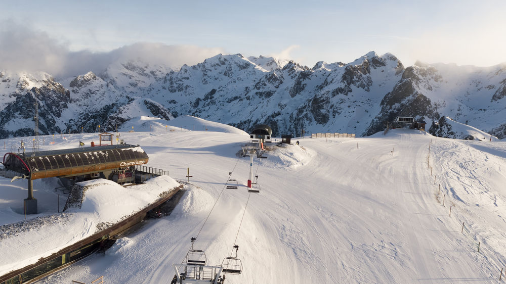
Climb to the top of the Chamrousse resort, through the forest and discover magnificent views.
Departure point: uphill bend in the Bachat Bouloud road, near the Skiset store.
The characteristics of the route.
Chamrousse (38)
- Distance 8 km
- Elevation gain 510 m
- Elevation lost 510 m
- Min. elevation 1741 m
- Max. elevation. 2246 m
- Duration (depending on pace) 5h
- Marking Yes
From Route de Bachat Bouloud: approx. 5h round trip / 7km and 520m ascent.
On arrival, the view of Grenoble and the Grésivaudan valley is breathtaking.
Please note that dogs are not allowed on this route.Marking : Follow the purple sign with the number 5 blackEquipments : Parking nearby, Delicate passages : High elevation gain.Admission fee : Free access.Opening : From 01/12 to 15/04 daily. Subject to snow conditions.
Area : Grésivaudan
Report a problem
Croix de Chamrousse itinerary Features of the application :
- Location and orientation on detailed maps thanks to the GPS of your smartphone
- Description of routes and points of interest on the route
- Photo gallery by route
- Detailed elevation profile
- Route tracking alert to warn you if you stray from the route
- Send predefined messages by SMS to your contacts
- Emergency module: trigger a call or send an emergency SMS in case of problem
- Agenda: access to events organized in the department
- News: find in the application the latest news on the web portal
- Adding achievements
- Add reports in case of problems encountered on the routes
- Share on social networks
Add your time and share your feelings
Services nearby

Arselle Peatbog (Preserved Natural Area)
Chamrousse

Chamrousse Tourist Office
Chamrousse

Romanche Museum
Livet-et-Gavet
Office Thermal et Touristique d'Uriage-les-Bains
Saint-Martin-d'Uriage

Taillefer Hut
Oulles


Information updated on 2026-04-13 by Office du Tourisme de Chamrousse


Follow us on
the digital trails
the digital trails


![]()
The Isère Outdoor application was created
by the Département de l'Isère
Infos & contact
Conseil départemental de l'Isère
7 rue Fantin Latour
CS 41096
38 022 Grenoble cedex 1
Tel. 04 76 00 38 38
 Isère Outdoor - Parcours - Snowshoeing itinerary: Croix de Chamrousse
Hello, world! This is a toast message.
Isère Outdoor - Parcours - Snowshoeing itinerary: Croix de Chamrousse
Hello, world! This is a toast message.
Isère Outdoor - Parcours - Snowshoeing itinerary: Croix de Chamrousse
Hello, world! This is a toast message.


OK
Annuler