Col d'Ornon, Col de Parquetout
Add to my favorites

Caution! Zone of vigilance near the route
Pregentil - du 15/05/2026 au 30/10/2026 In progress
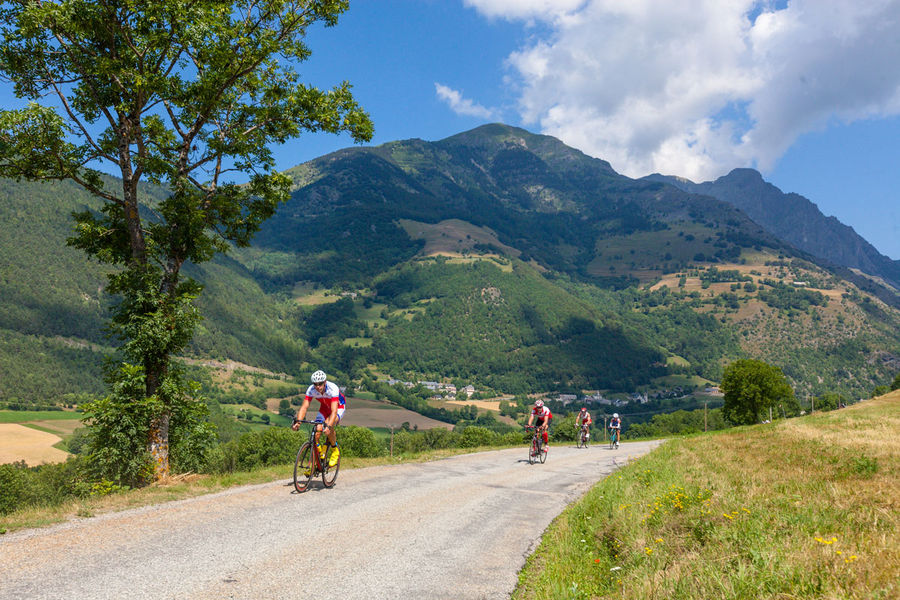
This fairly easy road through the Lignarre Valley is very popular among cyclists at the beginning of the season. The bravest cyclists will use this warming up to carry on to the Valbonnais side up to Col de Parquetout, one of the toughest in the region.
The characteristics of the route.

Le Bourg-d'Oisans (38)
- Distance 28.17 km
- Elevation gain 720 m
- Elevation lost 720 m
- Min. elevation 716 m
- Max. elevation. 1369 m
- Duration (depending on pace) 1h20
- Marking No
This route is available on the “Vélo en Oisans” map (Oisans Tourisme)
Start/Finish: Bourg d’Oisans 720 m
Duration: 1 hr 20 min
Distance (round trip): 28 km
Maximum elevation: 1,380 m
Minimum elevation: 716 m
Elevation gain: 764 m
Maximum gradient: 10%
Map: Michelin Isère and Savoie Department Map No. 333
ROUTE
From Bourg d’Oisans, take the D1091 toward Grenoble. After 2 km, turn left toward Valbonnais–La Mure–Ornon via the D526. The Col d’Ornon is at the 14 km mark. The final kilometers before the Col d’Ornon are a bit steeper than the rest of the route, though never too grueling.
At the pass, you can stop for a break at the lodgings and restaurants in the Col d’Ornon ski resort.
THE “EXTRA BONUS”: Col de Parquetout
If you’re brave enough to make it all the way to the Col de Parquetout, the atmosphere changes dramatically! Although this climb is short, it won’t give you a moment’s respite. It’s one of the toughest passes in Isère!
Max. gradient 16%, average gradient 10%, min. gradient 9%… that sets the tone.
From the Col d’Ornon, descend toward La Mure. Pass through Chantelouve and Entraigues. At the 16th kilometer, leave the D526 by turning left just before the bridge leading to Valbonnais—easily recognizable by its wooden framework. You have 7 km left to ride on the D212f before reaching the pass.
---
Distance (round trip): 48 km
Duration: 3 hrs 30 mins
Elevation gain: 747 mOpening : From 04/01 to 10/31 : open daily. depending on snow conditions.
Area : Oisans
Report a problem
Website Topo Col d'Ornon, Col de Parquetout Features of the application :
- Location and orientation on detailed maps thanks to the GPS of your smartphone
- Description of routes and points of interest on the route
- Photo gallery by route
- Detailed elevation profile
- Route tracking alert to warn you if you stray from the route
- Send predefined messages by SMS to your contacts
- Emergency module: trigger a call or send an emergency SMS in case of problem
- Agenda: access to events organized in the department
- News: find in the application the latest news on the web portal
- Adding achievements
- Add reports in case of problems encountered on the routes
- Share on social networks
Add your time and share your feelings
Services nearby

Maison de l'Oisans et du Parc national des Écrins
Le Bourg-d'Oisans

GALTA the Alpine Treasures Gallery
Le Bourg-d'Oisans
Auris-en-Oisans Tourist Office
Auris-en-Oisans
Tourist office of Villard-Reculas
Villard-Reculas
Office de Tourisme
Alpe d'Huez



Follow us on
the digital trails
the digital trails





The Isère Outdoor application was created
by the Département de l'Isère
Infos & contact
Conseil départemental de l'Isère
7 rue Fantin Latour
CS 41096
38 022 Grenoble cedex 1
Tel. 04 76 00 38 38
 Isère Outdoor - Parcours - Col d'Ornon, Col de Parquetout
Hello, world! This is a toast message.
Isère Outdoor - Parcours - Col d'Ornon, Col de Parquetout
Hello, world! This is a toast message.
Isère Outdoor - Parcours - Col d'Ornon, Col de Parquetout
Hello, world! This is a toast message.


OK
Annuler