N° 29 moutainbike itinerary : La crête de la sciau - black path
Add to my favorites

Caution! Zone of vigilance near the route
Circaète Jean-le-Blanc - du 01/03/2026 au 30/09/2026 In progress
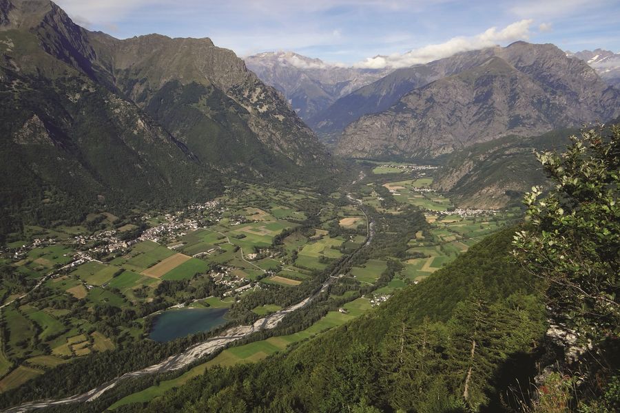
A initinerary with the charm of a ride trough the trees and the majesty of the ridge de la Sciau with incredible vieuws on the north of the Valbonnais, the "Beaumont" and the south of the Dévoluy. Don't miss the technical and final descent !
The characteristics of the route.

Valbonnais (38)
- Distance 28.1 km
- Elevation gain 1220 m
- Elevation lost 1220 m
- Min. elevation 688 m
- Max. elevation. 1486 m
- Duration (depending on pace) 2h30
- Marking Yes
Equipments : Parking nearby, Admission fee : Free access.Opening : All year round.
Subject to favorable weather.
Area : Matheysine
Report a problem
Website Features of the application :
- Location and orientation on detailed maps thanks to the GPS of your smartphone
- Description of routes and points of interest on the route
- Photo gallery by route
- Detailed elevation profile
- Route tracking alert to warn you if you stray from the route
- Send predefined messages by SMS to your contacts
- Emergency module: trigger a call or send an emergency SMS in case of problem
- Agenda: access to events organized in the department
- News: find in the application the latest news on the web portal
- Adding achievements
- Add reports in case of problems encountered on the routes
- Share on social networks
Add your time and share your feelings
Services nearby

Maison du tourisme de Corps
Corps

Museum "Musée Matheysin"
La Mure
Heritage House
Pellafol

Foyer de ski de fond du Col d'Ornon
Chantelouve
Musuem "La Mine Image"
La Motte-d'Aveillans


Information updated on 2024-05-20 by Matheysine Tourisme


Follow us on
the digital trails
the digital trails


![]()
The Isère Outdoor application was created
by the Département de l'Isère
Infos & contact
Conseil départemental de l'Isère
7 rue Fantin Latour
CS 41096
38 022 Grenoble cedex 1
Tel. 04 76 00 38 38
 Isère Outdoor - Parcours - N° 29 moutainbike itinerary : La crête de la sciau - black path
Hello, world! This is a toast message.
Isère Outdoor - Parcours - N° 29 moutainbike itinerary : La crête de la sciau - black path
Hello, world! This is a toast message.
Isère Outdoor - Parcours - N° 29 moutainbike itinerary : La crête de la sciau - black path
Hello, world! This is a toast message.


OK
Annuler