Cascade de la Pisse - Walk from Le Bourg-d'Oisans
Add to my favorites

Caution! Zone of vigilance near the route
Faucon pèlerin - du 01/02/2026 au 30/06/2026 In progress
Aigle royal - du 01/01/2026 au 31/08/2026 In progress
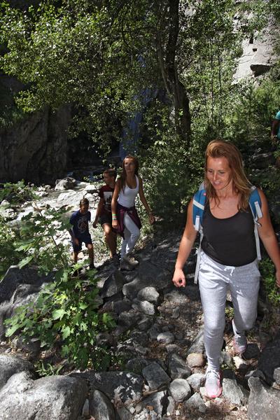
A quiet, bucolic walk at the foot of the cliff, in the sun in the morning and in the shade in the afternoon. An almost flat itinerary, except for the last section which climbs to the waterfall on a footpath.
Route labeled FFRandonnée

The characteristics of the route.

Le Bourg-d'Oisans (38)
- Distance 11 km
- Elevation gain 80 m
- Elevation lost 80 m
- Min. elevation 716 m
- Max. elevation. 794 m
- Duration (depending on pace) 3h
- Marking Yes
TECHNICAL INFORMATION
Start: Bourg-d'Oisans town hall - 700 m altitude
Difference in altitude: 70 m
Round trip duration: 1h30 one way and 1h30 return
Round trip distance: 10.4 km
Difficulty: very easy
MAP AND TOPO
Top 25 IGN 3335 ET Bourg-d'Oisans, Alpe d'Huez
OBP (l'Oisans au Bout des Pieds) map no. 1, trail 657 (available from the tourist office).
ITINERARY
This easy stroll through the valley is recommended for families and light walkers. The waterfall is a perfect excuse for a cool picnic and to take advantage of the various watering holes during the hot summer months. An itinerary that reveals the hidden face of the Romanche plain and the banks of the Vénéon.
In Le Bourg-d'Oisans, join the park in front of the town hall. Between the town hall and the church, follow rue Humbert in the direction of "Villard-Notre-Dame". At the end, take the left-hand road "chemin de St-Claude", not the right-hand road which climbs up to the village of Villard-Notre-Dame (a must-see! but take the car... The balcony road is narrow and suspended, a typical Oisans journey).
For 2 km you'll follow a tarmac road, then for a more natural itinerary look out for a path on the right that joins the road a little further on. Once you've reached the sources de la Rive, the starting point for canoe and paddle trips on the peaceful Rive that runs through Le Bourg-d'Oisans, the itinerary is now pedestrianized. But that's not all: you're on the voie verte (hence the tarmac), so many non-motorized machines share the area with you.
From here, follow the cliff on your right to the waterfall. You then leave the voie verte to follow the signs for "cascade de la Pisse", which go up to the right along a path.
Return by the same route, with a detour to Lac de Buclet to soak up its luminous turquoise blue!
THINGS TO SEE ALONG THE WAY
- the Mairie park and its bucolic little pond
- the church and the Museum of Fauna and Minerals
- the blue lake and picnic area.
- Buclet lake
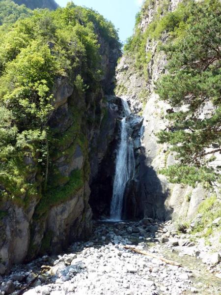
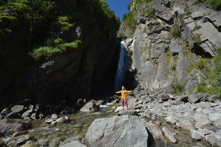
- the Pisse waterfall
- the vast bed of the Vénéon and its Siberian allureAdmission fee : Free access.Opening : From 01/04 to 31/10 daily. Subject to favorable snow and weather conditions.
Start: Bourg-d'Oisans town hall - 700 m altitude
Difference in altitude: 70 m
Round trip duration: 1h30 one way and 1h30 return
Round trip distance: 10.4 km
Difficulty: very easy
MAP AND TOPO
Top 25 IGN 3335 ET Bourg-d'Oisans, Alpe d'Huez
OBP (l'Oisans au Bout des Pieds) map no. 1, trail 657 (available from the tourist office).
ITINERARY
This easy stroll through the valley is recommended for families and light walkers. The waterfall is a perfect excuse for a cool picnic and to take advantage of the various watering holes during the hot summer months. An itinerary that reveals the hidden face of the Romanche plain and the banks of the Vénéon.
In Le Bourg-d'Oisans, join the park in front of the town hall. Between the town hall and the church, follow rue Humbert in the direction of "Villard-Notre-Dame". At the end, take the left-hand road "chemin de St-Claude", not the right-hand road which climbs up to the village of Villard-Notre-Dame (a must-see! but take the car... The balcony road is narrow and suspended, a typical Oisans journey).
For 2 km you'll follow a tarmac road, then for a more natural itinerary look out for a path on the right that joins the road a little further on. Once you've reached the sources de la Rive, the starting point for canoe and paddle trips on the peaceful Rive that runs through Le Bourg-d'Oisans, the itinerary is now pedestrianized. But that's not all: you're on the voie verte (hence the tarmac), so many non-motorized machines share the area with you.
From here, follow the cliff on your right to the waterfall. You then leave the voie verte to follow the signs for "cascade de la Pisse", which go up to the right along a path.
Return by the same route, with a detour to Lac de Buclet to soak up its luminous turquoise blue!
THINGS TO SEE ALONG THE WAY
- the Mairie park and its bucolic little pond
- the church and the Museum of Fauna and Minerals
- the blue lake and picnic area.
- Buclet lake
- the Pisse waterfall
- the vast bed of the Vénéon and its Siberian allureAdmission fee : Free access.Opening : From 01/04 to 31/10 daily. Subject to favorable snow and weather conditions.
Area : Oisans
Report a problem
Website Pdf file Features of the application :
- Location and orientation on detailed maps thanks to the GPS of your smartphone
- Description of routes and points of interest on the route
- Photo gallery by route
- Detailed elevation profile
- Route tracking alert to warn you if you stray from the route
- Send predefined messages by SMS to your contacts
- Emergency module: trigger a call or send an emergency SMS in case of problem
- Agenda: access to events organized in the department
- News: find in the application the latest news on the web portal
- Adding achievements
- Add reports in case of problems encountered on the routes
- Share on social networks
Add your time and share your feelings
Services nearby

Tourist office of Le Bourg-d'Oisans
Le Bourg-d'Oisans

Museum of Minerals and Alpine Wildlife
Le Bourg-d'Oisans
Auris-en-Oisans tourist office
Auris-en-Oisans
Tourist office of Villard-Reculas
Villard-Reculas
Office de Tourisme
Alpe d'Huez


Information updated on 2026-03-11 by Oisans Tourisme


Follow us on
the digital trails
the digital trails


![]()
The Isère Outdoor application was created
by the Département de l'Isère
Infos & contact
Conseil départemental de l'Isère
7 rue Fantin Latour
CS 41096
38 022 Grenoble cedex 1
Tel. 04 76 00 38 38
 Isère Outdoor - Parcours - Cascade de la Pisse - Walk from Le Bourg-d'Oisans
Hello, world! This is a toast message.
Isère Outdoor - Parcours - Cascade de la Pisse - Walk from Le Bourg-d'Oisans
Hello, world! This is a toast message.
Isère Outdoor - Parcours - Cascade de la Pisse - Walk from Le Bourg-d'Oisans
Hello, world! This is a toast message.


OK
Annuler