Col du Mont Noir par Presles
Add to my favorites

Caution! Zone of vigilance near the route
Faucon pèlerin - du 01/02/2026 au 30/06/2026 In progress
Faucon pèlerin - du 01/02/2026 au 30/06/2026 In progress
Aigle royal - du 01/01/2026 au 31/08/2026 In progress
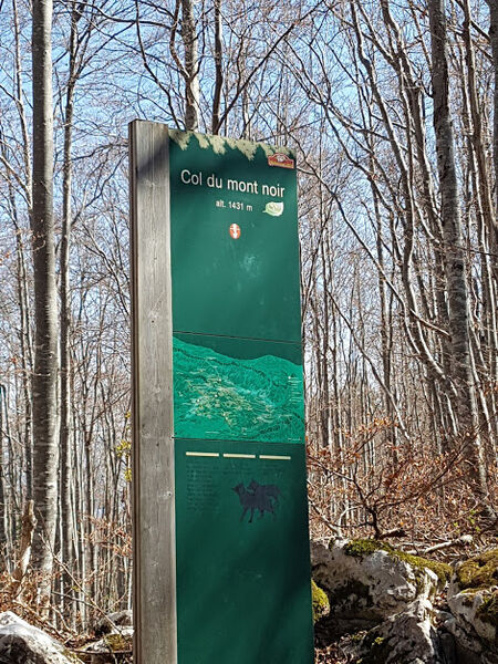
Le Mont Noir est le col cyclable le plus haut du Vercors. L'itinéraire par Pont en Royans et Presles offre une multitude d'ambiances variées.
The characteristics of the route.

Rencurel (38)
- Distance 21.1 km
- Elevation gain 1240 m
- Elevation lost 30 m
- Min. elevation 213 m
- Max. elevation. 1424 m
- Duration (depending on pace) 2h30
- Marking No
Admission fee : Free access.Opening : From 01/04 to 31/10.
Subject to snow conditions.
Area : Saint-Marcellin Vercors Isère
Report a problem
Features of the application :
- Location and orientation on detailed maps thanks to the GPS of your smartphone
- Description of routes and points of interest on the route
- Photo gallery by route
- Detailed elevation profile
- Route tracking alert to warn you if you stray from the route
- Send predefined messages by SMS to your contacts
- Emergency module: trigger a call or send an emergency SMS in case of problem
- Agenda: access to events organized in the department
- News: find in the application the latest news on the web portal
- Adding achievements
- Add reports in case of problems encountered on the routes
- Share on social networks
Add your time and share your feelings
Services nearby

Bureau d'information touristique de Pont-en-Royans
Pont-en-Royans

Le Musée de l'eau
Pont-en-Royans
Le Couvent des Carmes
Beauvoir-en-Royans

Foyer de ski de fond de Presles
Presles
Bureau d'Information touristique de Saint-Marcellin
Saint-Marcellin


Information updated on 2020-06-19 by Département de l'Isère


Follow us on
the digital trails
the digital trails


![]()
The Isère Outdoor application was created
by the Département de l'Isère
Infos & contact
Conseil départemental de l'Isère
7 rue Fantin Latour
CS 41096
38 022 Grenoble cedex 1
Tel. 04 76 00 38 38
 Isère Outdoor - Parcours - Col du Mont Noir par Presles
Hello, world! This is a toast message.
Isère Outdoor - Parcours - Col du Mont Noir par Presles
Hello, world! This is a toast message.
Isère Outdoor - Parcours - Col du Mont Noir par Presles
Hello, world! This is a toast message.


OK
Annuler