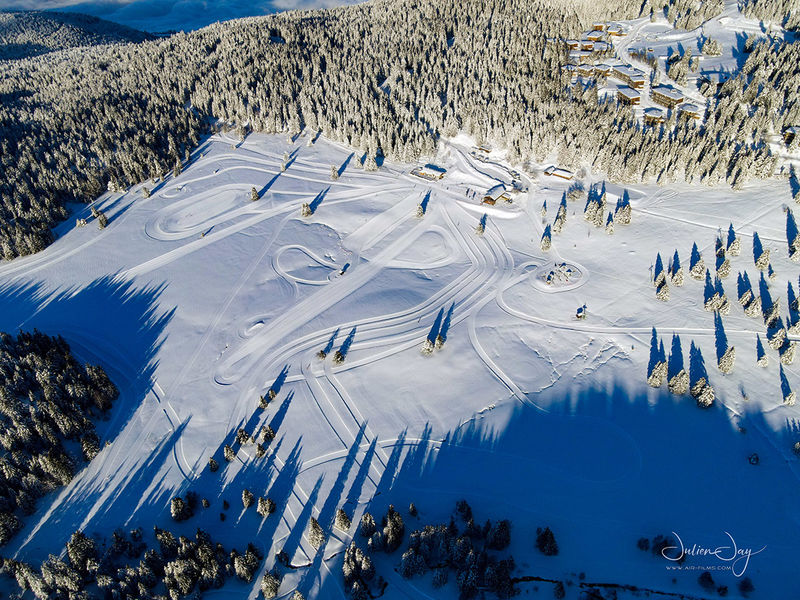
Arselle plateau
Add to my favorites

Caution! Zone of vigilance near the route
Faucon pèlerin - du 01/02/2026 au 30/06/2026 In progress
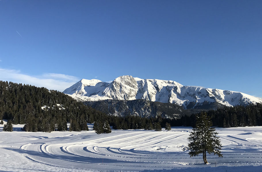
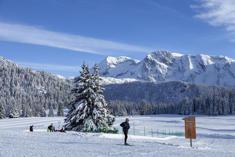
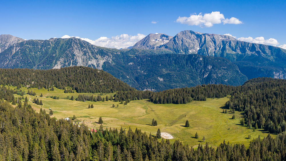
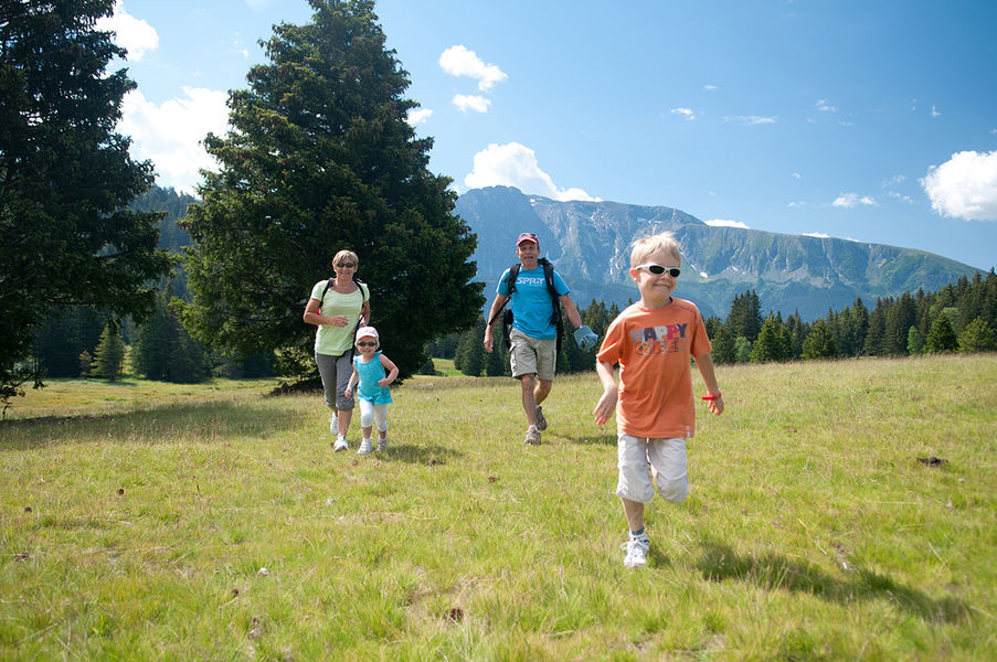
In winter or in summer, this loop path is very accessible and easy for the whole family. Explore the Arselle peatbog and its vews on the Taillefer.
Route labeled FFRandonnée

The characteristics of the route.

Chamrousse (38)
- Distance 3.7 km
- Elevation gain 70 m
- Elevation lost 70 m
- Min. elevation 1600 m
- Max. elevation. 1652 m
- Duration (depending on pace) 1h15
- Marking Yes
From the salle hors-sac / foyer de ski de fond, take the wide trail down past the restaurant de la Salinière. Leave the track and turn left onto a narrow path that runs along the edge of the forest and alongside the peat bog.
Continue south towards the Plateau de l'Arselle. An incursion into an area of meadowland offers a magnificent panorama of the neighbouring Taillefer massif.
After a short climb, a wider path leads you to the "La Lanse" signpost. Leave the path leading up to Lac Achard on your right, and turn left onto a track that takes you back to the starting point (Plateau de l'Arselle post).
The wetland is a sensitive area, so make sure you stay on the paths and don't cut across any small paths in the peat bog.
? Warning: the plateau de l'Arselle is a protected area (peat bog classified APPB - Arrêtés Préfectoraux de Protection Biotope), so there are a few rules to observe to help protect it. Fires, wild camping, bivouacs, picking and dumping waste are strictly forbidden. Please stay on the path that circles the area, as it is forbidden to go onto the plateau in order to preserve the fragile environment.Marking : Yellow and green signs (PR)Equipments : Car park, Public WC, Delicate passages : No difficulties, but a damp environment. The Arselle peat bog is a sensitive natural area (ENS), so be sure to stay on the paths.Admission fee : Free access.Opening : All year round daily. Subject to favorable weather.
Area : Grésivaudan
Report a problem
Website Chamrousse Arselle plateau sketch ENS Plateau Arselle and Lac Achard Chamrousse summer municipal bylaw Features of the application :
- Location and orientation on detailed maps thanks to the GPS of your smartphone
- Description of routes and points of interest on the route
- Photo gallery by route
- Detailed elevation profile
- Route tracking alert to warn you if you stray from the route
- Send predefined messages by SMS to your contacts
- Emergency module: trigger a call or send an emergency SMS in case of problem
- Agenda: access to events organized in the department
- News: find in the application the latest news on the web portal
- Adding achievements
- Add reports in case of problems encountered on the routes
- Share on social networks
Add your time and share your feelings
Services nearby

Arselle Peatbog (Preserved Natural Area)
Chamrousse

Romanche Museum
Livet-et-Gavet

Chamrousse Tourist Office
Chamrousse
Office Thermal et Touristique d'Uriage-les-Bains
Saint-Martin-d'Uriage

Taillefer Hut
Oulles


Follow us on
the digital trails
the digital trails


![]()
The Isère Outdoor application was created
by the Département de l'Isère
Infos & contact
Conseil départemental de l'Isère
7 rue Fantin Latour
CS 41096
38 022 Grenoble cedex 1
Tel. 04 76 00 38 38
 Isère Outdoor - Parcours - Arselle plateau
Hello, world! This is a toast message.
Isère Outdoor - Parcours - Arselle plateau
Hello, world! This is a toast message.
Isère Outdoor - Parcours - Arselle plateau
Hello, world! This is a toast message.


OK
Annuler