The Pic Saint-Michel and the Col de l'Arc
Add to my favorites

Caution! Zone of vigilance near the route
Aigle royal - du 01/01/2026 au 31/08/2026 In progress
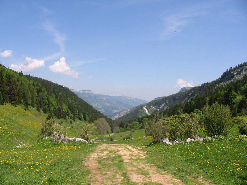
The Pic Saint-Michel offers magnificent views of the Vercors Massif and much of the Alps. This beautiful mountain hike will take you through stunning landscapes of woodland, alpine pastures and lapies.
Route labeled FFRandonnée

The characteristics of the route.

Lans-en-Vercors (38)
- Distance 8.8 km
- Elevation gain 650 m
- Elevation lost 650 m
- Min. elevation 1278 m
- Max. elevation. 1937 m
- Duration (depending on pace) 4h30
- Marking Yes
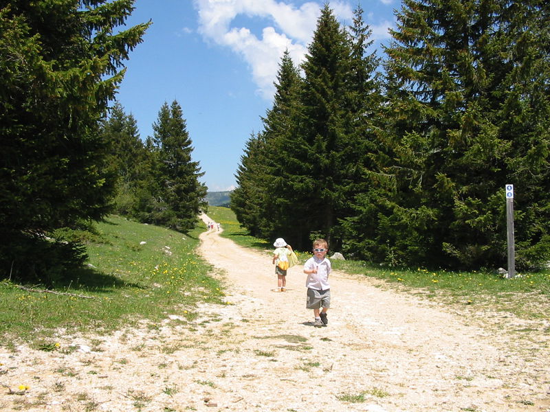
From Les Barnets car park, head towards the Pic Saint-Michel by following the 'GR® de Pays', 'Tour des Quatre-Montagnes' (yellow and red markers). At the Collet du Furon, take the path up to Combe Oursière, and follow the yellow-and-green markers from then onwards. The path continues, winding between the boulders to end up at the Pic Saint-Michel, which offers views over the Grenoble valley and the Alpine mountains.
The hike continues just below the ridge, descending steadily to eventually join the Col de l'Arc. Keep descending until you reach Font Froide, then take the 'GR® 9' path (white-and-red markers), to end up at Salière and the Collet du Furon. From there, head back to Les Barnets car park via the path you took at the beginning of the hike.Marking : Yellow and green markers ('PR', day hike route) Yellow and red markers ( 'GRP®', local hiking circuit) White and red markers ( 'GR® 9', long-distance hiking route)Equipments : Car park, Delicate passages : Depending on the time of year, on the mountain pastures you may come across a Patou (Pyrenean mountain dog) or other livestock guardian dog. If you do, just walk around the flock or herd, and stay calm while the dog assesses you. Do not threaten or stroke these dogs. If you have a dog, you must keep it on a leash. Warning: when it rains, some of the more technical sections can become slippery and tricky to negotiate! Use the structures provided to cross fences, and make sure to close any gates behind you.Admission fee : Free access.Opening : From 01/05 to 31/10. Subject to favorable weather.
The hike continues just below the ridge, descending steadily to eventually join the Col de l'Arc. Keep descending until you reach Font Froide, then take the 'GR® 9' path (white-and-red markers), to end up at Salière and the Collet du Furon. From there, head back to Les Barnets car park via the path you took at the beginning of the hike.Marking : Yellow and green markers ('PR', day hike route) Yellow and red markers ( 'GRP®', local hiking circuit) White and red markers ( 'GR® 9', long-distance hiking route)Equipments : Car park, Delicate passages : Depending on the time of year, on the mountain pastures you may come across a Patou (Pyrenean mountain dog) or other livestock guardian dog. If you do, just walk around the flock or herd, and stay calm while the dog assesses you. Do not threaten or stroke these dogs. If you have a dog, you must keep it on a leash. Warning: when it rains, some of the more technical sections can become slippery and tricky to negotiate! Use the structures provided to cross fences, and make sure to close any gates behind you.Admission fee : Free access.Opening : From 01/05 to 31/10. Subject to favorable weather.
Area : Massif du Vercors
Report a problem
Website Pdf file Features of the application :
- Location and orientation on detailed maps thanks to the GPS of your smartphone
- Description of routes and points of interest on the route
- Photo gallery by route
- Detailed elevation profile
- Route tracking alert to warn you if you stray from the route
- Send predefined messages by SMS to your contacts
- Emergency module: trigger a call or send an emergency SMS in case of problem
- Agenda: access to events organized in the department
- News: find in the application the latest news on the web portal
- Adding achievements
- Add reports in case of problems encountered on the routes
- Share on social networks
The latest reviews & times
Cecile
finished in 03:00:00
The 2024/05/10
En savoir plus
TomtomDbois
The 2022/09/12
En savoir plus
Jean-Phi
finished in 01:35:00
The 2021/07/12
En savoir plus
See all reviews & times
2024/05/10 03:00:00
Cécile Trace de Trail
Cécile Trace de Trail
2022/09/12 TomtomDbois
Magnifique, la vue du sommet vaux la peine. Quelque passage rocheux et d autres en bord de ravine. Attention que les points noeds de la carte sont a l'envers par rapport au topo guide !!!
2021/07/12 01:35:00
Jean-Phi
Jean-Phi
Services nearby

Auberge des Allières
Lans-en-Vercors

OTI Vercors - Bureau d'information touristique de Lans en Vercors
Lans-en-Vercors

Espace naturel sensible de la tourbière du Peuil
Claix

Maison du Patrimoine
Villard-de-Lans
Office Municipal de Tourisme de Villard de Lans
Villard-de-Lans


Follow us on
the digital trails
the digital trails


![]()
The Isère Outdoor application was created
by the Département de l'Isère
Infos & contact
Conseil départemental de l'Isère
7 rue Fantin Latour
CS 41096
38 022 Grenoble cedex 1
Tel. 04 76 00 38 38
 Isère Outdoor - Parcours - The Pic Saint-Michel and the Col de l'Arc
Hello, world! This is a toast message.
Isère Outdoor - Parcours - The Pic Saint-Michel and the Col de l'Arc
Hello, world! This is a toast message.
Isère Outdoor - Parcours - The Pic Saint-Michel and the Col de l'Arc
Hello, world! This is a toast message.


OK
Annuler