Rochassac and the Swallow Trail
Add to my favorites

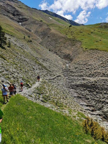
Caution! Zone of vigilance near the route
Crousoux - du 22/07/2026 au 04/08/2026 Upcoming
Rochassac - du 05/08/2026 au 14/09/2026 Upcoming
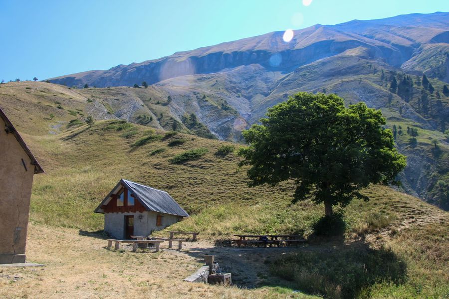
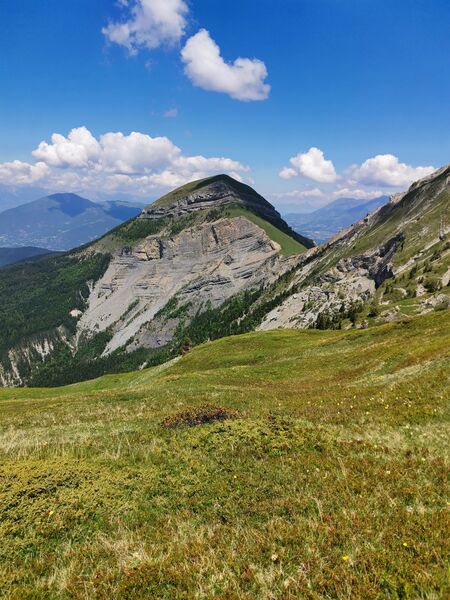
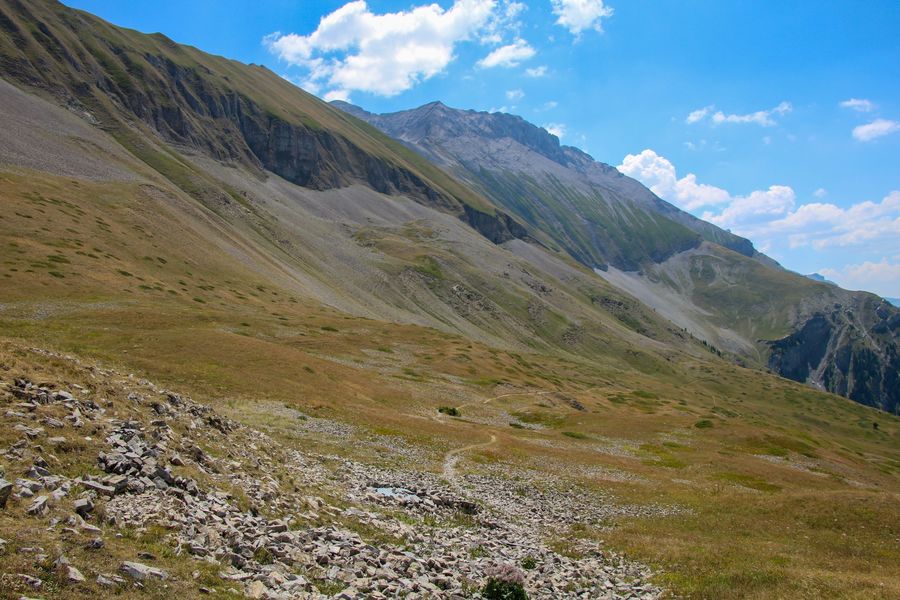
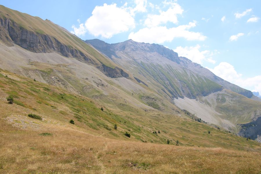
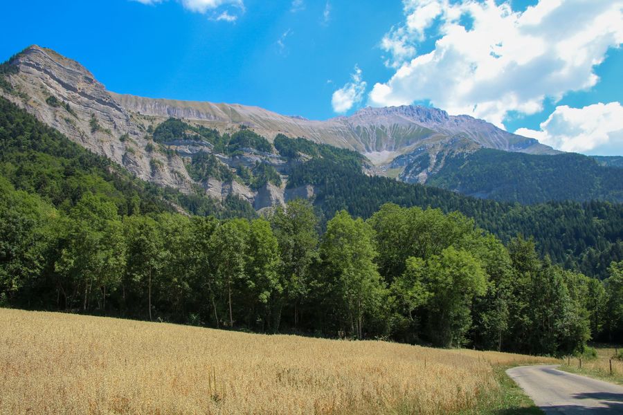
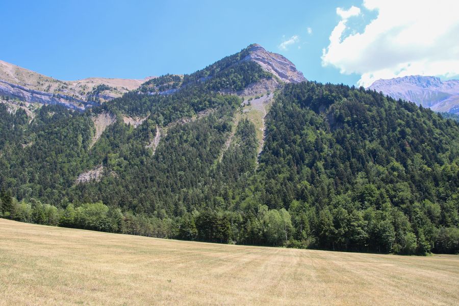
Set off on this mountain loop on the balcony of Rattier and Obiou. A short path clinging to the cliffs takes you up to the Rochassac mountain pasture. Take a picnic break at the pleasant Rochassac hut and its fountain.
Route labeled FFRandonnée

The characteristics of the route.

Saint-Baudille-et-Pipet (38)
- Distance 10.8 km
- Elevation gain 860 m
- Elevation lost 860 m
- Min. elevation 1001 m
- Max. elevation. 1842 m
- Duration (depending on pace) 4h30
- Marking Yes
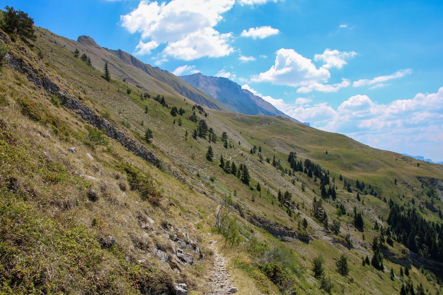
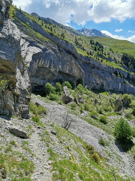
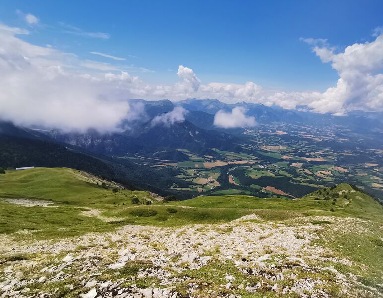
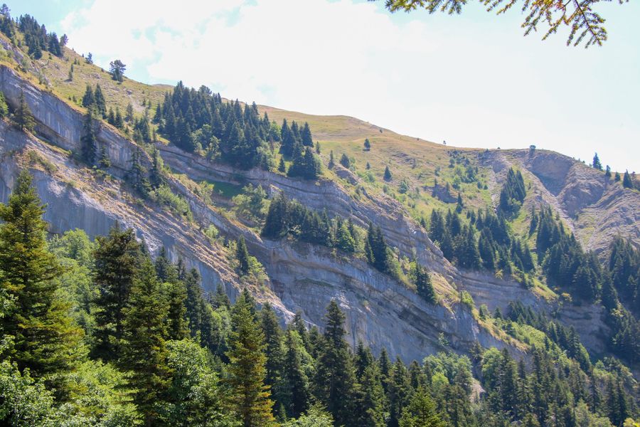
Let yourself be tempted by a magnificent hike to the Rochassac mountain pastures. Enjoy the panoramic view over the Trièves. This characteristic walk will allow you to discover different facets of the mountains, sometimes cool in the forest, sometimes warm on the mountain pastures. Several watercourses allow you to enjoy the landscape even more. We mainly recommend this hike in late spring, when the snow is melting and the weather is not too hot.Equipments : Car park, Delicate passages : Some vertiginous passages with handrails. Only to be done in good weather and after the snow has melted.Admission fee : Free access.Opening : All year round daily.
Subject to favorable weather.Step by step description : Departure: Park at the Rochassac parking lot, then head for "Refuge de Rochassac", which is signposted 2h15 from your position.
1) Take the forest track for a few hundred metres, then turn left to follow the signs for "Refuge de Rochassac". A pretty forest path will take you up quickly. This is a steep climb, so be sure to follow the signs as you cross several paths along the way. There are several switchbacks on the way to the Rochassac refuge. You can quench your thirst at the refuge's fountain.
2) From the "Refuge de Rochassac" head towards "L'Hirondelle", taking another short climb through the alpine pastures. You'll pass the sheepfold usually used in August by the shepherd and his flock.
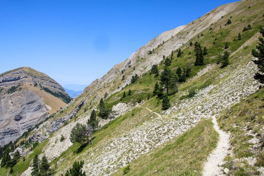
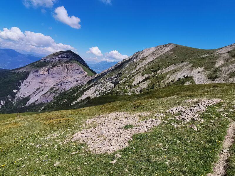
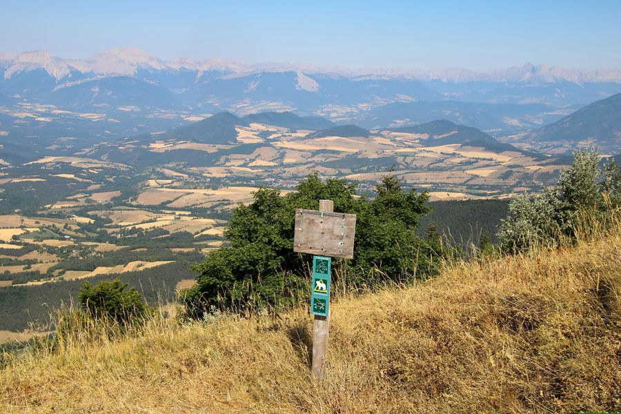
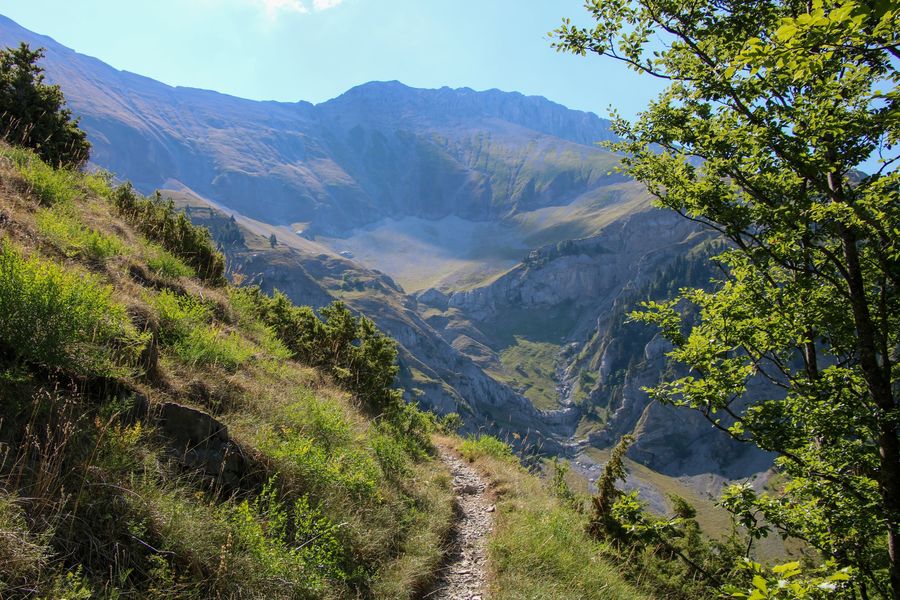
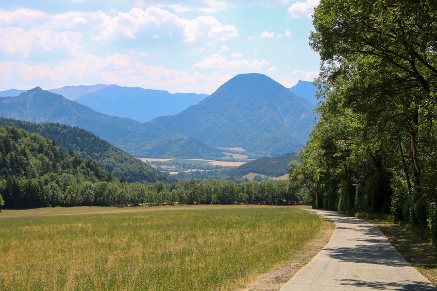
3) From "L'Hirondelle", enjoy the magnificent view of the Trièves plateau. Head for "Le Réservoir" to begin your descent. The descent can be tricky at times, with a few passages involving cables. Take care, as the descent can also be relatively steep. A multitude of bends make for a rapid descent, as you pass through a pretty cirque and close to several streams. At the bottom you'll find the "Reservoir" post.
4) From the "Le Réservoir" post, follow the signs for "Longueville", continuing along the path opposite.
You must cross the stream, then continue on a downhill concrete track to the hamlet of "Longueville". The view to your left is magnificent, with the Rochassac plateau in full view. From the hamlet, follow the signs for "Des Granges". Follow the road to the path leading to the Rochassac parking lot, where you'll find your car.
Area : Trièves
Report a problem
Website Pdf file Features of the application :
- Location and orientation on detailed maps thanks to the GPS of your smartphone
- Description of routes and points of interest on the route
- Photo gallery by route
- Detailed elevation profile
- Route tracking alert to warn you if you stray from the route
- Send predefined messages by SMS to your contacts
- Emergency module: trigger a call or send an emergency SMS in case of problem
- Agenda: access to events organized in the department
- News: find in the application the latest news on the web portal
- Adding achievements
- Add reports in case of problems encountered on the routes
- Share on social networks
Add your time and share your feelings
Services nearby

Bureau d'Informations Touristiques de Mens - Office de Tourisme du Trièves
Mens

Musée du Trièves
Mens

Foyer nordique de Tréminis
Tréminis
Point d'information Tréminis
Tréminis

Espace Naturel Sensible Sources des Gillardes
Pellafol


Information updated on 2026-05-30 by Isère Attractivité


Follow us on
the digital trails
the digital trails


![]()
The Isère Outdoor application was created
by the Département de l'Isère
Infos & contact
Conseil départemental de l'Isère
7 rue Fantin Latour
CS 41096
38 022 Grenoble cedex 1
Tel. 04 76 00 38 38
 Isère Outdoor - Parcours - Rochassac and the Swallow Trail
Hello, world! This is a toast message.
Isère Outdoor - Parcours - Rochassac and the Swallow Trail
Hello, world! This is a toast message.
Isère Outdoor - Parcours - Rochassac and the Swallow Trail
Hello, world! This is a toast message.


OK
Annuler