From Uriage-Les-Bains to Belledonne mountain range
Add to my favorites

Caution! Zone of vigilance near the route
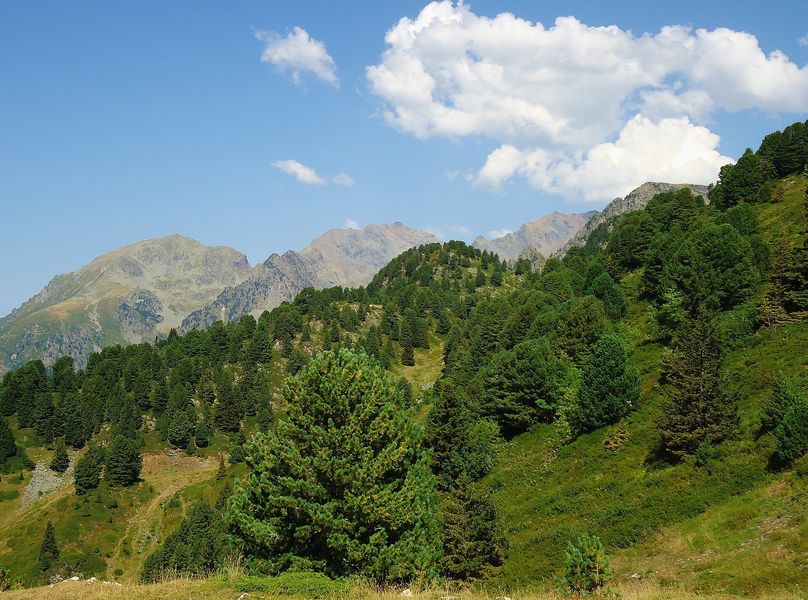
This itinerary starts in the spa resort, Uriage-les-Bains. It winds along a moderate slope through a series of tranverse valleys and combes as far as Saint-Pierre-d'Allevard, a few kilometres from the other spa resort in the massif: Allevard-les-Bains.
The characteristics of the route.

Saint-Martin-d'Uriage (38)
- Distance 100.9 km
- Elevation gain 2290 m
- Elevation lost 2290 m
- Min. elevation 216 m
- Max. elevation. 1042 m
- Duration (depending on pace) 6h30
- Marking Yes
Take the D280 from Uriage-les-Bains towards Chamrousse.
Pass through the centre of Saint-Martin-d'Uriage. 400 m from the centre, carry on along the D280 towards Allevard.
3 km after Col du Barioz, turn left onto the D280i towards Sailles-le-Bas.
Turn left at the crossroads of the D525 and D280i. Continue along the D525 for 1 km, then turn right onto the D78.
Turn left at Arthaudière on the local road to the D523.
Turn left towards Grenoble, pass through Goncelin, then turn left at Villard-Bozon on the D29. Turn right on the D30 to reach the D523 and the centre of Tencin.
Continue on the D523 towards Grenoble.
In La Pierre, turn left onto the D250a then the D250 towards Froges. Turn left towards Grenoble at the crossroads with the D523.
In Gières, turn left onto the D164, then take the D524 to return to the start.
The route passes through a multitude of pretty villages. Each bend reveals new scenes of the Isère valley and the Chartreuse. The return trip is via the Grésivaudan valley, a wide and flat glacier valley where the Isère river flows.Good plans : Many farms produce a variety of excellent honey including spring honey, acacia honey, multi-flower honey and mountain honey. Some producers set up their hives in the mountain pastures for the summer.Admission fee : Free access.Opening : From 01/05 to 31/10. Subject to favorable weather.
Area : Grésivaudan
Report a problem
Website Features of the application :
- Location and orientation on detailed maps thanks to the GPS of your smartphone
- Description of routes and points of interest on the route
- Photo gallery by route
- Detailed elevation profile
- Route tracking alert to warn you if you stray from the route
- Send predefined messages by SMS to your contacts
- Emergency module: trigger a call or send an emergency SMS in case of problem
- Agenda: access to events organized in the department
- News: find in the application the latest news on the web portal
- Adding achievements
- Add reports in case of problems encountered on the routes
- Share on social networks
Add your time and share your feelings
Services nearby

Office Thermal et Touristique d'Uriage-les-Bains
Saint-Martin-d'Uriage
Chamrousse Tourist Office
Chamrousse

Arselle Peatbog (Preserved Natural Area)
Chamrousse

Romanche Museum
Livet-et-Gavet
The chemistry Museum
Jarrie


Information updated on 2022-06-21 by Isère Attractivité


Follow us on
the digital trails
the digital trails


![]()
The Isère Outdoor application was created
by the Département de l'Isère
Infos & contact
Conseil départemental de l'Isère
7 rue Fantin Latour
CS 41096
38 022 Grenoble cedex 1
Tel. 04 76 00 38 38
 Isère Outdoor - Parcours - From Uriage-Les-Bains to Belledonne mountain range
Hello, world! This is a toast message.
Isère Outdoor - Parcours - From Uriage-Les-Bains to Belledonne mountain range
Hello, world! This is a toast message.
Isère Outdoor - Parcours - From Uriage-Les-Bains to Belledonne mountain range
Hello, world! This is a toast message.


OK
Annuler