Balcony Paths & Valleys of Dauphiné
Add to my favorites

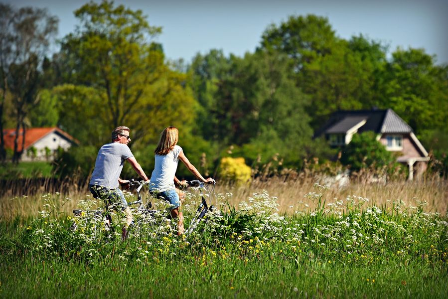
This trail takes you exploring some beautiful countryside as well as Morestel, Brangues, and other small towns that have inspired many a painter and writer.
The characteristics of the route.
Morestel (38)
- Distance 46.3 km
- Elevation gain 430 m
- Elevation lost 430 m
- Min. elevation 203 m
- Max. elevation. 411 m
- Duration (depending on pace) 3h
- Marking Yes
Equipments : Charging stations for electric vehicles, Charging station for 2 electric wheels, Admission fee : Free access.Opening : All year round.
Subject to favorable weather.Services for cyclists : 1 Ebike rental outlet (Volts Bike) can be found at the departure point.
2 Ebike charging stations are within easy reach of the itinerary.
Area : Vals du Dauphiné
Report a problem
Website Features of the application :
- Location and orientation on detailed maps thanks to the GPS of your smartphone
- Description of routes and points of interest on the route
- Photo gallery by route
- Detailed elevation profile
- Route tracking alert to warn you if you stray from the route
- Send predefined messages by SMS to your contacts
- Emergency module: trigger a call or send an emergency SMS in case of problem
- Agenda: access to events organized in the department
- News: find in the application the latest news on the web portal
- Adding achievements
- Add reports in case of problems encountered on the routes
- Share on social networks
Add your time and share your feelings
Services nearby

Morestel - Balcons de Dauphine Tourist Information Office
Morestel

Ravier Centre
Morestel

Save Sensitive Natural Area, étangs de Passins lakes sector
Arandon-Passins
Avenières Veyrins-Thuellin - Balcons du Dauphine Tourist Information Office
Les Avenières Veyrins-Thuellin
Saint-Chef Museum
Saint-Chef


Information updated on 2022-07-12 by Isère Attractivité


Follow us on
the digital trails
the digital trails


![]()
The Isère Outdoor application was created
by the Département de l'Isère
Infos & contact
Conseil départemental de l'Isère
7 rue Fantin Latour
CS 41096
38 022 Grenoble cedex 1
Tel. 04 76 00 38 38
 Isère Outdoor - Parcours - Balcony Paths & Valleys of Dauphiné
Hello, world! This is a toast message.
Isère Outdoor - Parcours - Balcony Paths & Valleys of Dauphiné
Hello, world! This is a toast message.
Isère Outdoor - Parcours - Balcony Paths & Valleys of Dauphiné
Hello, world! This is a toast message.


OK
Annuler