Bike tour : The Vaulserre
Add to my favorites

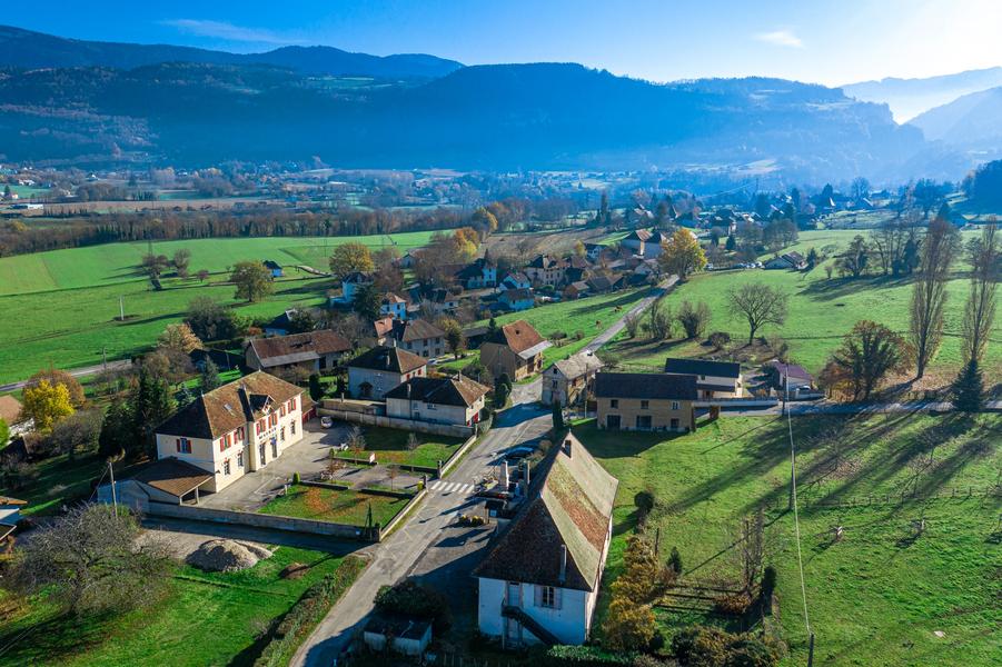
This route will take you to Vaulserre, a largely rural area offering numerous panoramic views of the Chartreuse, Bugey, and Épine mountains. Along the way, admire our beautiful Dauphiné-style buildings.
The characteristics of the route.

Pont-de-Beauvoisin (38)
- Distance 21.29 km
- Elevation gain 270 m
- Elevation lost 270 m
- Min. elevation 257 m
- Max. elevation. 408 m
- Duration (depending on pace) 1h45
- Marking No
Start / return (parking):
- Parking of the station of Pont de Beauvoisin.
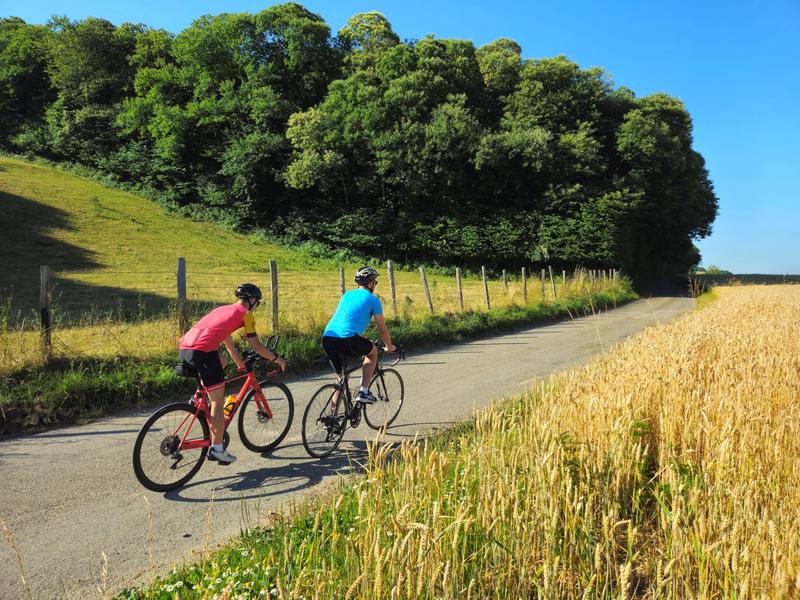
From the station, take the D82H for about 500m. Once you have turned left on the Chemin des Carmes, you will arrive on the uncrowded roads of the Vaulserre. Throughout your journey, you can look up and admire the surrounding massifs (Bugey, Epine, Chartreuse ...) as well as the typical Dauphinoise architecture of our territory.
After 5.5 km, do not hesitate to go down on your left to see the orientation table in Saint Albin de Vaulserre, positioned next to the church.
Arriving in the town of Pressins, after 15 km, once past the town hall and the school, you can stop on your left at the bridge to take a short break on the picnic table. A bucolic setting will then be offered to you, with a bread oven and a small stream to refresh you.
Finish this beautiful loop by passing near the Reculfort pond, very popular with fishermen, then take the D82H again, remaining vigilant until you reach the Pont de Beauvoisin station.Equipments : Free car park, Bicycle parking, Car park, Picnic area, Admission fee : Free access. Bike map available for free at tourist office Les Vals du Dauphiné.Opening : All year round daily. See opening hours of Pont-de-Beauvoisin tourist information center.
- Parking of the station of Pont de Beauvoisin.
From the station, take the D82H for about 500m. Once you have turned left on the Chemin des Carmes, you will arrive on the uncrowded roads of the Vaulserre. Throughout your journey, you can look up and admire the surrounding massifs (Bugey, Epine, Chartreuse ...) as well as the typical Dauphinoise architecture of our territory.
After 5.5 km, do not hesitate to go down on your left to see the orientation table in Saint Albin de Vaulserre, positioned next to the church.
Arriving in the town of Pressins, after 15 km, once past the town hall and the school, you can stop on your left at the bridge to take a short break on the picnic table. A bucolic setting will then be offered to you, with a bread oven and a small stream to refresh you.
Finish this beautiful loop by passing near the Reculfort pond, very popular with fishermen, then take the D82H again, remaining vigilant until you reach the Pont de Beauvoisin station.Equipments : Free car park, Bicycle parking, Car park, Picnic area, Admission fee : Free access. Bike map available for free at tourist office Les Vals du Dauphiné.Opening : All year round daily. See opening hours of Pont-de-Beauvoisin tourist information center.
Report a problem
Website Circuit vélo : La Vaulserre Features of the application :
- Location and orientation on detailed maps thanks to the GPS of your smartphone
- Description of routes and points of interest on the route
- Photo gallery by route
- Detailed elevation profile
- Route tracking alert to warn you if you stray from the route
- Send predefined messages by SMS to your contacts
- Emergency module: trigger a call or send an emergency SMS in case of problem
- Agenda: access to events organized in the department
- News: find in the application the latest news on the web portal
- Adding achievements
- Add reports in case of problems encountered on the routes
- Share on social networks
Add your time and share your feelings
Services nearby

Local Resistance and Deportation Museum
Le Pont-de-Beauvoisin

Tourist Information Office of Pont-de-Beauvoisin - Office de Tourisme des Vals du Dauphiné
Le Pont-de-Beauvoisin
Wood Machine Museum
Le Pont-de-Beauvoisin
Pégoud Museum
Montferrat

Relais Cyné de Montferrat
Montferrat


Information updated on 2025-11-13 by Office de Tourisme des Vals du Dauphiné


Follow us on
the digital trails
the digital trails


![]()
The Isère Outdoor application was created
by the Département de l'Isère
Infos & contact
Conseil départemental de l'Isère
7 rue Fantin Latour
CS 41096
38 022 Grenoble cedex 1
Tel. 04 76 00 38 38
 Isère Outdoor - Parcours - Bike tour : The Vaulserre
Hello, world! This is a toast message.
Isère Outdoor - Parcours - Bike tour : The Vaulserre
Hello, world! This is a toast message.
Isère Outdoor - Parcours - Bike tour : The Vaulserre
Hello, world! This is a toast message.


OK
Annuler