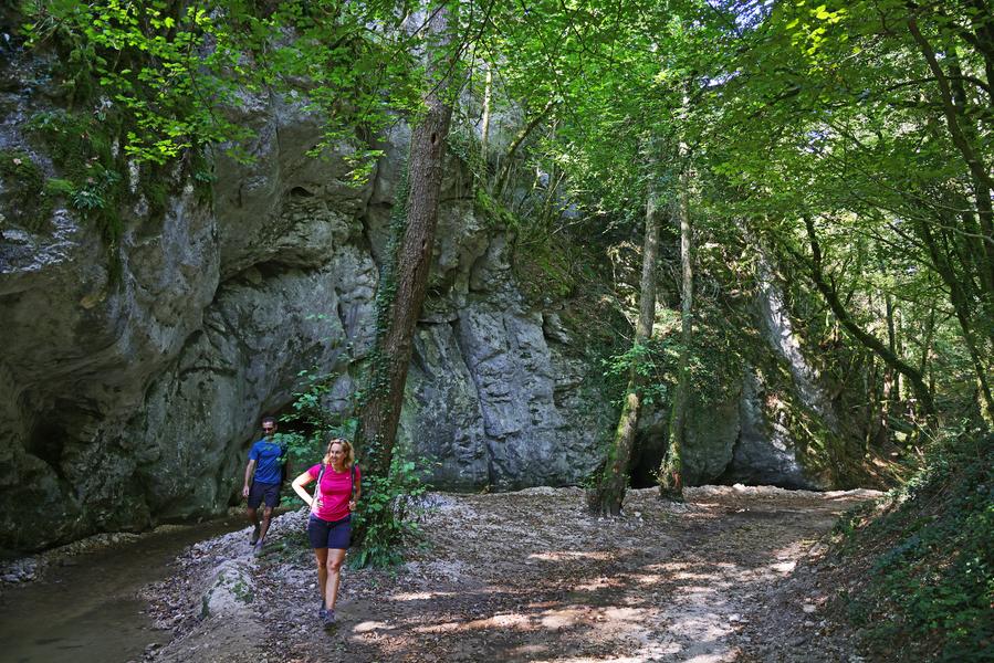
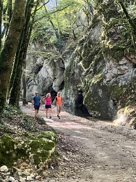
Walking trail: Roche Corbière Gorges
Add to my favorites

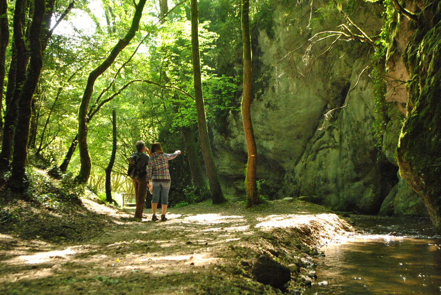
Promenez-vous dans une combe calme et reposante qui a été aménagée avec 2 étangs de pêche, à l'extrémité d'un discret petit plateau... Idéale pour une petite balade en toutes saisons pour profiter d'ambiances très variées !
Route labeled FFRandonnée

The characteristics of the route.

Tullins (38)
- Distance 4.28 km
- Elevation gain 120 m
- Elevation lost 120 m
- Min. elevation 267 m
- Max. elevation. 346 m
- Duration (depending on pace) 1h15
- Marking Yes
Equipments : Car park, Admission fee : Free access.Opening : All year round.
Area : Pays Voironnais
Report a problem
Website Pdf file Features of the application :
- Location and orientation on detailed maps thanks to the GPS of your smartphone
- Description of routes and points of interest on the route
- Photo gallery by route
- Detailed elevation profile
- Route tracking alert to warn you if you stray from the route
- Send predefined messages by SMS to your contacts
- Emergency module: trigger a call or send an emergency SMS in case of problem
- Agenda: access to events organized in the department
- News: find in the application the latest news on the web portal
- Adding achievements
- Add reports in case of problems encountered on the routes
- Share on social networks
alyss
The 2025/06/22
En savoir plus
Ajouter votre chrono et partager vos sensations
2025/06/22 alyss
2025/06/22 alyss
Services nearby

Le Grand Séchoir | Maison du pays de la noix
Vinay

Espace naturel sensible du Domaine des Ecouges
Saint-Gervais

Refuge de Gève
Autrans-Méaudre en Vercors
Espace Naturel Sensible de l'Etang de Côte-Manin
Saint-Blaise-du-Buis

St Etienne de St Geoirs Tourist information center
Saint-Étienne-de-Saint-Geoirs


Information updated on 2025-04-14 by Office de Tourisme du Pays Voironnais


Follow us on
the digital trails
the digital trails


![]()
The Isère Outdoor application was created
by the Département de l'Isère
Infos & contact
Conseil départemental de l'Isère
7 rue Fantin Latour
CS 41096
38 022 Grenoble cedex 1
Tel. 04 76 00 38 38
 Isère Outdoor - Parcours - Walking trail: Roche Corbière Gorges
Hello, world! This is a toast message.
Isère Outdoor - Parcours - Walking trail: Roche Corbière Gorges
Hello, world! This is a toast message.
Isère Outdoor - Parcours - Walking trail: Roche Corbière Gorges
Hello, world! This is a toast message.


OK
Annuler