3 - Frettvieille fountain trail running
Add to my favorites

Head for the Frettevieille Fountain! A shaded route through the Chartreuse-Terminorum base camp, between forest and local cultural heritage.
The characteristics of the route.

Saint-Pierre-de-Chartreuse (38)
- Distance 8.94 km
- Elevation gain 450 m
- Elevation lost 450 m
- Min. elevation 774 m
- Max. elevation. 1054 m
- Duration (depending on pace) 2h30
- Marking Yes
The perfect course to kick it up a notch! With a slightly longer distance and elevation gain than classic green courses, Fontaine de Fretteveille offers a varied and enjoyable playground. The climbs and descents flow smoothly, without any major technical difficulties, leaving plenty of room for the pure joy of running. As a bonus, the course passes through remarkable architectural heritage sites and offers superb panoramic views of the Saint-Pierre-de-Chartreuse valley. A fun and fast-paced route, ideal for challenging yourself while enjoying the exceptional surroundings to the full.
Marking : Trail Marking No. 3 Green Starting panels are placed in villages at parking areas or visitor reception points. To follow your route, posts are installed at intersections, identifiable by a plaque indicating the name and altitude. Between two posts, painted markers guide the path, though not always. You may also be guided by small directional signs.
Admission fee : Free access.
Opening : All year round daily. Subject to favorable snow and weather conditions.
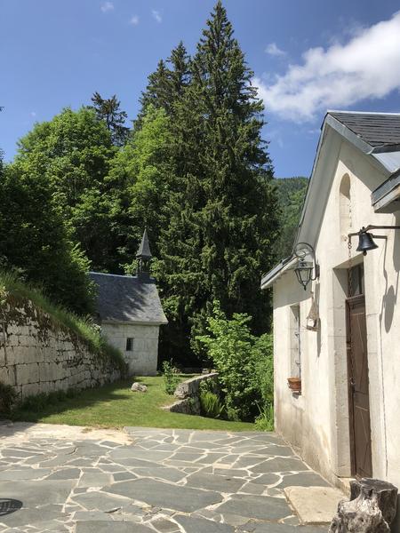
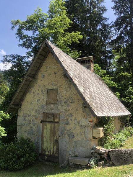
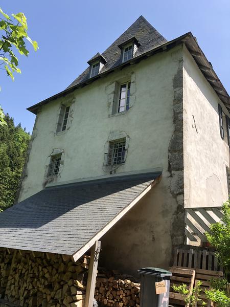
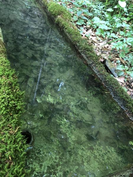
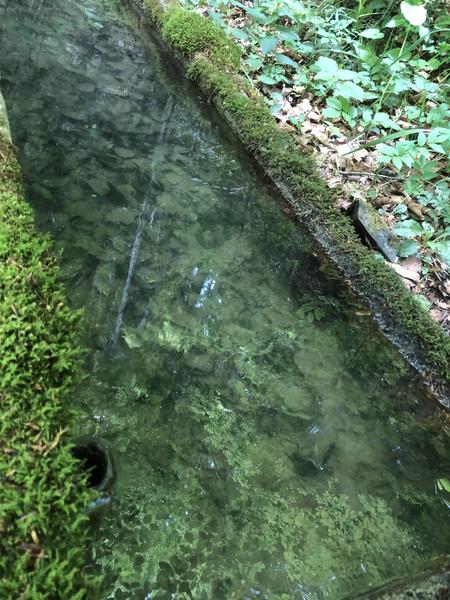
Step by step description : Starting from Raidlight, head towards Plan de Ville, then take the Bois des Lièvres trail on the right for a narrow initial descent. You will then cross the Couzon river via a footbridge before continuing your adventure through an alpine pasture to reach the road. At the Patassière sign, continue left downhill to the end of the road before turning right, crossing a hedge and going around a Cartusian barn on the left. At the end of the climb, you can admire Chamechaude and, at your feet, La Diat, a hamlet of Saint Pierre de Chartreuse and the starting point of the famous Chartreuse Terminorum. At the next junction, turn left to continue down a wide, easy descent. Cross a stream, which in spring can be surprising both for its flow and its temperature, and continue downhill. A little further on, turn right to take a path through the heart of the forest that would be a shame to miss. On the way back, continue to the right to take the bridge over the Guiers Mort, where you can admire the sculpture of Saint Bruno by Guy Laffont. Continue straight ahead on the path to reach the road and then immediately take the path that climbs up to the right. You are now on Chemin du Grand Logis. At the top of the hill, you can admire the Saint Hugues Chapel on your right and the Grand Logis on your left, the residence of the armed men and women who, at the time, were not allowed to enter the grounds of the Grande Chartreuse Monastery. Continue your adventure on the path to the right before joining the path slightly to the right that crosses the road and then opposite on the forest path. At the Sur Chargeat signpost, turn right onto the path towards Pierre Mesure. You will enjoy the coolness of the forest on this undulating path. At the Fontaine de Fretteveille fountain, after admiring the still existing basin, continue on the path on your left, descending towards Mourinas. Back on the road, continue straight ahead before taking the gravel path on the left at the signpost for La Martinière. When you come out into the clearing, you can admire the view of the village and Chamechaude behind you before heading into the forest slightly to the left. A fairly technical descent in wet weather takes you back to La Diat and its trial area, which you will go around to reach the Herretang footbridge. Continue straight ahead between the tennis courts and the mini golf course to rejoin the road. Then cross the Pont Routier de la Dame bridge and continue straight ahead. Then turn right and immediately left onto the path after the bridge towards Pont de la Laiterie. The last 100 metres of elevation gain of the vertical kilometre take you to Place le Mairie, where you turn right to reach Raidlight.
Marking : Trail Marking No. 3 Green Starting panels are placed in villages at parking areas or visitor reception points. To follow your route, posts are installed at intersections, identifiable by a plaque indicating the name and altitude. Between two posts, painted markers guide the path, though not always. You may also be guided by small directional signs.
Admission fee : Free access.
Opening : All year round daily. Subject to favorable snow and weather conditions.
Step by step description : Starting from Raidlight, head towards Plan de Ville, then take the Bois des Lièvres trail on the right for a narrow initial descent. You will then cross the Couzon river via a footbridge before continuing your adventure through an alpine pasture to reach the road. At the Patassière sign, continue left downhill to the end of the road before turning right, crossing a hedge and going around a Cartusian barn on the left. At the end of the climb, you can admire Chamechaude and, at your feet, La Diat, a hamlet of Saint Pierre de Chartreuse and the starting point of the famous Chartreuse Terminorum. At the next junction, turn left to continue down a wide, easy descent. Cross a stream, which in spring can be surprising both for its flow and its temperature, and continue downhill. A little further on, turn right to take a path through the heart of the forest that would be a shame to miss. On the way back, continue to the right to take the bridge over the Guiers Mort, where you can admire the sculpture of Saint Bruno by Guy Laffont. Continue straight ahead on the path to reach the road and then immediately take the path that climbs up to the right. You are now on Chemin du Grand Logis. At the top of the hill, you can admire the Saint Hugues Chapel on your right and the Grand Logis on your left, the residence of the armed men and women who, at the time, were not allowed to enter the grounds of the Grande Chartreuse Monastery. Continue your adventure on the path to the right before joining the path slightly to the right that crosses the road and then opposite on the forest path. At the Sur Chargeat signpost, turn right onto the path towards Pierre Mesure. You will enjoy the coolness of the forest on this undulating path. At the Fontaine de Fretteveille fountain, after admiring the still existing basin, continue on the path on your left, descending towards Mourinas. Back on the road, continue straight ahead before taking the gravel path on the left at the signpost for La Martinière. When you come out into the clearing, you can admire the view of the village and Chamechaude behind you before heading into the forest slightly to the left. A fairly technical descent in wet weather takes you back to La Diat and its trial area, which you will go around to reach the Herretang footbridge. Continue straight ahead between the tennis courts and the mini golf course to rejoin the road. Then cross the Pont Routier de la Dame bridge and continue straight ahead. Then turn right and immediately left onto the path after the bridge towards Pont de la Laiterie. The last 100 metres of elevation gain of the vertical kilometre take you to Place le Mairie, where you turn right to reach Raidlight.
Area : Cœur de Chartreuse
Report a problem
3 - Frettvieille fountain trail running_Saint-Pierre-de-Chartreuse Features of the application :
- Location and orientation on detailed maps thanks to the GPS of your smartphone
- Description of routes and points of interest on the route
- Photo gallery by route
- Detailed elevation profile
- Route tracking alert to warn you if you stray from the route
- Send predefined messages by SMS to your contacts
- Emergency module: trigger a call or send an emergency SMS in case of problem
- Agenda: access to events organized in the department
- News: find in the application the latest news on the web portal
- Adding achievements
- Add reports in case of problems encountered on the routes
- Share on social networks
Add your time and share your feelings
Services nearby

Coeur de Chartreuse Tourist Information center at Saint Pierre de Chartreuse
Saint-Pierre-de-Chartreuse

Museum of Contemporary Sacred Art
Saint-Pierre-de-Chartreuse

Location de matériel au foyer de ski de fond
Saint-Pierre-de-Chartreuse
Museum of la Grande Chartreuse
Saint-Pierre-de-Chartreuse

Espace naturel sensible du col du Coq
Plateau des Petites Roches


Information updated on 2026-05-02 by Office de Tourisme Coeur de Chartreuse


Follow us on
the digital trails
the digital trails





The Isère Outdoor application was created
by the Département de l'Isère
Infos & contact
Conseil départemental de l'Isère
7 rue Fantin Latour
CS 41096
38 022 Grenoble cedex 1
Tel. 04 76 00 38 38
 Isère Outdoor - Parcours - 3 - Frettvieille fountain trail running
Hello, world! This is a toast message.
Isère Outdoor - Parcours - 3 - Frettvieille fountain trail running
Hello, world! This is a toast message.
Isère Outdoor - Parcours - 3 - Frettvieille fountain trail running
Hello, world! This is a toast message.


OK
Annuler