Les Ramées - Ski de Rando alpin
Add to my favorites

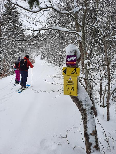
Caution! Zone of vigilance near the route
Moucherotte / Les Ramées - du 08/08/2026 au 11/10/2026 Upcoming
La Sierre - du 14/09/2026 au 25/10/2026 Upcoming
Stade de Neige - du 11/10/2026 au 31/10/2026 Upcoming
Les Ramées / Stade de neige - du 27/09/2026 au 31/10/2026 Upcoming
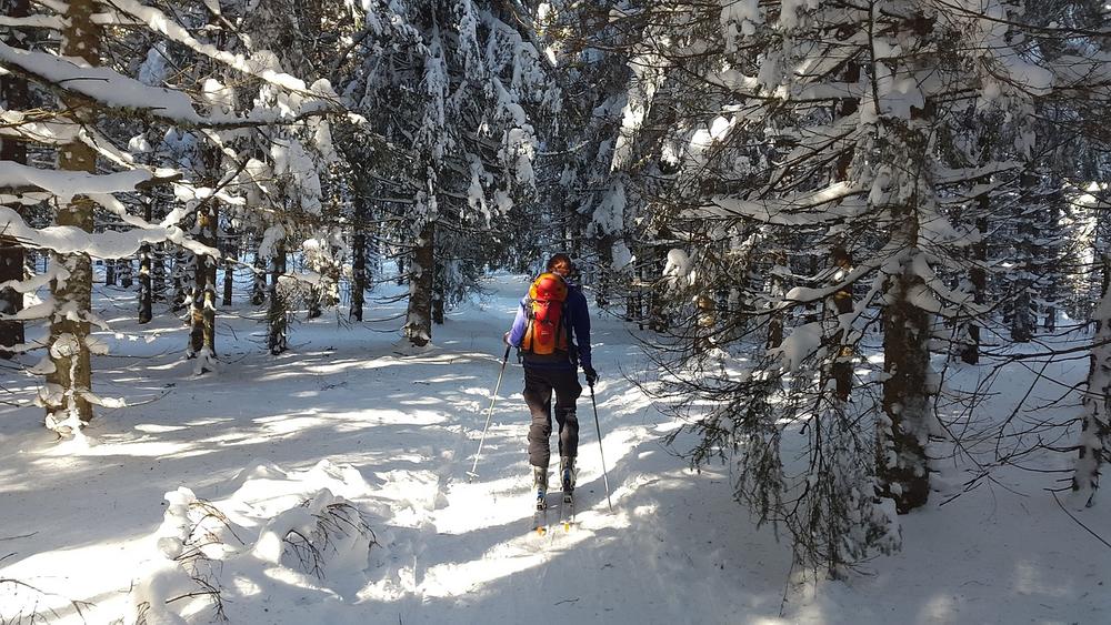
Au départ du parking des Virets, un chemin en sous bois et vues dégagées. Vous traverserez le plateau des Ramées, où vous aurez une vue grandiose sur la vallée Grenobloise et massifs alpins alentours, possibilité de se rendre jusqu'au Vertige des Cimes.
The characteristics of the route.

Lans-en-Vercors (38)
- Distance 4.9 km
- Elevation gain 340 m
- Elevation lost 70 m
- Min. elevation 1396 m
- Max. elevation. 1670 m
- Duration (depending on pace) 2h30
- Marking Yes
Features of the application :
- Location and orientation on detailed maps thanks to the GPS of your smartphone
- Description of routes and points of interest on the route
- Photo gallery by route
- Detailed elevation profile
- Route tracking alert to warn you if you stray from the route
- Send predefined messages by SMS to your contacts
- Emergency module: trigger a call or send an emergency SMS in case of problem
- Agenda: access to events organized in the department
- News: find in the application the latest news on the web portal
- Adding achievements
- Add reports in case of problems encountered on the routes
- Share on social networks
Add your time and share your feelings
Services nearby

OTI Vercors - Bureau d'information touristique de Lans en Vercors
Lans-en-Vercors

Espace naturel sensible de la tourbière du Peuil
Claix

Auberge des Allières
Lans-en-Vercors
Gite d'alpage de la Molière
Engins
Point Information Touristique de St Nizier du Moucherotte
Saint-Nizier-du-Moucherotte


Information updated on 2024-01-11 by Office de Tourisme Intercommunal du Vercors


Follow us on
the digital trails
the digital trails


![]()
The Isère Outdoor application was created
by the Département de l'Isère
Infos & contact
Conseil départemental de l'Isère
7 rue Fantin Latour
CS 41096
38 022 Grenoble cedex 1
Tel. 04 76 00 38 38
 Isère Outdoor - Parcours - Les Ramées - Ski de Rando alpin
Hello, world! This is a toast message.
Isère Outdoor - Parcours - Les Ramées - Ski de Rando alpin
Hello, world! This is a toast message.
Isère Outdoor - Parcours - Les Ramées - Ski de Rando alpin
Hello, world! This is a toast message.


OK
Annuler