Randonnée Vaulnaveys-le-Haut - Lac Luitel
Add to my favorites

Hike to go from Vaulnaveys-le-Haut to reach the National Nature Reserve of Lake Luitel on the foothills of Belledonne, for seasoned hikers.
The characteristics of the route.

Vaulnaveys-le-Haut (38)
- Distance 15.9 km
- Elevation gain 980 m
- Elevation lost 980 m
- Min. elevation 329 m
- Max. elevation. 1286 m
- Duration (depending on pace) 6h30
- Marking Yes
The start is near the Café du Centre in Vaulnaveys-le-Haut, taking the Chemin des Chartreux.
Gradually, by gaining altitude, we discover the many meadows occupying a terrace: the Rinjat plan at an altitude of 550m, from where the point of view is already very clear. The path climbs up and skims the road to Chamrousse at the level of the laces of Montgardier and Fujarey.
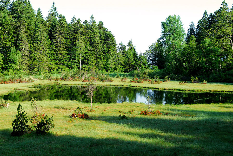
The route then turns south and becomes forest. Beeches and spruces are everywhere. Continue the forest ascent to Prémol, at 1080m, pass near the remains of the old Chartreuse. Then cross the Chamrousse road for the first time, then a second time to stay downstream from the latter to Lac du Luitel at an altitude of 1250m, the end of the ascent.
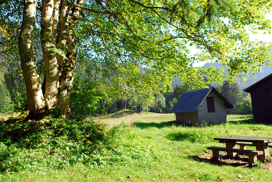
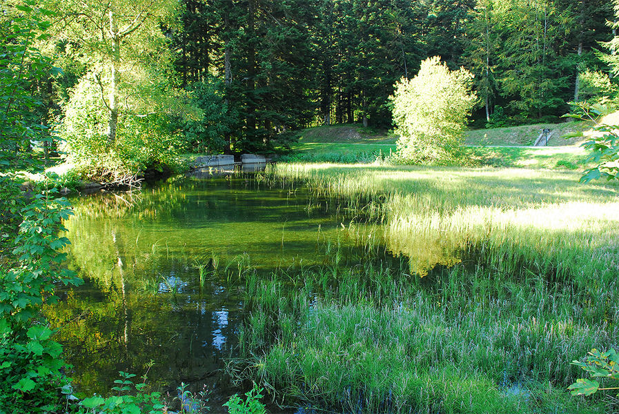
Arriving near the chalet of the nature reserve, it is possible to picnic on tables, but also to learn about peat bogs to discover sphagnum mosses, carnivorous plants, hook pines, dragonflies and many other natural curiosities.
The departure by the discovery path on slatted floor will allow the observation of this complex and fragile ecosystem.
The descent will take place on a wide and comfortable track with beautiful views of the Vercors, the Chartreuse and the Grenobloise conurbation. Further down, hikers will cross the charming hamlet of "Montchaffrey" then join the hamlet "Les Roberts" lower down.
Then go down to the Alloues. The descent will take place between meadows and forest, then join a small road at Les Meynards ”.
At the "Les Meynards" post, turn right and then reach the starting point by a small road: "promenade de la mondée", then by the route des penitents blancs and finally the chemin de prè'abé.
The stages of the circuit:
Les Meynards / Vaulnaveys-le-Haut / Le Bourg / La Gorge / Montgardier / Fujarey / Reservoir / Chartreuse de Prémol / Beacon / L'Exutoire / Maison de la Réserve / Lac Luitel / L'Exutoire / Le Moulin / Fontaine du mulet / Montchaffrey / Les Roberts / Bessera et la Ripa: Les MeynardsEquipments : Picnic area, Admission fee : Free of charge.Opening : All year round. Subject to favorable weather.
Gradually, by gaining altitude, we discover the many meadows occupying a terrace: the Rinjat plan at an altitude of 550m, from where the point of view is already very clear. The path climbs up and skims the road to Chamrousse at the level of the laces of Montgardier and Fujarey.
The route then turns south and becomes forest. Beeches and spruces are everywhere. Continue the forest ascent to Prémol, at 1080m, pass near the remains of the old Chartreuse. Then cross the Chamrousse road for the first time, then a second time to stay downstream from the latter to Lac du Luitel at an altitude of 1250m, the end of the ascent.
Arriving near the chalet of the nature reserve, it is possible to picnic on tables, but also to learn about peat bogs to discover sphagnum mosses, carnivorous plants, hook pines, dragonflies and many other natural curiosities.
The departure by the discovery path on slatted floor will allow the observation of this complex and fragile ecosystem.
The descent will take place on a wide and comfortable track with beautiful views of the Vercors, the Chartreuse and the Grenobloise conurbation. Further down, hikers will cross the charming hamlet of "Montchaffrey" then join the hamlet "Les Roberts" lower down.
Then go down to the Alloues. The descent will take place between meadows and forest, then join a small road at Les Meynards ”.
At the "Les Meynards" post, turn right and then reach the starting point by a small road: "promenade de la mondée", then by the route des penitents blancs and finally the chemin de prè'abé.
The stages of the circuit:
Les Meynards / Vaulnaveys-le-Haut / Le Bourg / La Gorge / Montgardier / Fujarey / Reservoir / Chartreuse de Prémol / Beacon / L'Exutoire / Maison de la Réserve / Lac Luitel / L'Exutoire / Le Moulin / Fontaine du mulet / Montchaffrey / Les Roberts / Bessera et la Ripa: Les MeynardsEquipments : Picnic area, Admission fee : Free of charge.Opening : All year round. Subject to favorable weather.
Area : Grenoble-Alpes Métropole
Report a problem
Website Pdf file Features of the application :
- Location and orientation on detailed maps thanks to the GPS of your smartphone
- Description of routes and points of interest on the route
- Photo gallery by route
- Detailed elevation profile
- Route tracking alert to warn you if you stray from the route
- Send predefined messages by SMS to your contacts
- Emergency module: trigger a call or send an emergency SMS in case of problem
- Agenda: access to events organized in the department
- News: find in the application the latest news on the web portal
- Adding achievements
- Add reports in case of problems encountered on the routes
- Share on social networks
Add your time and share your feelings
Services nearby

Office Thermal et Touristique d'Uriage-les-Bains
Saint-Martin-d'Uriage
Chamrousse Tourist Office
Chamrousse

Museum of the French Revolution
Vizille

Arselle Peatbog (Preserved Natural Area)
Chamrousse
Vizille Tourist Information Center
Vizille


Information updated on 2022-06-21 by Office de Tourisme Grenoble Alpes Métropole


Follow us on
the digital trails
the digital trails


![]()
The Isère Outdoor application was created
by the Département de l'Isère
Infos & contact
Conseil départemental de l'Isère
7 rue Fantin Latour
CS 41096
38 022 Grenoble cedex 1
Tel. 04 76 00 38 38
 Isère Outdoor - Parcours - Randonnée Vaulnaveys-le-Haut - Lac Luitel
Hello, world! This is a toast message.
Isère Outdoor - Parcours - Randonnée Vaulnaveys-le-Haut - Lac Luitel
Hello, world! This is a toast message.
Isère Outdoor - Parcours - Randonnée Vaulnaveys-le-Haut - Lac Luitel
Hello, world! This is a toast message.


OK
Annuler