Montée au refuge de La Soldanelle
Add to my favorites

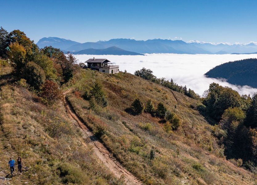
Un merveilleux point de vue sur le Balcon Est du Vercors, juste sous les Deux Soeurs !
Départ du parking de Mauret : pour éviter la portion de route , privilégier l'aller-retour.
The characteristics of the route.

Château-Bernard (38)
- Distance 4.2 km
- Elevation gain 340 m
- Elevation lost 340 m
- Min. elevation 1145 m
- Max. elevation. 1484 m
- Marking Yes
Admission fee : Free access.Opening : All year round.
Area : Trièves
Report a problem
Features of the application :
- Location and orientation on detailed maps thanks to the GPS of your smartphone
- Description of routes and points of interest on the route
- Photo gallery by route
- Detailed elevation profile
- Route tracking alert to warn you if you stray from the route
- Send predefined messages by SMS to your contacts
- Emergency module: trigger a call or send an emergency SMS in case of problem
- Agenda: access to events organized in the department
- News: find in the application the latest news on the web portal
- Adding achievements
- Add reports in case of problems encountered on the routes
- Share on social networks
Add your time and share your feelings
Services nearby

Refuge La Soldanelle
Château-Bernard

Atelier Gilioli
Saint-Martin-de-la-Cluze

Foyer de ski de fond des Hauts Plateaux
Corrençon-en-Vercors
Maison du Patrimoine
Villard-de-Lans

Bureau d'Informations Touristiques de Gresse en Vercors - Office de Tourisme du Trièves
Gresse-en-Vercors


Information updated on 2022-07-26 by Département de l'Isère


Follow us on
the digital trails
the digital trails


![]()
The Isère Outdoor application was created
by the Département de l'Isère
Infos & contact
Conseil départemental de l'Isère
7 rue Fantin Latour
CS 41096
38 022 Grenoble cedex 1
Tel. 04 76 00 38 38
 Isère Outdoor - Parcours - Montée au refuge de La Soldanelle
Hello, world! This is a toast message.
Isère Outdoor - Parcours - Montée au refuge de La Soldanelle
Hello, world! This is a toast message.
Isère Outdoor - Parcours - Montée au refuge de La Soldanelle
Hello, world! This is a toast message.


OK
Annuler