Parcours Martin-Pêcheur
Add to my favorites

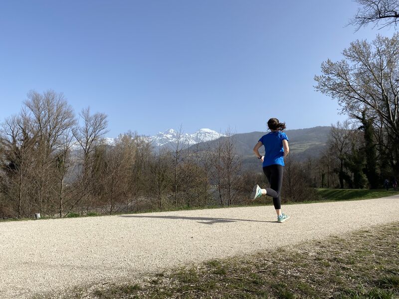
Un parcours très agréable qui nous donne l'impression d'être en pleine nature grâce à l'ENS, au lac et au fleuve qui le jalonnent.
The characteristics of the route.
Meylan (38)
- Distance 7.6 km
- Elevation gain 20 m
- Elevation lost 20 m
- Min. elevation 211 m
- Max. elevation. 225 m
- Duration (depending on pace) 0h55
- Marking No
Equipments : Picnic area, Sustainable development, Parking, Outhouse, Admission fee : Free access.Opening : All year round.
Area : Grenoble-Alpes Métropole
Report a problem
Features of the application :
- Location and orientation on detailed maps thanks to the GPS of your smartphone
- Description of routes and points of interest on the route
- Photo gallery by route
- Detailed elevation profile
- Route tracking alert to warn you if you stray from the route
- Send predefined messages by SMS to your contacts
- Emergency module: trigger a call or send an emergency SMS in case of problem
- Agenda: access to events organized in the department
- News: find in the application the latest news on the web portal
- Adding achievements
- Add reports in case of problems encountered on the routes
- Share on social networks
Add your time and share your feelings
Services nearby

Musée Hébert
La Tronche
Medical science museum of Grenoble
La Tronche
Resistance Museum
Grenoble
Saint-Laurent Archaeological Museum, Grenoble
Grenoble
The Grenoble Museum of arts
Grenoble


Follow us on
the digital trails
the digital trails


![]()
The Isère Outdoor application was created
by the Département de l'Isère
Infos & contact
Conseil départemental de l'Isère
7 rue Fantin Latour
CS 41096
38 022 Grenoble cedex 1
Tel. 04 76 00 38 38
 Isère Outdoor - Parcours - Parcours Martin-Pêcheur
Hello, world! This is a toast message.
Isère Outdoor - Parcours - Parcours Martin-Pêcheur
Hello, world! This is a toast message.
Isère Outdoor - Parcours - Parcours Martin-Pêcheur
Hello, world! This is a toast message.


OK
Annuler