Brouffier lake by way Bonniot.
Add to my favorites

Caution! Zone of vigilance near the route
Brouffier - du 15/06/2026 au 15/09/2026 In progress
Set off to conquer Lac du Brouffier, a wild mountain lake with crystal-clear water.
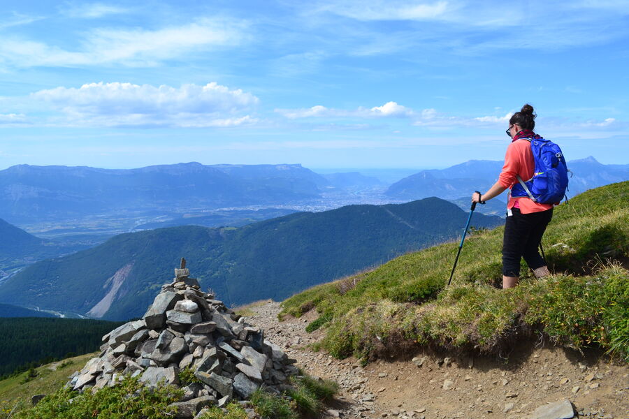
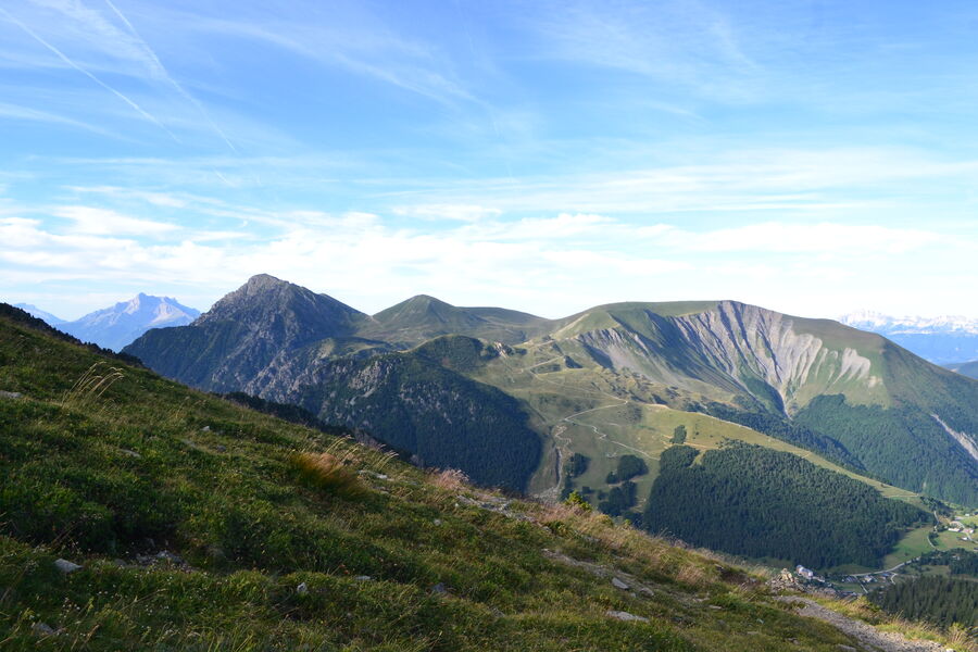
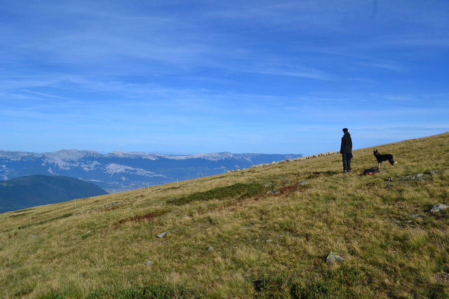
The entire route offers breathtaking panoramic views. On the way back via the Côte des Salières, you'll feel like you're walking above Grenoble, almost flying!
The characteristics of the route.

Alpe Du Grand Serre (38)
- Distance 8.1 km
- Elevation gain 600 m
- Elevation lost 600 m
- Min. elevation 1600 m
- Max. elevation. 2153 m
- Duration (depending on pace) 3h
- Marking Yes
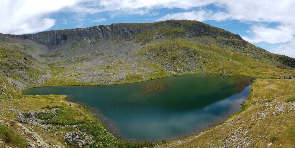
Lac du Brouffier – A Picture-Perfect Mountain Hike
Lac du Brouffier is everything you could wish for in a mountain lake: crystal-clear water, pristine surroundings, and exceptional views. The perfect recipe for a memorable hiking adventure! On the way back via the Côte des Salières, you’ll be rewarded with a breathtaking 360° panorama: walk seemingly above the city of Grenoble, spread out just below your feet, and take in stunning views of the surrounding massifs — Obiou, Grand Serre, Vercors, Chartreuse, and Belledonne. A hike you’ll never forget!
Route:
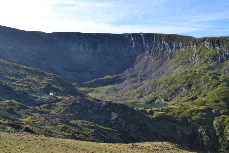
From the resort, take the road to Lac du Poursollet. After about 4 km, park at the fourth hairpin turn. From there, take the flat path to the right named Bonniot (marked with a no-entry sign). This trail leads to the Cabane du Louvet (once home to wolves) and the tiny Lac de Prévourey. At the cabane, continue straight ahead — the path to Lac du Brouffier is also signposted to the left; this will be your return route.
Cross the valley towards the end of the combe. A determined path climbs along the stream’s axis. As the slope eases, the trail approaches and crosses the stream. A few switchbacks on the opposite bank lead you up the lake’s natural threshold, finally arriving at its outlet after a last traverse to the right. For the descent, follow the path along the left side of the lake (you’ll see it clearly) and veer toward a small cabin marking the start of the return trail. Climb slightly, then descend to the hiking signpost Les Fontenettes. From there, turn left in the direction of Cabane du Louvet and Lac de Prévourey.
Important!
You are hiking in a protected natural area. Please stay on marked trails, keep dogs on a leash, do not light fires, and carry your waste back with you or to the nearest bins. Respecting and preserving this environment is essential!
Looking to swim? Use the designated lake in the heart of the resort.Marking : Yellow PDIPR waymarking - red and white waymarkingDelicate passages : Fairly steep and often rocky descent (due to water runoff and snowmelt) between Côte des Salières and Les Fontenettes (about 800?m).Admission fee : Free access.Opening : From 01/06 to 15/11 daily. Subject to snow conditions.Step by step description : From the ski resort, take the "route du lac du Poursollet". After nearby 4km, park your car at the fourth hairpin turns. From theren take on your right the flat path called "Bonniot" (forbidden direction sign) which arrives at the "Cabane du Louvet" (place where wolves were) and one the small Prévourey lake. Once at the cabin, take the path in front of you : the Brouffier's lake is also announced on the left trail, it will be your way back. Cross the dale towards the back of the hollow ; a trail attacks with determination the slope in the axis of the river. While the slope is weakening, the trail is coming closer to the river and cross it. In some switchbacks on the other shore, it swallows the rock bar of the lake of which it joins the spillway by a last cross on the right. The comedown goes by going along the lake on the left side (you see the trail) and away from a cabin where starts the way back. Keep following the trail which goes up and go down to the hiking pole "Les Fontenettes". From there, take on the left towards the "Cabane du Louvet" and "Lac de Prévourey".
Lac du Brouffier is everything you could wish for in a mountain lake: crystal-clear water, pristine surroundings, and exceptional views. The perfect recipe for a memorable hiking adventure! On the way back via the Côte des Salières, you’ll be rewarded with a breathtaking 360° panorama: walk seemingly above the city of Grenoble, spread out just below your feet, and take in stunning views of the surrounding massifs — Obiou, Grand Serre, Vercors, Chartreuse, and Belledonne. A hike you’ll never forget!
Route:
From the resort, take the road to Lac du Poursollet. After about 4 km, park at the fourth hairpin turn. From there, take the flat path to the right named Bonniot (marked with a no-entry sign). This trail leads to the Cabane du Louvet (once home to wolves) and the tiny Lac de Prévourey. At the cabane, continue straight ahead — the path to Lac du Brouffier is also signposted to the left; this will be your return route.
Cross the valley towards the end of the combe. A determined path climbs along the stream’s axis. As the slope eases, the trail approaches and crosses the stream. A few switchbacks on the opposite bank lead you up the lake’s natural threshold, finally arriving at its outlet after a last traverse to the right. For the descent, follow the path along the left side of the lake (you’ll see it clearly) and veer toward a small cabin marking the start of the return trail. Climb slightly, then descend to the hiking signpost Les Fontenettes. From there, turn left in the direction of Cabane du Louvet and Lac de Prévourey.
Important!
You are hiking in a protected natural area. Please stay on marked trails, keep dogs on a leash, do not light fires, and carry your waste back with you or to the nearest bins. Respecting and preserving this environment is essential!
Looking to swim? Use the designated lake in the heart of the resort.Marking : Yellow PDIPR waymarking - red and white waymarkingDelicate passages : Fairly steep and often rocky descent (due to water runoff and snowmelt) between Côte des Salières and Les Fontenettes (about 800?m).Admission fee : Free access.Opening : From 01/06 to 15/11 daily. Subject to snow conditions.Step by step description : From the ski resort, take the "route du lac du Poursollet". After nearby 4km, park your car at the fourth hairpin turns. From theren take on your right the flat path called "Bonniot" (forbidden direction sign) which arrives at the "Cabane du Louvet" (place where wolves were) and one the small Prévourey lake. Once at the cabin, take the path in front of you : the Brouffier's lake is also announced on the left trail, it will be your way back. Cross the dale towards the back of the hollow ; a trail attacks with determination the slope in the axis of the river. While the slope is weakening, the trail is coming closer to the river and cross it. In some switchbacks on the other shore, it swallows the rock bar of the lake of which it joins the spillway by a last cross on the right. The comedown goes by going along the lake on the left side (you see the trail) and away from a cabin where starts the way back. Keep following the trail which goes up and go down to the hiking pole "Les Fontenettes". From there, take on the left towards the "Cabane du Louvet" and "Lac de Prévourey".
Area : Matheysine
Report a problem
Website Pdf file Features of the application :
- Location and orientation on detailed maps thanks to the GPS of your smartphone
- Description of routes and points of interest on the route
- Photo gallery by route
- Detailed elevation profile
- Route tracking alert to warn you if you stray from the route
- Send predefined messages by SMS to your contacts
- Emergency module: trigger a call or send an emergency SMS in case of problem
- Agenda: access to events organized in the department
- News: find in the application the latest news on the web portal
- Adding achievements
- Add reports in case of problems encountered on the routes
- Share on social networks
Add your time and share your feelings
Services nearby

Alpe du Grand Serre Tourist Office
Alpe Du Grand Serre

Romanche Museum
Livet-et-Gavet

Arselle Peatbog (Preserved Natural Area)
Chamrousse
Belvédère Olivier Messiaen
Saint-Théoffrey

Taillefer Hut
Oulles


Information updated on 2026-03-25 by Matheysine Tourisme


Follow us on
the digital trails
the digital trails


![]()
The Isère Outdoor application was created
by the Département de l'Isère
Infos & contact
Conseil départemental de l'Isère
7 rue Fantin Latour
CS 41096
38 022 Grenoble cedex 1
Tel. 04 76 00 38 38
 Isère Outdoor - Parcours - Brouffier lake by way Bonniot.
Hello, world! This is a toast message.
Isère Outdoor - Parcours - Brouffier lake by way Bonniot.
Hello, world! This is a toast message.
Isère Outdoor - Parcours - Brouffier lake by way Bonniot.
Hello, world! This is a toast message.


OK
Annuler